
Aerial Acres, California — unincorporated community in Kern County
Aerial Acres is a small unincorporated community in Kern County, California, situated at about 2,428 ft (740 m). This article summarizes its setting, governance, likely origins and local characteristics.
Overview
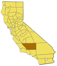
Aerial Acres is an unincorporated community in Kern County, in the state of California. It lies at an elevation of approximately 2,428 feet (740 m). As an unincorporated place, Aerial Acres does not have a municipal government and instead falls under the jurisdiction and service provisions of Kern County.
Image gallery
2 Images
Setting and landscape
The community occupies a rural, high-desert environment typical of portions of eastern Kern County. Vegetation is sparse and land use is dominated by residential parcels, vacant lots and open desert. The terrain and climate influence local building styles, infrastructure needs and water use; properties in such communities often depend on private wells, septic systems and county-maintained roads.
History and name
There are few formal historical records published specifically about Aerial Acres. The place name suggests a mid-20th century origin tied to aviation themes or real-estate marketing aimed at buyers seeking remote desert homes — a pattern seen elsewhere in California. Because documentation is limited, the origin of the name and the chronology of settlement are best described cautiously: the community likely developed as a low-density residential subdivision rather than as an incorporated town.
Governance, services and community life
As part of Kern County, public services such as law enforcement, planning and road maintenance are provided by county agencies rather than by a city. Residents typically rely on nearby towns for schools, medical care, retail and postal services. Community life in such unincorporated areas often revolves around private property activities, informal neighborhood organizations and county-level civic participation.
Characteristics and notable facts
- Elevation: about 2,428 ft (740 m), which affects climate and vegetation.
- Unincorporated status: governed by Kern County rather than a municipal council.
- Rural, desert setting with low population density and dispersed housing.
For additional context on local administration and geography, consult county resources or regional maps that cover Kern County and surrounding areas. This concise profile summarizes broadly known attributes without relying on detailed local records, which may be limited for very small unincorporated communities.
Related articles
Author
AlegsaOnline.com Aerial Acres, California — unincorporated community in Kern County Leandro Alegsa
URL: https://en.alegsaonline.com/art/1156
Sources
- geonames.usgs.gov : "Feature Detail Report for: Aerial Acres"