
William Christie Gosse (1842–1881) — explorer of central Australia
British-born surveyor and colonial explorer who led a notable 1873 expedition into central Australia, recorded Uluru (Ayers Rock) for European maps, and worked on South Australian surveying projects.
Overview
William Christie Gosse (1842–12 August 1881) was a British-born surveyor and explorer who played a prominent role in mid-19th-century European exploration of central Australia. He was born in Hertfordshire, England, and emigrated with his family to Adelaide, Australia in 1850. Employed in government surveying work in South Australia, Gosse combined technical surveying duties with leadership of sanctioned inland expeditions during a period of rapid colonial expansion and telegraph construction.
Image gallery
1 Image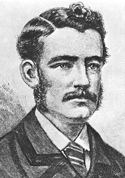
Early life and surveying career
Trained as a surveyor, Gosse undertook the practical and demanding tasks expected of colonial survey staff: mapping country, locating water, marking routes for roads and telegraph lines, and compiling official reports. Surveying skills were highly valued for exploration because they allowed precise bearings, sketches and field notes that could be added to colonial maps. As an official party leader he worked in the context of government aims to identify pastoral lands and practical overland routes through often arid and little-charted country.
The 1873 central Australian expedition
In 1873 Gosse led a small inland expedition into the central Australian interior, an area that had become more accessible following the construction of sections of the Overland Telegraph Line. On 19 July 1873 he sighted and recorded a large sandstone monolith that he named Ayers Rock after Sir Henry Ayers, then Chief Secretary of South Australia. The formation is widely known by its Indigenous name Uluru, and Gosse’s report was among the early European accounts that brought the landmark to wider colonial attention. His party included assistants and Aboriginal guides; accounts of the journey note the practical importance of Indigenous knowledge of water and country to survival and navigation in the desert environment.
Routes, contemporaries and context
Exploration of central Australia in this era involved multiple parties and competing objectives. Ernest Giles was another explorer working in similar country at the same time; Giles made several attempts to find practicable routes westwards and his tracks and reports influenced later parties. Gosse’s successful line of travel in 1873 overlapped with material and routes left by earlier expeditions. The driving force behind many such journeys included not only scientific inquiry but also the search for suitable routes for communication and pastoral development.
Reports, maps and colonial legacy
Gosse produced field reports, sketches and observations that were incorporated into colonial maps and survey records. These contributions helped consolidate European geographic knowledge of central Australia and informed subsequent travel and settlement planning. Official documents of the period commonly used the name Ayers Rock for the landmark; over time the prominence of Indigenous names and cultural significance led to changing usage and to the adoption of the dual name Uluru/Ayers Rock in many contexts before Uluru was restored as the primary official name in later decades.
Indigenous connections and later reassessment
Modern perspectives recognize that the landscapes recorded by Gosse and other 19th-century explorers had long-standing Indigenous connections, cultural meanings and place names. Contemporary histories therefore situate Gosse’s achievements within a broader context that includes the rights, knowledge and perspectives of the traditional owners of the land. The history of naming and map-making in the colony reflects shifting attitudes, and the story of Uluru is emblematic of how settler accounts and Indigenous relationships to country have been re-evaluated.
Later life and death
Gosse continued to serve as a surveyor after his exploring work but suffered from chronic ill health in later years. He died of a heart attack on 12 August 1881 at the age of 38. His field papers and official reports are preserved in a variety of archival collections and are consulted by historians of exploration and of South Australian surveying. Research into regional archives and museum holdings in both Hertfordshire and Adelaide can provide original documents and contemporary notices relating to his life and work.
Significance
- Gosse is remembered for the 1873 expedition that recorded the sandstone formation widely known today as Uluru and for contributions to colonial surveying.
- His work illustrates the practical role of government surveyors in mapping and opening inland Australia during the telegraph era.
- Historical assessment places his achievements alongside the contributions and knowledge of Indigenous peoples and other explorers such as Ernest Giles.
Further reading and sources
Primary sources for Gosse’s career include survey reports and expedition journals held in South Australian government collections and contemporary newspaper notices. General histories of Australian inland exploration and of the Overland Telegraph era provide context for his journeys. For archival inquiries consult library and state archive guides in both the region of his birth and his adopted home in England and Australia, and specialized works on central Australian exploration that discuss routes, maps and surviving records.
Related articles
Author
AlegsaOnline.com William Christie Gosse (1842–1881) — explorer of central Australia Leandro Alegsa
URL: https://en.alegsaonline.com/art/108229
Sources
- trove.nla.gov.au : Obituary
- environment.gov.au : "Uluru - Kata Tjuta National Park: Park History" · web.archive.org
- gutenberg.net.au : 'William Christie Gosse'