Wall Cloud: formation, features, and relation to severe storms
A wall cloud is a localized, often lowered cloud base beneath a thunderstorm updraft. Rotating wall clouds signal mesocyclones and can precede tornadoes; non-rotating wall clouds are also common.
Overview
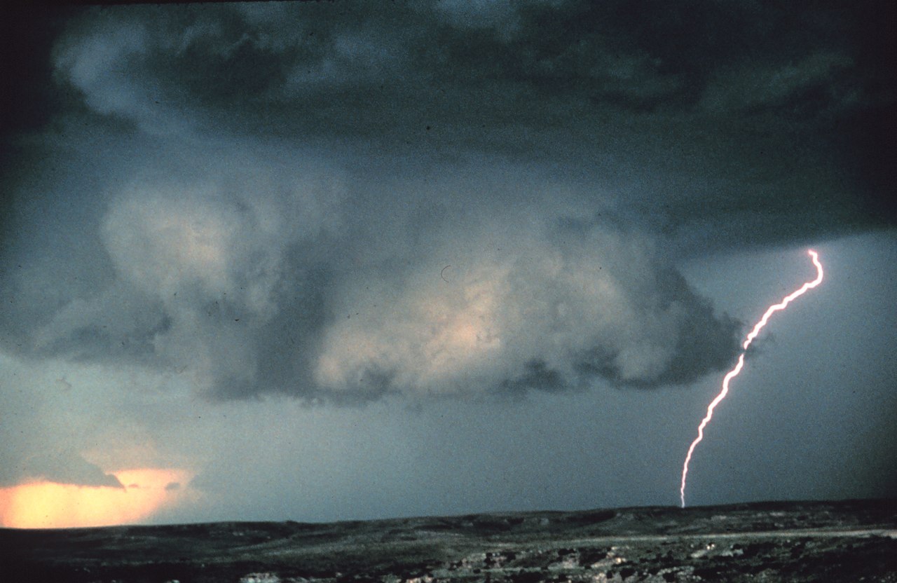
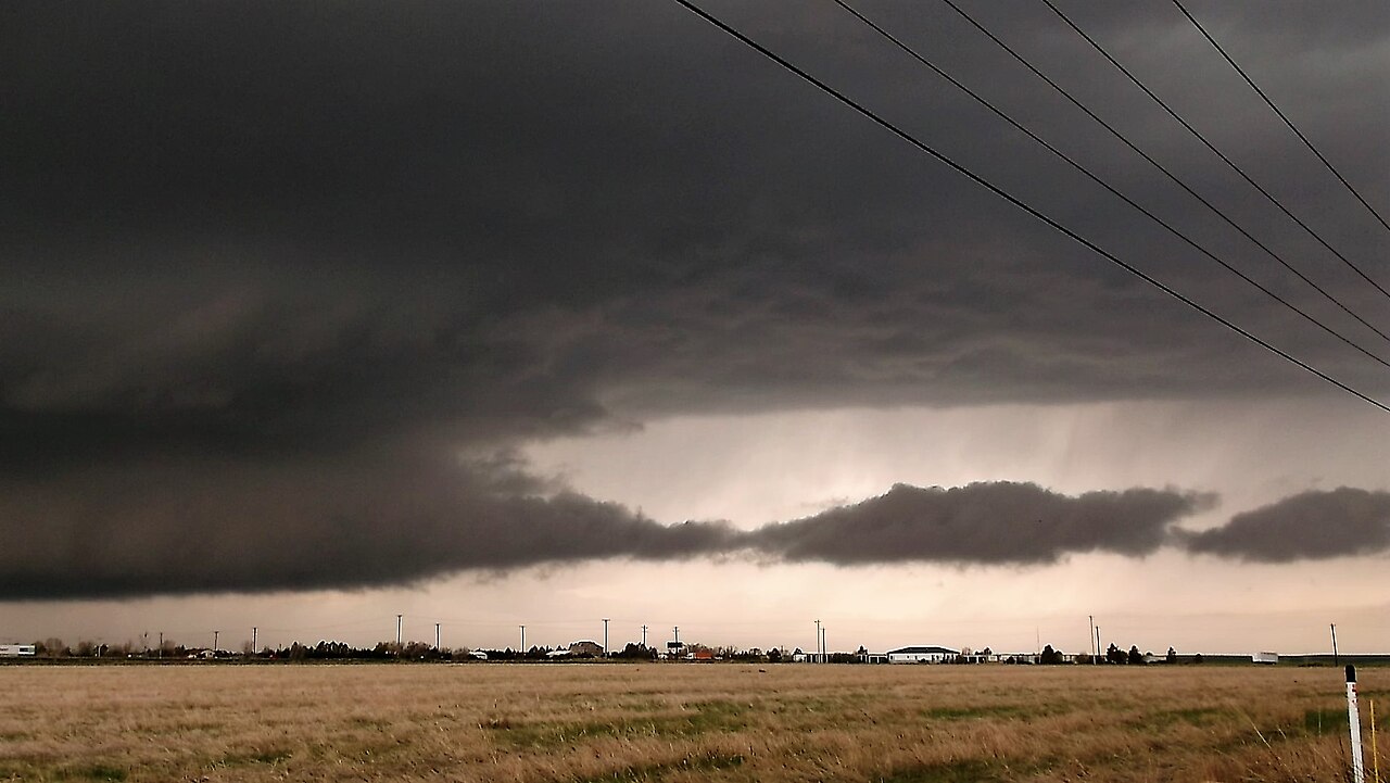
A wall cloud (also called a pedestal cloud) is a distinct, localized lowering of the cloud base that forms beneath the rain-free portion of a thunderstorm. It appears as a concentrated, often abrupt descent of cloud material beneath the storm’s main base and is most commonly associated with strong convective cells such as supercells. The feature may remain stationary or move slowly relative to the parent storm and can vary in size from on the order of hundreds of meters to a few kilometers across. A wall cloud is a type of cloud feature that forms in the immediate vicinity of intense updrafts within a storm.
Image gallery
7 Images


Formation and structure
Wall clouds form where warm, moist inflow air is drawn into a thunderstorm updraft and condenses as it rises. This process involves entrainment and the interaction of the storm’s inflow with cooler, rain-cooled air from downdrafts. The inflow can undercut the downdraft air, producing a localized lowering beneath the storm base that is often darker and more defined than surrounding clouds. When the updraft is strong and organized, the lowering can develop a compact, base-like appearance with vertical motion and sometimes visible rotation.
Identification and distinctions
Observers distinguish wall clouds from other low cloud features by several characteristics:
- Placement beneath the storm’s rain-free base (RFB), typically on the southwest or rear side of the updraft in the Northern Hemisphere.
- Clear, concentrated lowering that contrasts with the surrounding cloud deck, rather than a horizontal shelf that signals an outflow boundary.
- Often connected to the main storm base by striations or a narrow tail cloud and sometimes accompanied by rapid rising motion.
- Rotation may be visible in some wall clouds; rotating wall clouds commonly indicate an organized mid-level circulation (a mesocyclone) within the parent thunderstorm.
It is important to differentiate a wall cloud from a shelf cloud (an outflow feature associated with gust fronts) and from scud clouds (disconnected, ragged low clouds). A funnel cloud or tornado may appear as a narrowing extension from a wall cloud, but not all wall clouds produce funnels or tornadoes.
History and meteorological context
Recognition of wall clouds grew with improved storm observation and the emergence of storm-chasing and radar analyses. Meteorologists use both visual spotting and radar indicators—such as mid-level rotation signatures—to link wall clouds with mesocyclones and tornadogenesis. While wall clouds are closely monitored in severe weather forecasting, the relationship between a particular wall cloud and subsequent tornado formation depends on multiple dynamic factors within the storm.
Significance, examples and safety
Wall clouds are significant because rotating examples often signal a heightened potential for strong tornadoes, especially in supercell thunderstorms. Non-rotating wall clouds are more benign but still indicate strong updrafts and localized severe weather potential. For forecasters, storm spotters and researchers, wall clouds provide a visible cue to underlying storm dynamics when used alongside radar and other observations. For the public, a persistent, lowering, rotating wall cloud beneath a storm warrants taking immediate shelter, since tornado formation can occur rapidly from these features.
Notable facts and limitations
Not every rotating wall cloud produces a tornado, and not all tornadoes are preceded by a clearly visible wall cloud; some form rapidly or at low visibility. Wall clouds may persist for minutes to hours depending on the storm’s lifecycle. Their presence is one of several observational clues—together with radar-detected mesocyclones, hail cores, and inflow boundaries—used to assess severe weather threats.
Related articles
Author
AlegsaOnline.com Wall Cloud: formation, features, and relation to severe storms Leandro Alegsa
URL: https://en.alegsaonline.com/art/106263