
Strand Underpass (London vehicle tunnel)
The Strand Underpass is a mid-20th-century vehicle tunnel in central London connecting Waterloo Bridge to Kingsway near Holborn. Built by John Mowlem & Co., it opened in 1964 to ease surface traffic.
Overview
The Strand Underpass is a motor vehicle tunnel in central London that provides a direct link between Waterloo Bridge and Kingsway near Holborn. Constructed in the early 1960s, it was intended to move through-traffic off congested surface streets and to improve traffic flow across a busy area of the city.
Image gallery
2 Images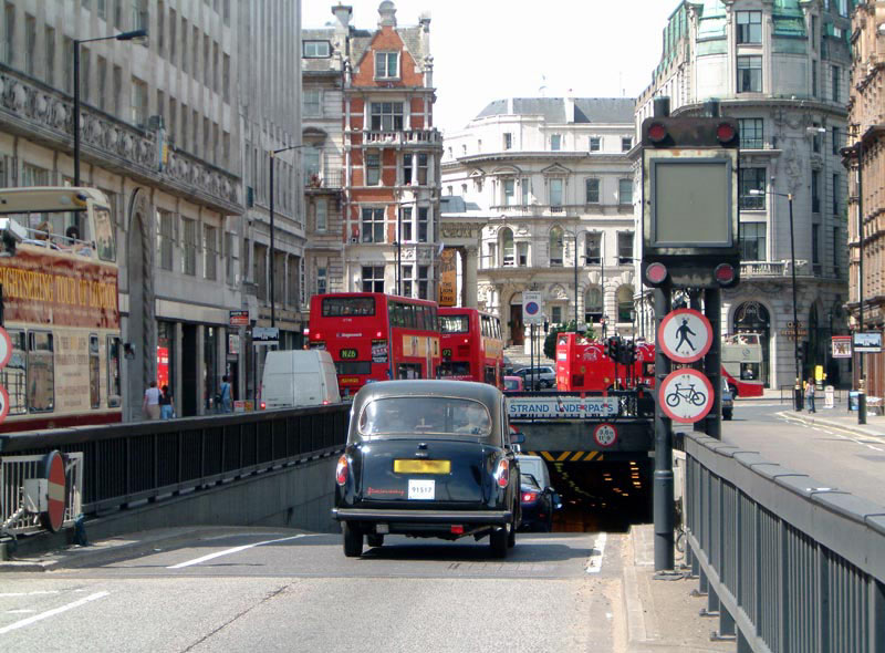

Design and construction
The underpass was built by John Mowlem & Co. and reflects the period's emphasis on modern road engineering and urban traffic management. While not a long tunnel by national standards, it required careful integration with existing roadways and utilities in a dense urban environment. It remains a purpose-built route for motor vehicles rather than for pedestrians or cyclists.
History and opening
Work on the route culminated in its formal opening on 21 January 1964. Its creation was part of wider post-war changes to central London’s traffic networks, when planners sought to separate local pedestrian zones from high-volume carriageways. The name "Kingsway Underpass" is sometimes used incorrectly; "Strand Underpass" is the accepted designation in most records.
Use and notable facts
The underpass serves as a practical urban link and is primarily used by motor traffic seeking a quicker north–south connection across the Thames corridor. Access is controlled and signage directs drivers to appropriate exits and connecting streets. Because it is entirely a vehicular route, it is not suitable for pedestrian access and is subject to routine maintenance schedules to ensure safety and clearances.
Location and quick facts
- Function: vehicle-only road tunnel linking major central London streets.
- Builder: John Mowlem & Co..
- Opening date: 21 January 1964.
- Often misnamed: sometimes called "Kingsway Underpass" in error.
- Map reference/coordinates: see 51.516583°N, 0.118861°W.
For contemporary maps and planning documents, consult local transport authority sources and historic archives that document London’s road development in the 1950s and 1960s. Further background on the surrounding streets—such as Waterloo Bridge and Kingsway—provides useful context for the underpass’s role in the city network.
Related articles
Author
AlegsaOnline.com Strand Underpass (London vehicle tunnel) Leandro Alegsa
URL: https://en.alegsaonline.com/art/94168