Saint Mary Parish — Antigua and Barbuda
Saint Mary is a civil parish on the island of Antigua in Antigua and Barbuda. Its capital is Bolans. The parish features coastal settlements, rural landscapes, and a mix of tourism and agriculture.
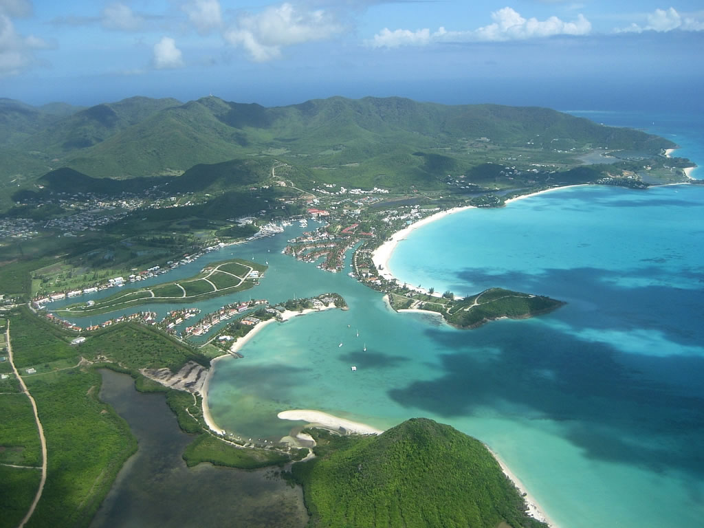
Saint Mary is a civil parish on the island of Antigua within the nation of Antigua and Barbuda. The parish administrative centre is the village of Bolans, and its approximate geographic position is given as 17°02′N 61°53′W. Saint Mary forms part of Antigua’s traditional system of parishes established during the British colonial period.
Image gallery
5 Images


Geography and settlements
Saint Mary occupies coastal and near-coastal terrain with a mixture of lowland plains, small hills and shoreline. The parish contains several villages and small communities that combine residential areas, local shops and community facilities. Its coastline includes beaches and sheltered bays typical of Antigua’s western and southern shores.
History and administration
The parish system on Antigua dates from colonial administration, when ecclesiastical boundaries also served civil functions. Saint Mary takes its name from the Christian tradition of parish naming. Today it functions as a recognized local division used for statistical, electoral and community purposes within the national framework.
Economy and local life
Economic activity in Saint Mary reflects common Antiguan patterns: small-scale agriculture, fishing, and services tied to tourism. Local businesses cater to both year-round residents and visitors. Community life centers on village institutions, markets and parish-level events.
Notable facts and distinctions
- Capital (administrative centre): Bolans.
- One of Antigua’s civil parishes, forming part of the island’s internal divisions.
- Coastal location contributes to a mixed economy of tourism, fishing and farming.
Related articles
Author
AlegsaOnline.com Saint Mary Parish — Antigua and Barbuda Leandro Alegsa
URL: https://en.alegsaonline.com/art/85952