Balakan District, Azerbaijan
Balakan District is a northwestern district of Azerbaijan in the Shaki‑Zagatala region, a foothill area noted for mixed agriculture, multiethnic communities and cross‑border links with Dagestan.
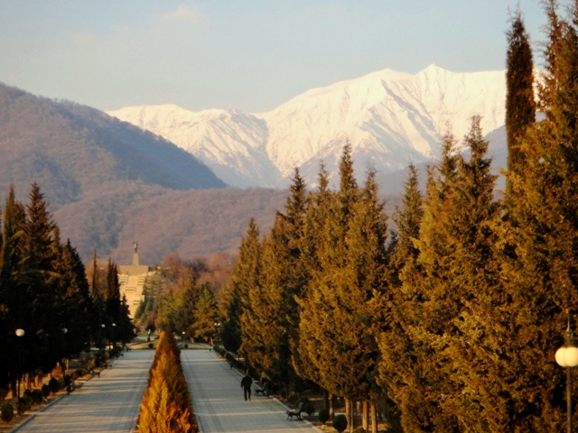
Balakan District is an administrative district in the northwest of Azerbaijan. Its administrative centre and largest urban settlement is the city of Balakan. The district lies within the Shaki‑Zagatala Economic Region and occupies a transitional zone of foothills, low mountains, forested slopes and river valleys at the southern edge of the Greater Caucasus.
Image gallery
3 Images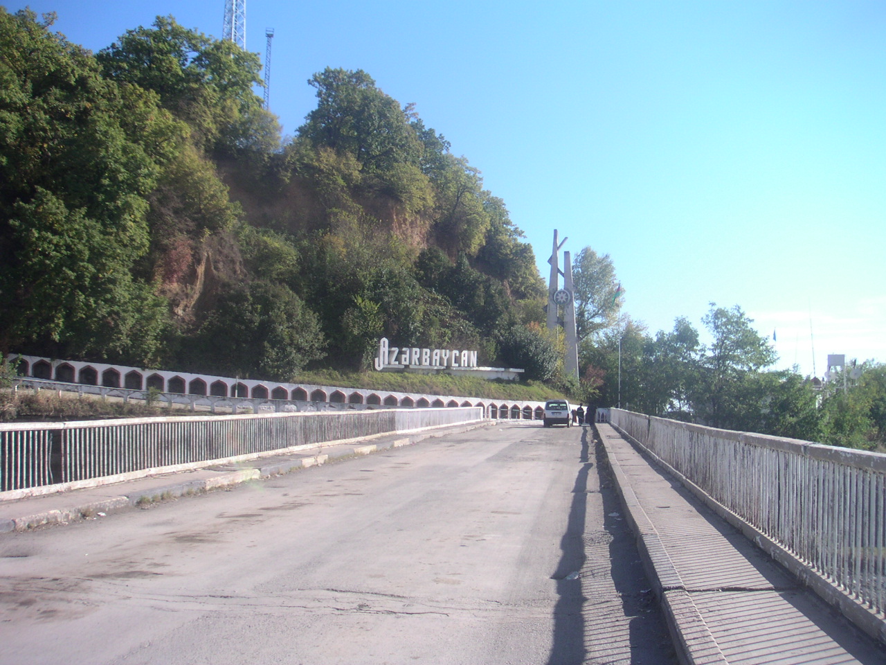

Names and peoples
The district's local names reflect its linguistic diversity: in Azerbaijani it is Balakən rayonu and in Avar it is recorded as Bilkan muq. The population includes ethnic Azerbaijanis alongside speakers of minority languages; the area has a long tradition of mixed communities typical of the western Caucasus. Local communities maintain languages, crafts and culinary traditions that form part of the region's multiethnic character.
Geography and climate
Balakan borders the neighbouring district of Zagatala and an international frontier with the Republic of Russia, specifically the Republic of Dagestan. Rivers originating in higher ground feed valley agriculture and wetlands, while patches of deciduous forest and terraced fields shape settlement and land use. The climate is generally temperate with variations between lowland and higher foothill zones that influence cropping patterns.
Administration and population
The district is one of the country's 66 administrative districts and forms part of national territorial organisation (see national subdivisions). Official estimates in recent years put the district population near one hundred thousand residents, concentrated in the capital and a number of rural municipalities. Local councils and executive authorities oversee services, schools and community development.
Economy and land use
Economic activity in Balakan is largely rural and agricultural, adapted to the foothill environment. Common livelihoods include horticulture (fruit and nut cultivation), small‑scale farming, livestock rearing and beekeeping. Local markets and cottage processing industries support sale of produce and traditional foodstuffs. The district's landscape also supports sustainable forestry, and its natural setting provides potential for rural and eco‑tourism.
History, culture and transport
Historically the region was woven into Caucasian trade and political networks and experienced the administrative changes common to the South Caucasus, including periods under local khanates, imperial Russian administration and Soviet organisation before integration within independent Azerbaijan. Cultural life blends local music, craftwork and cuisine. Transport links connect Balakan with neighbouring districts and with cross‑border points toward Dagestan, enabling trade and family ties across the frontier.
- Major features: foothill forests, river valleys and mixed agriculture.
- Typical activities: fruit and nut cultivation, beekeeping, small trade and crafts.
- Administrative context: district within the Shaki‑Zagatala economic region of Azerbaijan.
Tags
Related articles
Author
AlegsaOnline.com Balakan District, Azerbaijan Leandro Alegsa
URL: https://en.alegsaonline.com/art/8439