
Roper River: geography, history, ecology and human use
The Roper River in Australia's Northern Territory flows about 400 km east from near Mataranka to the Gulf of Carpentaria. This article covers its course, ecology, history, navigation and contemporary significance.
Overview
The Roper River is a major watercourse in the Northern Territory of Australia. Running roughly east for about 400 km, it drains a broad tropical floodplain and empties into the Gulf of Carpentaria. The river plays a central role in the landscape, linking inland savannas to coastal wetlands and supporting both ecological diversity and human communities.
Image gallery
5 Images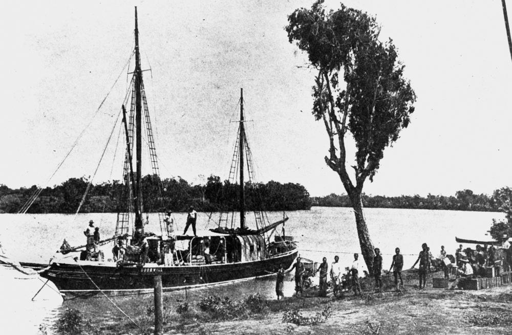


Course and physical characteristics
The river rises near the Mataranka area and flows across low-gradient country before reaching a notable natural feature known as Roper Bar. Roper Bar is a rocky shelf that marks a change in gradient and has traditionally been the upriver limit for larger boats. Below the bar the river broadens into estuarine and tidal reaches that are influenced by the seasonal monsoon cycle, with pronounced wet- and dry-season differences in flow, extent of flooding and salinity along the lower reaches.
Ecology and landscape
The Roper River system supports a mosaic of habitats: freshwater billabongs, seasonally inundated grasslands, mangrove-lined estuaries and open water channels. These habitats provide feeding and breeding grounds for fish, waterbirds and other wetland species, and mangroves help stabilise the coastline where the river meets the gulf. Like many northern Australian rivers it is also home to crocodiles and a variety of freshwater fish important to local subsistence and recreational fisheries.
History and human connections
Long before European contact the river and its floodplain were part of the country of several Aboriginal groups, who relied on its fish, access routes and ceremonial sites. The Roper entered written European records during 19th-century exploration: Ludwig Leichhardt and his party encountered the river in 1845 and named it after John Roper, a member of the expedition (European exploration). In the later 19th century paddle steamers and small riverboats operated on the navigable reaches below Roper Bar, servicing stations and settlements.
Uses, communities and economy
Today the river continues to support remote communities, cattle stations and small-scale fisheries. It attracts tourists for fishing, wildlife viewing and cultural experiences. Navigation is generally possible to Roper Bar in the middle reaches, with smaller craft able to travel further during the wet season when waterways expand. Management of water resources, invasive species and the protection of cultural sites are ongoing concerns for local people and authorities.
Notable facts and conservation
Key points about the Roper River include its seasonal tropical hydrology, the natural barrier formed by Roper Bar, and its role as a link between inland ecosystems and the Gulf of Carpentaria. Conservation efforts focus on maintaining water quality, sustaining fish and bird populations, and respecting Indigenous cultural connections. For further regional context see resources on the Northern Territory, Australia and the Gulf.
Related articles
Author
AlegsaOnline.com Roper River: geography, history, ecology and human use Leandro Alegsa
URL: https://en.alegsaonline.com/art/84071
Sources
- britannica.com : "Roper River"
- smh.com.au : "Roper Bar"