Ravendale, California
Ravendale is an unincorporated community in eastern Lassen County, California, located along U.S. Highway 395 at about 1,617 m (≈5,300 ft). It is a small service point with a nearby airstrip.
Overview
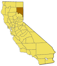
Ravendale is an unincorporated community in the eastern part of Lassen County in northern California. It sits along U.S. Highway 395 and is best described as a dispersed, rural settlement rather than an incorporated town. At an elevation near 1,617 meters (about 5,300 feet), Ravendale occupies high-desert country characteristic of this region.
Image gallery
2 Images
Geography and climate
The community lies within the high plateaus and basins that characterize much of northeastern California. Vegetation is generally sparse and adapted to semi-arid conditions; nearby lands are commonly used for grazing and open-space purposes. Seasonal weather tends to include warm, dry summers and cold winters with occasional snowfall at this elevation.
Transportation and facilities
Ravendale’s location on U.S. Highway 395 places it on a major north–south corridor that connects the eastern Sierra Nevada corridor with points to the north and south. The community also has a small local airport or airstrip that provides limited aviation access for light aircraft and occasional emergency use. For reference and further details, see the community listing at local community resources, the county page at Lassen County, statewide information at California resources, and the airstrip or airport summary at airfield information.
History and land use
Like many small communities in the American West, Ravendale developed as a service point for travelers, ranching operations, and transportation routes. Its existence reflects broader settlement patterns in Lassen County where access to water, grazing lands and routes for moving livestock and goods shaped local development. Today the surrounding economy is largely rural: ranching, outdoor recreation, and low-density residential use are typical.
Local character and importance
Ravendale is notable for its remote, quiet character and its role as a waypoint along a significant highway rather than as a population center. As an unincorporated place it relies on county-level governance for public services. The presence of a small airstrip, open landscapes, and proximity to public lands make the area of interest to pilots, outdoor enthusiasts, and those seeking access to more remote parts of northeastern California.
Notable facts
- Administrative status: Unincorporated community within Lassen County.
- Elevation: Approximately 1,617 meters (about 5,300 feet) above sea level.
- Transportation: Located on U.S. Highway 395 and served by a small local airport/airstrip.
- Character: Rural, sparsely populated, with land uses typical of high-desert northeastern California.
Related articles
Author
AlegsaOnline.com Ravendale, California Leandro Alegsa
URL: https://en.alegsaonline.com/art/81304