
Ramanathapuram district: geography, culture, economy and notable sites
Ramanathapuram district in southeastern Tamil Nadu is a coastal region centred on Rameswaram. It is known for fishing, palmyra products, pilgrimage centres, the Pamban bridge and marine biodiversity.
Overview
Ramanathapuram district occupies a coastal portion of southeastern Tamil Nadu and includes the island town of Rameswaram. The district stretches along the Palk Strait and the Gulf of Mannar and combines low sandy coastlines, palmyra groves and a maritime economy. Historically it has been an important area for fishing, seaborne trade and religious pilgrimage. The district is also widely known as the birthplace of former President A. P. J. Abdul Kalam; readers can find biographical and local context at related resources: A. P. J. Abdul Kalam references.
Image gallery
7 Images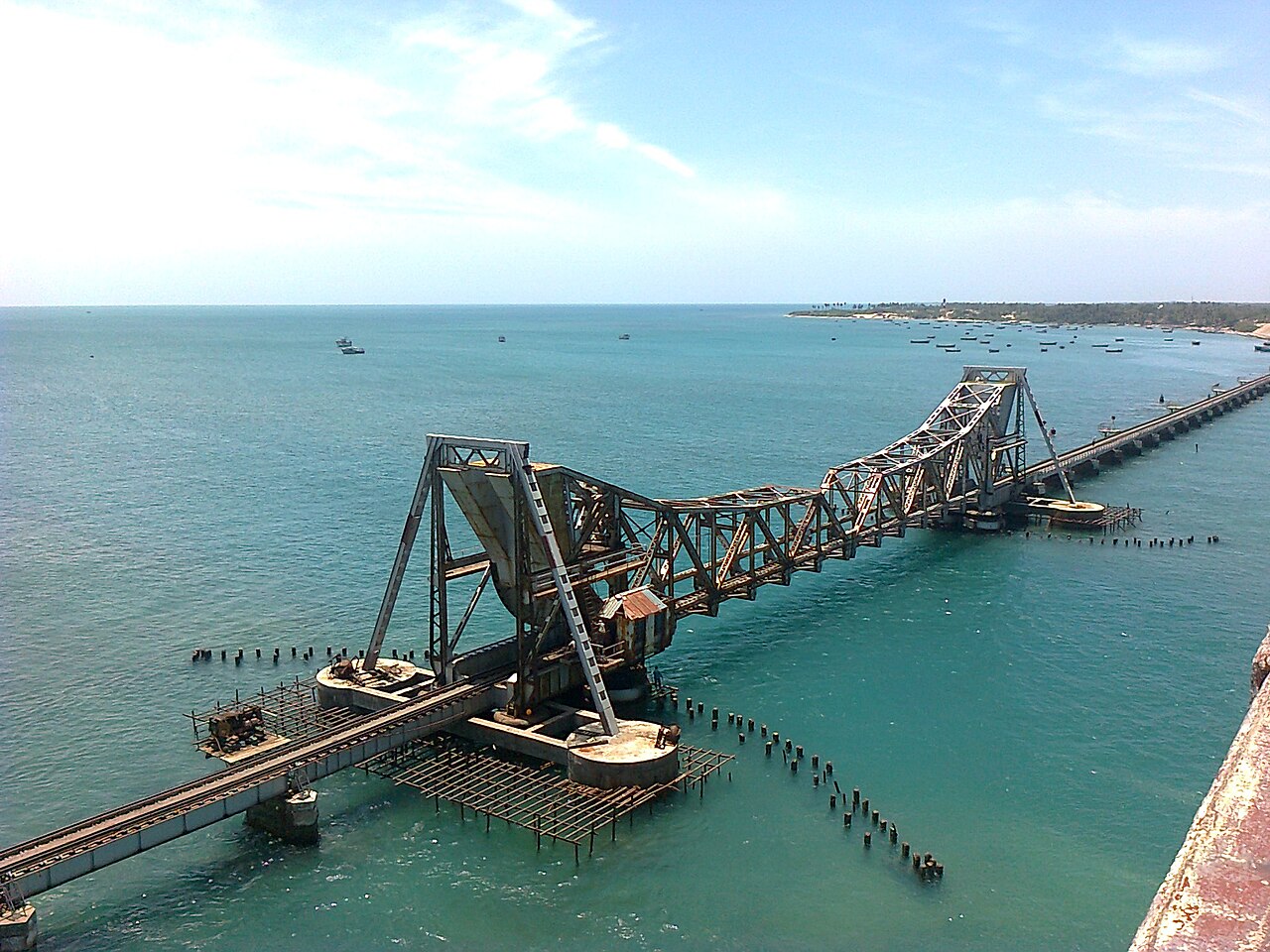


Geography and climate
Geographically the district faces shallow seas, islands and sandbars, and includes the Pamban (Rameswaram) island connected to the mainland by the Pamban causeway and bridge. Soils tend to be sandy or red loam and the climate is generally hot and semi-arid with seasonal monsoon rains. Coastal areas experience saline conditions that shape local agriculture and settlements, while offshore reefs and seagrass beds in the Gulf of Mannar support marine life.
Economy and livelihoods
The economy of Ramanathapuram is a mix of agriculture, fisheries and small-scale industry. Inland farmers cultivate millets, pulses and seasonal crops adapted to lower rainfall; along the coast, fishing is a primary livelihood. Palmyra palms are a distinctive local resource: communities harvest sap and produce a range of items including jaggery, sugar, fiber and traditional crafts. Additional economic activities include salt production from pans, boat building and food processing based on local catches and produce.
History, culture and pilgrimage
The district has a long cultural history. Rameswaram is one of the major pilgrimage centres of southern India and is associated with traditions centred on the epic Ramayana; many temples, sacred bathing spots and prayer routes draw pilgrims throughout the year. Other important religious sites include village temples with long-standing local traditions and Muslim shrines such as the Erwadi dargah, which attract devotees and visitors from across the region. Cultural life reflects a blend of Dravidian temple traditions, maritime customs and communities that have long relied on the sea.
Towns, administration and transport
Administrative and market towns serve as local hubs. Major towns include Ramanathapuram (the district headquarters), Rameswaram and Pamban island, Paramakudi, Kamuthi, Mandapam, Uchipuli and Sayalkudi. Road networks and rail links connect these towns to larger urban centres in Tamil Nadu, and the Pamban railway bridge is a notable engineering feature and transport link. For official information and services consult the district portal: district information.
Railway stations
- Sudiyur (சூடியூர்)
- Paramakudi (பரமக்குடி)
- Sathirakudi (சத்திரக்குடி)
- Ramanathapuram (இராமநாதபுரம்)
- Valantharavai (வாலாந்தரவை)
- Uchippuli (உச்சிப்புளி)
- Mandapam Camp (மண்டபம் கேம்ப்)
- Mandapam (மண்டபம்)
- Pamban (பாம்பன்)
- Rameswaram (இராமேஸ்வரம்)
Tourism and notable sites
Tourism in Ramanathapuram mixes pilgrimage with coastal scenery and historical interest. Key religious and heritage sites include the Ramanathaswamy Temple in Rameswaram and village temples such as the Thiru Uthirakosamangai complex. Coastal attractions include Dhanushkodi and its ruins, Agni Theertham, various beaches such as Kushi and Thalaithoppu, and the panoramic Pamban bridge and causeway. The district also serves as a gateway for visitors interested in the Gulf of Mannar and its marine life. Practical visitor and tourism resources are available via regional tourism guides: tourism information.
Environment, conservation and challenges
Like many coastal districts, Ramanathapuram faces environmental pressures: shoreline erosion, cyclone risk, salt intrusion into groundwater and stress on fisheries and coral and seagrass habitats. The Gulf of Mannar region is noted for biodiversity and has been the focus of conservation initiatives. Sustainable management of fishing, protection of marine habitats and measures to enhance coastal resilience are ongoing priorities for local communities, researchers and authorities.
Society, festivals and crafts
Local culture reflects a strong maritime character with festivals, temple rituals and seasonal events linked to fishing cycles and agricultural harvests. Palmyra-based crafts, toddy tapping and the production of traditional sweets and jaggery contribute to local identity. Cuisine emphasizes seafood and regional preparations that use locally available ingredients. Educational institutions and community groups play an increasing role in local development and cultural preservation.
Contemporary notes
Development efforts in the district aim to balance heritage tourism, sustainable fisheries, agricultural resilience and improved infrastructure. Preserving religious and historical sites, supporting palmyra-based livelihoods and strengthening disaster preparedness for coastal communities are recurrent themes in planning and civic discussion. For administrative, cultural and visitor information the district portal and tourism resources are useful starting points: district information, regional resources and tourism information.
Related articles
Author
AlegsaOnline.com Ramanathapuram district: geography, culture, economy and notable sites Leandro Alegsa
URL: https://en.alegsaonline.com/art/81012