
Kalam Valley (Swat, Pakistan) — Geography, Attractions and Travel Guide
Kalam Valley is a high-altitude sub-valley of Swat in Khyber Pakhtunkhwa, Pakistan, known for rivers, lakes, coniferous forests, alpine meadows and mountain views; a gateway for trekking and nature tourism.
Overview
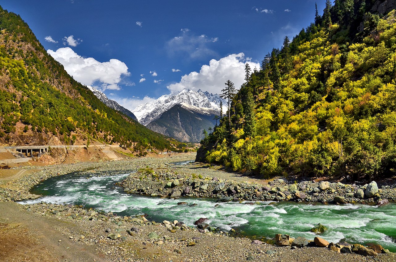
Kalam Valley is a scenic sub-valley in the northern part of Swat District, Khyber Pakhtunkhwa, Pakistan. Situated at roughly 2,000 metres above sea level and about 100 km from Mingora, Kalam lies along the upper reaches of the Swat River system. The valley is valued for its combination of rivers, lakes, coniferous forests, alpine meadows and snow-capped peaks, and it serves as a gateway to higher alpine terrain and several subsidiary valleys.
Image gallery
5 Images


Geography and hydrology
Kalam sits where two principal tributaries, the Ushu and the Gabral (also spelled Gabral/Gabrel in some accounts), join to form the Swat River, historically called Suvastu. These rivers originate in glaciated highlands and supply a network of streams, waterfalls and irrigation channels that sustain local agriculture. Topographically, Kalam includes a comparatively flat, fertile plateau above the river, surrounded by steep, wooded slopes and rising mountain ridges. From nearby viewpoints such as Matiltan visitors can see prominent snow-clad summits of the greater Himalayan and Hindu Kush system.
Natural features and attractions
The valley concentrates a number of natural attractions within a compact area. Key features include:
- Alpine lakes: Several clear, high-altitude lakes lie in neighbouring valleys and on trekking routes; these lakes are prized for their colour, reflections and mountain backdrops.
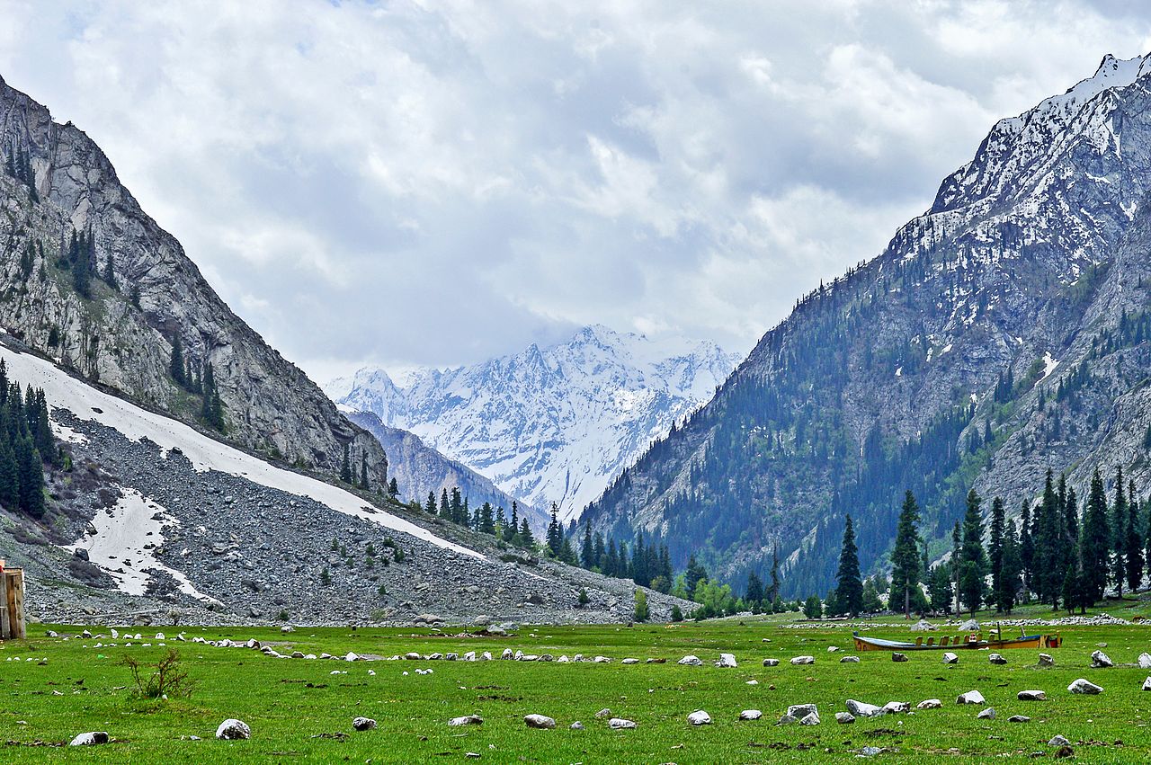
- Forests and meadows: Extensive coniferous forests and open grassy meadows support seasonal wildflowers, grazing livestock and wildlife typical of high temperate zones.
- Waterfalls and streams: Cascades and tributaries create attractive picnic and photography sites along trails and valley roads.
- Mountain vistas: Panoramic views of peaks are visible from vantage points such as Matiltan and other overlooks near the main road.
Notable nearby destinations
From Kalam, visitors commonly travel to neighbouring valleys and lakes. Well-known excursions include trips up Ushu and Utror valleys, and further to alpine lakes often reached by jeep track or on foot. These destinations provide opportunities for day hikes, multi-day treks and camping in remote settings. Local routes vary in difficulty and conditions; some higher reaches are only accessible in summer months.
Culture, history and economy
Kalam shares the cultural traditions of the greater Swat region. The local economy remains largely rural, based on small-scale agriculture, pastoralism and seasonal tourism. Guesthouses, small hotels and eateries operate in Kalam during the tourist season, and local handicrafts and foods are available in market areas. Tourism has grown in importance as a source of income, encouraging many residents to offer guiding, transport and hospitality services.
Access and transportation
Road access reaches Kalam on a metalled road that continues from lower Swat; beyond Kalam, shingled or unpaved tracks lead deeper into Ushu, Utror and other sub-valleys. The drive from Mingora or Saidu Sharif typically follows the main Swat valley road; travel times vary with weather and road conditions. In high snow or during heavy rains some tracks can become difficult or impassable, so seasonal timing matters.
Activities and practical information
- Hiking and trekking: Options range from short walks in meadows to longer treks into neighbouring valleys and to alpine lakes. Trails vary from easy to strenuous and are best attempted with local guides if you are unfamiliar with the terrain.
- Fishing and wildlife: Trout fishing occurs in some streams where permitted; birdwatching and observing mountain fauna can also be rewarding.
- Accommodation: Guesthouses and small hotels provide basic to comfortable lodging. Facilities are more limited the farther one travels from Kalam town.
- Health and safety: Altitude is moderate but visitors should allow time to acclimatise, carry warm clothing for nights and be prepared for changing weather. Mobile coverage and medical services are limited outside main settlements.
Best time to visit and conservation
The most favourable months for travel are late spring through early autumn, when mountain views are clearer, roads are more passable and highland pastures are green. Winters bring heavy snow and restricted access. Kalam's ecosystems—forests, alpine pastures and river corridors—are ecologically important but sensitive to unplanned development, waste and overuse. Local authorities and community groups promote measures to reduce impacts, such as encouraging responsible waste disposal, limiting driving off established tracks and supporting designated camping areas.
Visitor tips
- Plan travel according to the season and check local road conditions before departure.
- Use local guides for unfamiliar treks and respect private grazing lands and seasonal closures.
- Carry sufficient cash, basic supplies and warm clothing; expect limited services in remote valleys.
- Follow Leave No Trace principles: take rubbish back to collection points, avoid disturbing wildlife and minimize campfire impacts.
Kalam Valley offers a compact experience of northern Pakistan's mountain landscapes: accessible river valleys, high pastures, attractive lakes and a developing visitor infrastructure that connects travellers to the wider Himalayan and Hindu Kush highlands.
Related articles
Author
AlegsaOnline.com Kalam Valley (Swat, Pakistan) — Geography, Attractions and Travel Guide Leandro Alegsa
URL: https://en.alegsaonline.com/art/51938