
Haa District, Bhutan
Haa District is a mountain district in western Bhutan, known for its remote valley, traditional culture, and border location on the Tibetan frontier.
Overview
Haa District lies in western Bhutan and is one of the country's twenty dzongkhags (districts). Its approximate centre is given by the coordinates 27°15′N 89°10′E. The district administration is based in the town of Ha (Ha), and the dzongkhag is formally part of the Kingdom of Bhutan.
Image gallery
6 Images



Geography and environment
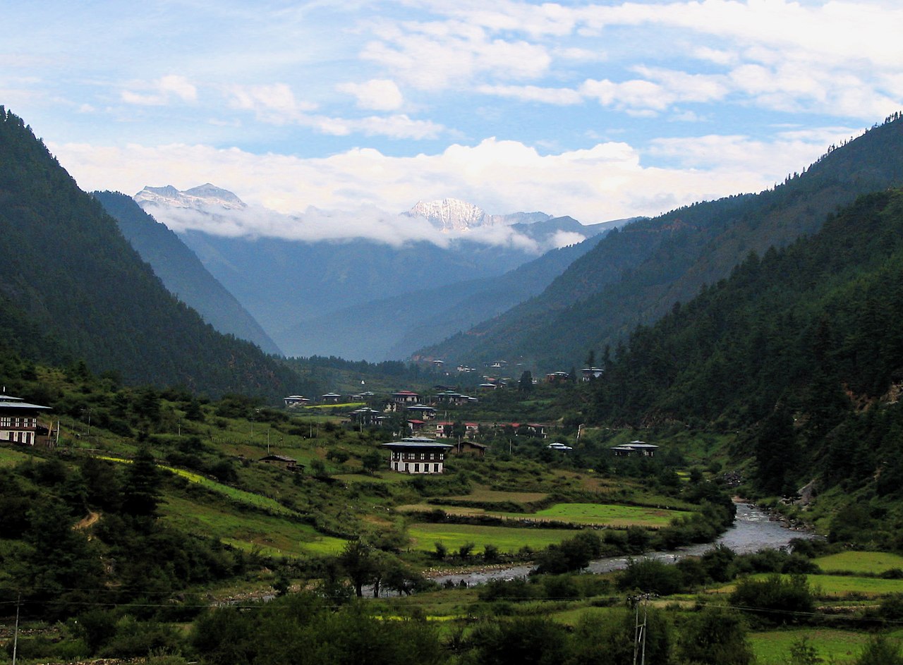
The district occupies a high Himalayan valley and surrounding slopes. Elevations vary from river valleys to high mountain passes and peaks, and the area includes alpine meadows, mixed conifer forests and glacial-fed streams. The landscape is largely rural and retains a strong sense of wilderness, with scenic mountain views that form part of Bhutan's protected and forested hill country.
Administration and local life
Haa District is divided into six gewogs (village blocks), which are the basic local administrative units. Settlements are dispersed and communities rely on subsistence agriculture, livestock herding and small-scale horticulture. Local infrastructure is modest; road links are confined to a few valley routes that connect the district to neighbouring areas.
Culture, tourism and attractions
The district preserves traditional Bhutanese culture, with local temples (lhakhangs), monastic events and seasonal festivals. Haa has become better known to visitors for its quiet valleys, cultural displays such as the Haa Summer Festival, and as a starting point for mountain walks and pilgrimage routes. The Chele La mountain pass and nearby Himalayan peaks offer dramatic scenery and trekking opportunities.
History and significance
Historically the Haa Valley lay along regional trade and pilgrimage corridors between Bhutan and Tibet, and its border location gives the district strategic importance. In recent decades authorities have balanced development with conservation, promoting controlled tourism while protecting traditional land use and forested landscapes.
Quick facts
- Administrative centre: Ha.
- National affiliation: Bhutan.
- Coordinates near district centre: 27°15′N 89°10′E.
- Divisions: six gewogs (village blocks).
Visitors and students of Himalayan culture value Haa for its compact valley character, strong local traditions and proximity to high-mountain scenery. The district remains a good example of Bhutan's efforts to combine cultural preservation, environmental stewardship and limited, sustainable tourism.
Questions and answers
Q: What are the coordinates of Haa District?
A: The coordinates of Haa District are 27°15′N 89°10′E / 27.250°N 89.167°E.
Q: How many districts are there in Bhutan?
A: There are 20 districts in Bhutan.
Q: What is the administrative centre of Haa District?
A: The administrative centre of Haa District is Ha.
Q: How many village blocks are there in Haa District?
A: There are six village blocks in Haa District.
Q: What is the name of the district located at 27°15′N 89°10′E?
A: The district located at 27°15′N 89°10′E is Haa District.
Q: Where is Haa District located?
A: Haa District is located in Bhutan.
Q: What is the significance of the coordinates 27°15′N 89°10′E?
A: The coordinates 27°15′N 89°10′E represent the location of Haa District in Bhutan.
Related articles
Author
AlegsaOnline.com Haa District, Bhutan Leandro Alegsa
URL: https://en.alegsaonline.com/art/41648