Geography of Taiwan
Overview of Taiwan's physical landscape, islands, climate, tectonic setting, ecosystems and human geography, including major regions and distinctive features.
Overview
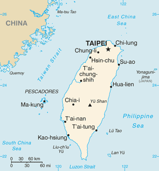
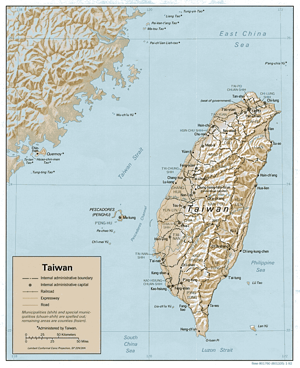
Taiwan, historically called Formosa, is a medium-sized island group in East Asia lying near 23°30'N, 121°00'E and crossed by the Tropic of Cancer. It forms the main territory of the Republic of China and is commonly referred to as Taiwan. The archipelago sits between the East China Sea, the Philippine Sea and the South China Sea and includes one large main island and several offshore islands.
Image gallery
10 Images


Physical geography
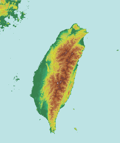
The main island is dominated by a central mountain range running from north to south, with steep slopes and narrow river valleys. To the west are broader alluvial plains and a densely settled coastal plain. The eastern side features a narrower coastal strip bounded by rugged mountains that descend quickly to the sea. Short, swift rivers drain the highlands to the plains and the surrounding seas.
Major islands and regions
- Main island of Taiwan (largest and most populated)
- Penghu (Pescadores) archipelago in the Taiwan Strait
- Kinmen and Matsu groups near the Chinese coast
- Orchid Island (Lanyu) and Green Island off the southeast coast
Climate and ecosystems
Climate ranges from tropical in the south to subtropical in the north, with a pronounced monsoon season and frequent typhoons in summer and autumn. The variation in elevation creates multiple ecological zones: coastal wetlands, lowland agriculture, montane forests and alpine vegetation at higher altitudes. Taiwan is noted for high biodiversity and many endemic species because of its island isolation and varied habitats.
Geology and natural hazards
Tectonically, Taiwan lies near the convergent boundary between the Eurasian Plate and the Philippine Sea Plate. This setting produces active uplift that created the island’s mountain ranges and makes the region prone to earthquakes and occasional tsunamis. Steep terrain, intense rainfall and seismic activity also increase the risk of landslides and erosion.
Human geography and land use
Most population and economic activity concentrate on the western plains and in major cities along a north–south corridor. Agriculture, especially rice and subtropical crops, is concentrated on flatter lowlands, while forestry and protected areas occupy much of the mountainous interior. Transportation and urban development often follow the coastal belt, linking ports and industrial centers.
Notable distinctions
Its position along important maritime routes, its complex tectonic origins, and a steep environmental gradient from sea level to high mountains give Taiwan distinctive physical and biological characteristics. The island’s varied landscape supports a mix of urban, agricultural and protected natural areas within a relatively compact territory.
Related articles
Author
AlegsaOnline.com Geography of Taiwan Leandro Alegsa
URL: https://en.alegsaonline.com/art/38134