Ennerdale Water (Lake District, Cumbria)
Ennerdale Water is a small glacial lake in the western Lake District, noted for its remote moorland setting, walking routes, and the Wild Ennerdale landscape-scale conservation partnership.
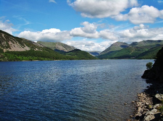
Ennerdale Water lies at the western edge of the Lake District National Park in Cumbria and occupies a quiet, long valley carved by glacial action. The lake is roughly 2½ miles (about 3.9 km) long, relatively narrow, and reaches significant depth for its size. Its shoreline remains largely undeveloped, giving the valley a secluded and unspoilt character that attracts walkers and naturalists seeking a less busy experience than the central lakes.
Image gallery
6 Images


Physical characteristics and geology
The basin of Ennerdale Water was formed by ice during the last ice age and is typical of glacial lakes in the region: elongated, deep relative to surface area, and set within steep-sided fells. The surrounding geology includes upland peat, heath and mixed woodlands on lower slopes. Small tributary streams drain the surrounding hills into the lake and a single outflow carries water westwards toward the Irish Sea. For general context about features of ice-formed bodies of water see resources on glacial lakes.
Wildlife and habitats
The valley supports a mosaic of habitats: open moor, upland grassland, pockets of native and planted woodland, and wetland areas associated with the lake and its inflows. Birdlife typical of the Lake District uplands can be found here, and the lake supports freshwater fish, with angling for trout a long-established recreational use. Peatland and woodland management in the catchment influence water quality and habitat diversity.
Access, recreation and local services
Access to Ennerdale Water is more limited than to many other Lake District lakes, which contributes to its sense of remoteness. Walking routes around parts of the shore and upland paths into neighbouring fells provide opportunities for day walks and longer routes. Facilities near the lake are minimal; the small settlement at the lake's western end is served by the village of Ennerdale Bridge, while nearby towns such as Whitehaven and Cleator Moor offer additional services. The lake is often referenced in guides that compare the quieter waters of the region—see comparative material on small lakes.
Conservation, management and Wild Ennerdale
The Ennerdale catchment has been the focus of a collaborative conservation initiative known as Wild Ennerdale. This partnership involves landowners, conservation organisations and public bodies working to restore natural processes, encourage native woodland regeneration, improve river habitats and promote sustainable land use. Management aims to balance nature recovery with public access and the interests of local farmers.
History and cultural context
Human use of the valley is long-standing but has left a lighter footprint than in more accessible parts of the Lakes. Traditional hill farming, small-scale woodland management and pastime visitors have shaped the landscape. Its relative isolation contributed to the preservation of open fell character and pockets of native vegetation.
Ennerdale Water's appeal for visitors lies in the combination of open moor, woodland and water within a setting that feels remote yet remains within reach of nearby communities. Practical visiting information, seasonal guidance and detailed walking routes are provided by local visitor services and conservation partners who manage access and habitat restoration in the valley.
Questions and answers
Q: What is Ennerdale Water?
A: Ennerdale Water is the most westerly lake in the Lake District National Park in Cumbria.
Q: Is Ennerdale Water a glacial lake?
A: Yes, Ennerdale Water is a glacial lake.
Q: What is the maximum depth of Ennerdale Water?
A: The maximum depth of Ennerdale Water is 150 feet (45 metres).
Q: How wide is Ennerdale Water?
A: Ennerdale Water is ½ mile to a mile (700 to 1,500 metres) wide.
Q: How long is Ennerdale Water?
A: Ennerdale Water is 2½ miles (3.9 kilometres) long.
Q: Where is Ennerdale Bridge located?
A: Ennerdale Bridge is located to the west of Ennerdale Water.
Q: What other places are close to Ennerdale Water?
A: The port of Whitehaven, the town of Cleator Moor, and the village of Cleator are close to Ennerdale Water.
Related articles
Author
AlegsaOnline.com Ennerdale Water (Lake District, Cumbria) Leandro Alegsa
URL: https://en.alegsaonline.com/art/31531
Sources
- books.google.com : A northern coast to coast walk: from St Bees Head to Robin Hood's Bay
- books.google.com : Lake District miscellany
- entertainment.timesonline.co.uk : "The pain of being Hillary"