Cleveland (England)
Region on the River Tees in north‑east England; a former county (1974–1996) centred on Teesside, noted for its iron and shipbuilding heritage, varied landscapes and continued use of the Cleveland name.
Cleveland is a region in north‑east England around the estuary of the River Tees. The name, which literally means "cliff‑land", refers to the hilly country south of the Tees, including the Cleveland Hills and the southern approach to the North York Moors. The area combines coastal ports, industrial lowlands and agricultural and moorland uplands. Between 1974 and 1996 Cleveland also existed as an administrative county created from parts of the North Riding of Yorkshire and County Durham.
Image gallery
5 Images


Geography and landscape
The Cleveland area stretches from the mouth of the Tees on the North Sea inland to the foothills of the North York Moors. Coastlines around Teesside are dominated by industrial complexes and the port facilities of Teesport, while land to the south becomes progressively rural and undulating. The Cleveland Hills rise to several hundred metres and form a transition to the moorland plateau. Lowland plains and river valleys are used for agriculture and urban development, whereas the higher ground provides open moorland, walking routes and smaller settlements.
Administrative history
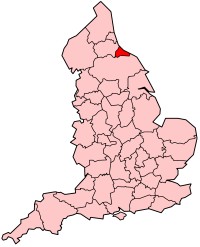
As an administrative entity Cleveland was created by the Local Government Act 1972 and came into being in 1974. It combined urban and coastal districts including Middlesbrough, Stockton‑on‑Tees, Hartlepool and the area later called Redcar and Cleveland. The county covered roughly 583 km² and had Hartlepool, Middlesbrough, Stockton and Langbaurgh (later Redcar and Cleveland) as principal districts. In 1996 the county council and county status were abolished during a reorganization of local government; the districts became unitary authorities. The historic, geographic notion of Cleveland, however, is older and not identical to the 1974–1996 administrative boundaries.
Economy and transport
Cleveland's modern character was shaped in the 19th century by the discovery and extraction of ironstone in the hills and by rapid industrial development along the Tees. Middlesbrough grew from a small township into a major industrial town serving ironworks, steelworks and shipbuilding, with raw materials brought to blast furnaces on the river. Teesport remains one of the United Kingdom's important ports, handling bulk cargoes and supporting chemical and engineering industries. In recent decades the area has experienced deindustrialization and subsequent economic restructuring, with growth in logistics, manufacturing niches, energy, chemicals and services. Major road links such as the A19 and rail connections support commuting and freight movements across the Tees Valley.
Culture, communities and institutions
The Cleveland name persists in a number of public bodies and cultural references. Examples include Cleveland Police and local fire and rescue services that historically carried the name; broadcasting and civic organisations have used the title at different times. The urban centre of Teesside contains cultural venues, museums and sporting clubs (notably football) that reflect the region's industrial past and community life. Nearby historical sites and associations with figures such as Captain James Cook (born in the area now within Middlesbrough) add to local identity.
Distinguishing features and legacy
It is important to distinguish between Cleveland as a geographic area and the county that existed from 1974 to 1996. The geographic Cleveland encompasses hills and moors to the south of the Tees as well as the industrial coastal strip; the former county covered principally the lower‑lying and urban parts around the river mouth and omitted some traditional southern extremities. The industrial era left a visible imprint on landscape, settlement pattern and built heritage, while contemporary Cleveland participates in regional regeneration, environmental conservation and efforts to diversify the local economy.
Quick facts
- Location: around the mouth of the River Tees, north‑east England.
- Former administrative county: 1974–1996; area about 583 km².
- Main urban centres: Middlesbrough, Stockton‑on‑Tees, Hartlepool, Redcar and surrounding towns.
- Landscape: industrial estuary and port, lowland agricultural areas, and upland Cleveland Hills leading to the North York Moors.


Cities and towns
- Billingham
- Guisborough
- Hartlepool
- Middlesbrough
- Redcar
- Saltburn
- Stockton-on-Tees
- Thornaby-on-Tees
- Yarm
Related articles
Author
AlegsaOnline.com Cleveland (England) Leandro Alegsa
URL: https://en.alegsaonline.com/art/20948