
Charles Mound — Highest Natural Point in Illinois
Gentle 1,235 ft (376 m) hill in Jo Daviess County, Illinois; the state's highest natural point near Scales Mound and northeast of Galena. Located in the Driftless Area, the summit is on private land.
Overview
Charles Mound is a low, rounded summit in northern Jo Daviess County that reaches an elevation of 1,235 feet (376 m). Although modest compared with mountainous terrain elsewhere, it is the highest natural point in the state of Illinois and a local geographic landmark. The rise stands within a landscape of fields, woodlots and ridges, a short distance from the village of Scales Mound and about 11 miles (18 km) northeast of Galena. The county seat and region are commonly referenced in descriptions of the site; for county-level information see resources on Jo Daviess County.
Image gallery
7 Images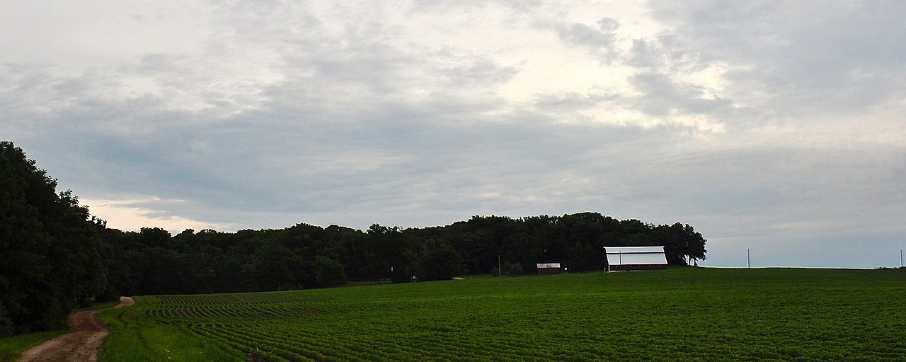



Geography and landscape
Charles Mound is a gentle hill rather than a steep peak. It lies in the part of northwestern Illinois that escaped the most recent glaciations and is often associated with the broader "Driftless" uplands of the Upper Midwest. The local terrain is more rolling and dissected than the surrounding plain, with small valleys and wooded slopes adjacent to agricultural land. The summit area itself is typically wooded and is representative of modest high points that are meaningful for their relative elevation rather than dramatic relief.
History and name
The mound is named for Elijah Charles, one of the region's early permanent settlers who arrived about 1828 and established a homestead at the base of the hill. The local name preserves that period of settlement and the common practice of naming places for pioneer families. For more on early settlement and family histories, see local historical sources such as material relating to Elijah Charles and county histories.
Access and visiting
The summit of Charles Mound is on private property, and access has typically required permission from the landowners. It attracts visitors interested in state high points, local history, and regional geography. Those planning a visit should secure permission in advance and respect property and conservation practices. Organized visits or arrangements are sometimes announced by local historical societies or highpointing groups; confirm current access policies before traveling.
Significance
Charles Mound illustrates how a state's highest natural point can be a modest landscape feature with cultural, recreational and educational value. It draws interest from "highpointers"—people who visit the high points of each state—students of local geography, and residents who value the area for its rural character. While not a park or public lookout, its status as Illinois' apex gives it symbolic importance within Jo Daviess County and to visitors documenting the geography of the United States.
Nearby places and resources
- Nearest village: Scales Mound.
- Nearby town: Galena, roughly 11 miles southwest.
- County information: Jo Daviess County resources and local historical societies may provide visitor guidance.
- Historical reference: Early settler Elijah Charles gave the mound its name.
Related articles
Author
AlegsaOnline.com Charles Mound — Highest Natural Point in Illinois Leandro Alegsa
URL: https://en.alegsaonline.com/art/18750