Bouillon (Belgian town)
Bouillon is a municipality in the Belgian Ardennes, known for its medieval castle, Semois valley setting and tourism. It lies in the province of Luxembourg and had about 5,477 residents in 2007.

Bouillon is a town and municipality administrative unit in the southern part of Belgium. It sits within the Belgian Ardennes in the province of Luxembourg, a largely rural and forested area; a general provincial overview is available at the province page. The locality is centred on a bend of the Semois River and is widely visited for its landscape and history.
Image gallery
8 Images


Location and characteristics
Bouillon occupies a valley position in the Ardennes; the town coordinates are roughly 49°47.7′N, 5°4.1′E. The settlement combines a compact historic core with surrounding villages and woodland. According to municipal figures cited for 2007, the population was 5,477. The Semois River and steep valley slopes shape local roads, viewpoints and walking routes.

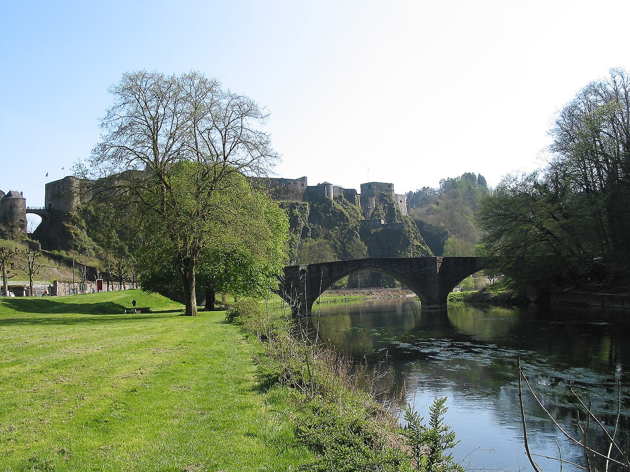
History and monuments
The most recognizable landmark is the Château de Bouillon, a medieval fortress perched above the river. The castle and the town grew in importance during the Middle Ages and are associated in popular accounts with Godfrey of Bouillon, a prominent figure of the First Crusade. Much of Bouillon’s historic fabric reflects its role as a fortified riverside settlement and later as a destination for cultural tourism.
Tourism and local life
Bouillon is a regional tourism hub: visitors come for the castle, riverside walks, canoeing on the Semois, and scenic drives through the Ardennes. The local economy blends services for visitors with agriculture and small businesses. Annual events, local markets and museums help interpret the area’s natural and historic heritage.
Notable distinctions
- Bouillon is in the Belgian province named Luxembourg, not to be confused with the neighbouring country of the Grand Duchy of Luxembourg.
- The town is representative of Ardennes river-valley settlements where geology and watercourses shape population patterns.
Related articles
Author
AlegsaOnline.com Bouillon (Belgian town) Leandro Alegsa
URL: https://en.alegsaonline.com/art/13316
Sources
- statbel.fgov.be : Werkelijke bevolking per gemeente op 1 januari 2007 / Population de droit par commune au 1 janvier 2007 (.xls)
- statbel.fgov.be : Geografische coördinaten van de gemeenten (.xls)
- commons.wikimedia.org : Bouillon