List of settlements in Iceland
An overview of Icelandic settlements, how they are defined and organized, notable towns and villages, historical development, and how modern lists are compiled and used.
Overview
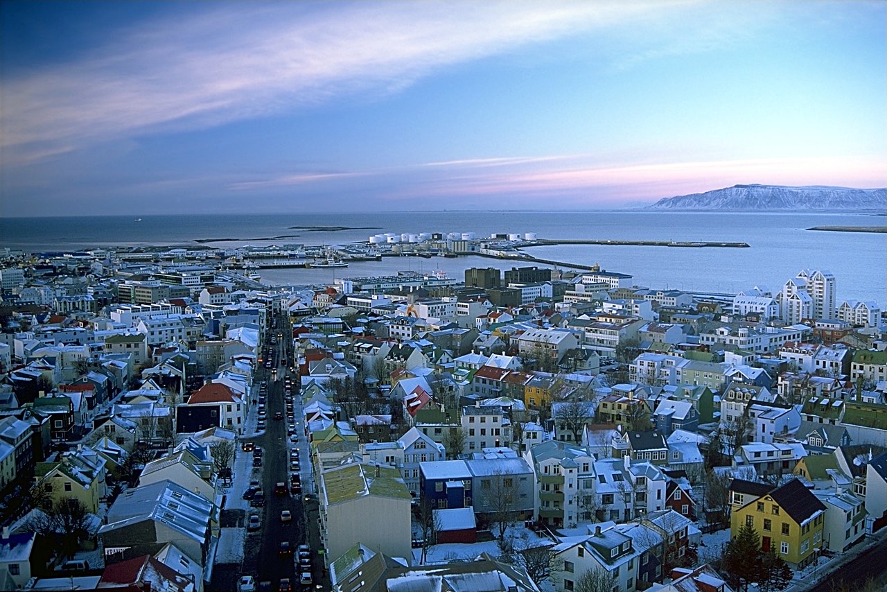
Iceland's inhabited places range from a single farmstead to Reykjavík, the island nation's capital and largest urban area. Because population is concentrated in a few coastal clusters, Iceland's settlement pattern mixes small fishing villages, service towns, and dispersed rural farms. A comprehensive list of settlements helps researchers, travellers and planners understand where people live and how communities are distributed across the island.
Image gallery
6 Images


Definition and administration
There is no strict legal hierarchy of "city" versus "town" in modern Icelandic local government; instead the country is divided into municipalities that may style themselves as a town (bær) or city (borg). National statistics agencies commonly publish lists of "urban areas" or localities (Icelandic: þéttbýli) using objective criteria such as minimum population and proximity of buildings. Municipalities provide local services and governance for the settlements within their borders.
How lists are compiled
Official lists of settlements are usually based on census and register data, identifying named inhabited places and aggregating adjacent dwellings into urban clusters. These compilations may include permanent villages, larger towns, seasonal camps and outlying rural farms that meet certain thresholds. For a current official compilation see the Official list of settlements.
History and development
Iceland was settled in the late ninth and tenth centuries by Norse and Celtic peoples; many settlement names reflect that origin and local geography (for example endings like -vík, -fjörður, -dalur). Long-distance travel and communications were limited historically, so communities developed around fishing grounds, sheltered harbours and fertile patches of soil. In the 20th century, urbanization concentrated population in coastal towns and the capital region.
Notable settlements
Examples that commonly appear near the top of lists include:
- Reykjavík — the capital and cultural, economic core of Iceland.
- Akureyri — a principal town in the north, an important regional hub.
- Keflavík/Reykjanesbær area — gateway for international air travel and services.
- Ísafjörður, Selfoss, Vestmannaeyjar — representative regional towns serving surrounding rural areas.
Uses and notable facts
Lists of settlements are used for planning, emergency services, postal systems, tourism and academic research. They reveal distinctive Icelandic features: extreme sparsity outside the capital region, strong coastal emphasis, and many place-names tied to landscape and maritime life. For maps and authoritative registers consult national statistics and municipal sources such as the official compilation.
Related articles
Author
AlegsaOnline.com List of settlements in Iceland Leandro Alegsa
URL: https://en.alegsaonline.com/art/125135