List of rivers of Kentucky
Overview and organized list of Kentucky's rivers, their drainage basins, uses, and historical significance, with major tributaries and notable distinctions.
This article presents an organized overview of the principal rivers in Kentucky and their roles in the state's geography, history, and economy. For a broader directory of waterways see the general rivers resource. Rivers in Kentucky drain into the Ohio and Mississippi systems and shape much of the state's landscape.
Image gallery
4 Images


Major rivers and drainage basins
Kentucky's waterways fall mainly into the Ohio River basin and the Mississippi River basin (including the Tennessee and Cumberland systems). Major rivers include:
- Ohio River — forms much of Kentucky's northern boundary and is a primary navigation route.
- Mississippi River — touches Kentucky's far-west corner and is the principal artery of the larger basin.
- Tennessee River — flows in the western/southwestern portion and connects to the Mississippi system.
- Cumberland River — runs across southern and west-central parts of the state.
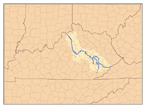
- Green River — often cited as the longest river located entirely within Kentucky.
- Kentucky River — central to the state's early settlement and industry.
- Licking River, Salt River, and Big Sandy River — other significant tributaries and border rivers.
Selected tributaries and local rivers
Many smaller streams feed the larger systems; a representative list includes:
- Dix River, Nolin River, and Elkhorn Creek (tributaries of the Kentucky River)
- Barren River and Green River tributaries in south-central Kentucky
- Levisa Fork and Tug Fork, which join to form the Big Sandy on the eastern border
- Little Sandy River and Tradewater River in eastern and western regions respectively
Characteristics and uses
Rivers in Kentucky serve multiple purposes: commercial navigation on the Ohio and lower Cumberland, water supply and irrigation, hydroelectric and flood-control reservoirs, and popular recreational uses such as boating, fishing, and canoeing. Riparian habitats along these waterways support diverse plant and animal communities and several protected areas.
History and cultural importance
Waterways shaped settlement patterns, transportation routes, and early industry in Kentucky. Towns and ports grew along navigable rivers, and many historical events and economic developments are tied to these channels. Today they remain important for local economies, conservation, and outdoor recreation.
Notable distinctions
Several rivers form political boundaries (Ohio and Big Sandy), while others are noted for being largely contained within the state (for example, the Green River). Flood control projects, locks and dams, and conservation efforts continue to influence how these rivers are managed.
For further lists and detailed entries on individual waterways consult the linked general river resource and regional references below.
Related articles
Author
AlegsaOnline.com List of rivers of Kentucky Leandro Alegsa
URL: https://en.alegsaonline.com/art/125028