Counties of Wyoming: List, History, and Key Facts
An overview of Wyoming's 23 counties, their purpose and origin, a complete county list, and notes on administrative identifiers such as FIPS codes.
Wyoming is divided into 23 counties that serve as the primary local units of government within the state. Counties in Wyoming manage services such as local courts, law enforcement, road maintenance, property records, public health programs, and elections. They range widely in geographic size and population, reflecting Wyoming's mix of broad high plains, mountain ranges, and federally managed lands.
Image gallery
1 Image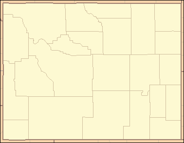
List of counties
- Albany
- Big Horn
- Campbell
- Carbon
- Converse
- Crook
- Fremont
- Goshen
- Hot Springs
- Johnson
- Laramie
- Lincoln
- Natrona
- Niobrara
- Park
- Platte
- Sheridan
- Sublette
- Sweetwater
- Teton
- Uinta
- Washakie
- Weston
These counties provide the framework for local administration and are the geographic units referenced for many public records and statistics. For an official directory or data resources that list county offices, courts, and elected officials, consult a statewide county directory or government portal such as the county directory or the state's official site at Wyoming state government.
History and development
The modern county map of Wyoming evolved during the late 19th century as the Wyoming Territory moved toward statehood. Territorial organization began with a small number of counties; early named counties included Laramie, Carbon, Albany and Uinta among others. By the time Wyoming was admitted to the Union on July 10, 1890, the territory had been redivided into thirteen counties. Subsequent boundary adjustments and the creation of additional counties produced the present total of 23.
County boundaries in Wyoming have often been influenced by geographic features such as mountain ranges and river basins, as well as by patterns of settlement, transportation corridors, and the location of natural resources. Large expanses of federally managed public land and national parks also affect how population and services are distributed across counties.
Administrative identifiers are used to link county-level data across federal and state systems. The Federal Information Processing Standard (FIPS) assigns Wyoming the state code 56; each county has its own three-digit FIPS code that is combined with the state code to form a unique identifier (for example, 56XXX for a Wyoming county). These codes are widely used in census data, mapping, and intergovernmental data exchange. For further statistical and demographic details, resources such as state data centers and national databases provide searchable county-level profiles — see additional resources at state and federal data pages.
Notable distinctions among Wyoming counties include variations in land area and population density. Some counties encompass large tracts of wilderness, ranchland, or energy-producing regions; others contain urban centers that serve as regional hubs for commerce, education, and healthcare. Understanding the counties is essential for interpreting local governance, regional planning, and the delivery of public services across Wyoming.
Questions and answers
Q: How many counties are there in Wyoming?
A: There are 23 counties in Wyoming.
Q: How many counties were there in the Wyoming Territory initially?
A: Initially, there were five counties in the Wyoming Territory.
Q: What are the names of the five counties formed in the Wyoming Territory?
A: The names of the five counties formed in the Wyoming Territory are Laramie, Carter, Carbon, Albany, and Uinta.
Q: When was Wyoming admitted to the Union and how many counties did it have at the time?
A: Wyoming was admitted to the Union on July 10, 1890, with thirteen counties.
Q: What is the FIPS code used by the United States government to identify states and counties?
A: The FIPS code is the Federal Information Processing Standard code.
Q: What is the FIPS code for Wyoming and how is it written in conjunction with a county's code?
A: The FIPS code for Wyoming is 56, and when combined with any county code, it would be written as 56XXX.
Q: What data does the FIPS code for each county link to?
A: The FIPS code for each county links to census data for that county.
Related articles
Author
AlegsaOnline.com Counties of Wyoming: List, History, and Key Facts Leandro Alegsa
URL: https://en.alegsaonline.com/art/124640
Sources
- wyoming.gov : "General Facts About Wyoming" · web.archive.org
- itl.nist.gov : "FIPS Publish 6-4"
- epa.gov : "EPA County FIPS Code Listing"
- naco.org : "NACo - Find a county"
- gowyld.net : "Name Derivations of Wyoming Counties"
- quickfacts.census.gov : "Wyoming QuickFacts"