List of cartographers
Overview and categorization of notable mapmakers from antiquity to the digital age, with examples, roles, methods, and the discipline's development.
Cartographers are practitioners of cartography, the discipline concerned with designing, compiling and producing maps. The field includes traditional mapmakers who surveyed and engraved charts, and modern specialists who use geographic information systems (GIS), remote sensing and digital cartographic design. For background on techniques and terminology see cartography resources.
Image gallery
10 Images


Notable cartographers (historical and influential)
- Claudius Ptolemy — Ancient Greek-Roman geographer whose writings preserved coordinate-based mapping concepts.
- Pei Xiu — Early Chinese scholar often credited with systematic map-making methods in Imperial China.
- Muhammad al-Idrisi — 12th-century geographer who compiled extensive regional maps and a descriptive geography.
- Martin Waldseemüller — Early modern cartographer associated with a world map that popularized the name "America".
- Gerardus Mercator — Flemish geographer known for the Mercator projection used in navigation.
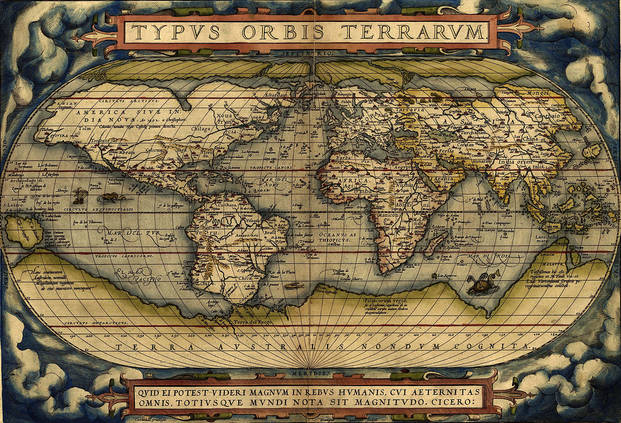
- Abraham Ortelius — Compiler of one of the first modern atlases.
- Charles Joseph Minard — Nineteenth-century engineer whose flow-map of Napoleon’s campaign is a landmark in information graphics.
- John Snow — Physician whose mapping of cholera cases is an early example of thematic and epidemiological mapping.
- Roger Tomlinson — Recognized as a pioneer of modern GIS and spatial data analysis.
Types of cartographers and methods
Cartographers may specialize in topographic, nautical, thematic, cadastral or digital mapping. Methods range from ground surveying, triangulation and engraving to aerial photography, satellite imagery and GIS-based spatial modeling. Choices about projection, scale, symbolization and generalization influence how geographic information is communicated.
Historically, mapmaking combined exploration, mathematics and artistic engraving; in the modern era it integrates computer science, statistics and design. Cartography has been central to navigation, territorial administration, resource management, public health, and scientific visualization.
Understanding notable cartographers helps trace technical advances (such as map projections and printing), evolving purposes (from imperial charts to public-health maps) and contemporary challenges, including ethical use of spatial data and representation of uncertain or sensitive information.
Related articles
Author
AlegsaOnline.com List of cartographers Leandro Alegsa
URL: https://en.alegsaonline.com/art/124533
Sources
- wdl.org : "General Depiction of the Empty Plains (in Common Parlance, the Ukraine) Together with its Neighboring Provinces"
- encyclopediaofukraine.com : "Beauplan, Guillaume Le Vasseur de"
- oxforddnb.com : Emanuel Bowen
- wdl.org : "Venezuela with the Southern Part of New Andalusia"
- oxforddnb.com : John Senex
- prestwidge.com : "Archived copy"
- prestwidge.com : "Archived copy"
- viaf.org : viaf.org/viaf/27152759/
- data.bnf.fr : data.bnf.fr
- wdl.org : "Map of Sweden"
- nysm.nysed.gov : Kitchen Map 1755
- wdl.org : "Pittsburgh, Pennsylvania, 1902"
- futuremaps.com : "The Women Who Shaped the World"