Upper Karabakh Economic Region
Former economic region of Azerbaijan in Karabakh, known for agriculture, historic towns such as Shusha and Aghdam, and the impact of conflict and reconstruction.
Upper Karabakh Economic Region was one of Azerbaijan's former economic regions, used for statistical and planning purposes. The name refers to the upper, more mountainous part of Karabakh, in the southwest of the country. It was not a separate self-governing unit, but a way of grouping nearby districts and cities for administration, development policy, and data collection.
The region's landscape combines uplands, river valleys, and fertile lowland areas. This gave it a mixed economy: grain growing, horticulture, vineyards, livestock raising, and food processing were traditionally important, alongside local trade and services. The area also contains well-known cultural and historical sites, which made it important beyond economics alone.
Among the best-known places associated with the region are Aghdam and Shusha, both of which have had major roles in Karabakh's history. Shusha is especially noted for its cultural heritage, while Aghdam became an important urban and agricultural center. More broadly, the region has long been linked to transport routes between the Karabakh plain and the surrounding mountains.
The area was deeply affected by the Nagorno-Karabakh conflict, which damaged settlements, disrupted economic activity, and displaced many residents. In recent years, reconstruction and demining have become central priorities in parts of the region, especially where infrastructure and housing are being rebuilt.
Image gallery
3 Images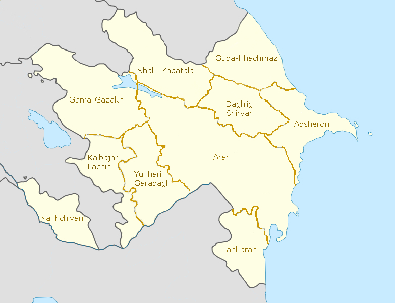


Key characteristics
- Geographic setting: uplands and foothills in Karabakh
- Main activities: agriculture, livestock, food production, and services
- Cultural role: historic towns, monuments, and memorial landscapes
- Administrative status: a former economic region, later superseded by newer regional divisions
For broader context on the country's regional system, see Azerbaijan. Because economic regions are planning units rather than political territories, their borders and composition can change when government classifications are updated.
Related articles
Author
AlegsaOnline.com Upper Karabakh Economic Region Leandro Alegsa
URL: https://en.alegsaonline.com/art/110189
Sources
- economy.gov.az : "Ministry of economy->Regional development->Economic regions"
- unpan1.un.org : "STATE PROGRAM ON SOCİAL-ECONOMİC DEVELOPMENT OF REGİONS"