Urfahr-Umgebung District (Upper Austria)
Overview of Urfahr-Umgebung, a district in Upper Austria: geography, administration, history, economy and cultural features surrounding the city of Linz.
Overview
The Urfahr-Umgebung District is an administrative district in Austria. It lies immediately north of the regional capital Linz and forms part of the Mühlviertel area. The district is made up of 27 municipalities and combines suburban settlements, agricultural land and forested highlands. For administrative details see Urfahr-Umgebung and its relation to the state of Upper Austria within Austria.
Image gallery
1 Image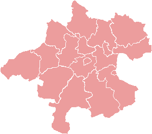
Geography and municipalities
Topographically the district transitions from the Danube plain near Linz into the rolling, granite-dominated hills of the Mühlviertel. This mix produces a varied landscape of meadows, woods and smaller river valleys. The administrative area comprises several towns and many small villages; some function as commuter communities for Linz while others retain a distinctly rural character.
History and administration
The modern district structure in this part of Austria dates to 19th-century administrative reforms that established Bezirke as local government units. Since then, Urfahr-Umgebung has evolved with industrialization and urban growth concentrated around Linz, while municipal borders and responsibilities have adjusted to population changes and transport developments.
Economy and transport
Economically the district reflects a mix of small and medium enterprises, light industry, agriculture and service businesses. Many residents commute to Linz for employment, education and specialised services. Transport links include regional roads and public transit connections that tie the municipalities into the wider Upper Austrian network.
Culture, nature and points of interest
The district offers rural tourism, hiking and seasonal festivals that celebrate local traditions of the Mühlviertel. Forested hills and panoramic viewpoints give recreational opportunities near the urban amenities of Linz. Local cultural life often balances traditional events with contemporary offerings from the adjacent city.
Notable distinctions
- Proximity to Linz: many towns serve as suburban or commuter communities.
- Mixed landscape: a junction between the Danube lowlands and the Mühlviertel heights.
- Administrative composition: organized into 27 municipalities that manage local services and planning.
Further municipal and governance information can be consulted via regional resources and the official district portal linked above (district page, state pages and broader Upper Austria references).
Related articles
Author
AlegsaOnline.com Urfahr-Umgebung District (Upper Austria) Leandro Alegsa
URL: https://en.alegsaonline.com/art/103592