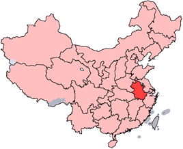
Baohe District, Hefei — urban district in Anhui, China
Baohe District is an urban district of Hefei in Anhui province, China. It covers about 294.94 km², has a population around 817,686, and comprises seven subdistricts and two towns.
Overview
Baohe District is one of the urban districts of Hefei, the capital city of Anhui province in China. It functions as a largely urbanized administrative area with residential neighborhoods, commercial zones and local government services. The district's area is reported as 294.94 km² and its population is approximately 817,686, making it a densely inhabited part of the metropolitan region.
Image gallery
4 Images


Administration and geography
Administratively, Baohe is divided into seven subdistricts and two towns. These subdivisions perform municipal services, local planning and community management. Geographically the district lies within the urban footprint of Hefei and is integrated with neighboring districts by road and public transit; its land use includes built-up neighborhoods, pockets of light industry and green spaces intended for recreation.
History and development
The area that now forms Baohe evolved from suburban and peri-urban lands into a more continuous urban district as Hefei expanded during the late 20th and early 21st centuries. Industrialization, followed by a shift toward services and commerce, has driven changes in land use and demographics. Local planning efforts have focused on improving infrastructure, housing and environmental management to support a growing urban population.
Economy and transport
Baohe's economy is a mix of retail, services, light manufacturing and logistics that serve the wider Hefei metropolitan area. The district benefits from connections to regional highways and public transit systems that link residents to employment centers, education and healthcare. Ongoing urban investment has emphasized modernizing streets, improving transit frequency and supporting small and medium enterprises.
Notable facts and role
As part of Hefei's core urban area, Baohe plays a role in housing a significant portion of the city's population and providing everyday services. Local amenities include municipal schools, health clinics, markets and commercial streets. The district also participates in broader municipal planning initiatives aimed at sustainable urban growth and improved quality of life for residents.
- Area: ~294.94 km²
- Population: ~817,686
- Divisions: 7 subdistricts, 2 towns
For administrative information and recent developments, consult local government resources or municipal planning publications via the district's official portals and public notices.
Related articles
Author
AlegsaOnline.com Baohe District, Hefei — urban district in Anhui, China Leandro Alegsa
URL: https://en.alegsaonline.com/art/8816