Schwarzenburg District (Canton of Bern)
A concise overview of the Schwarzenburg District in the canton of Bern: geography, administrative role, history of reorganization, economy, and where to find municipal information.

Overview
The Schwarzenburg District was an administrative district in the Swiss canton of Bern. Covering roughly 157 km², it comprised four municipalities and served as a local centre for government services. The town of Schwarzenburg functioned as the district seat and a focal point for commerce and administration.
Image gallery
1 Image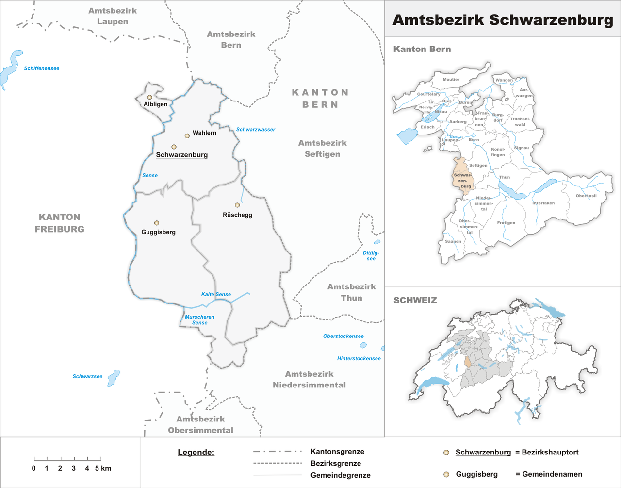
Geography and municipalities
Situated south of the city of Bern, the district occupies a transition zone between lowland plains and the Bernese Prealps. The landscape is a mix of farmland, forests and modest uplands, shaping a mainly rural settlement pattern with small villages and hamlets connected by regional roads and public transport links.
History and administration
The area developed within the historic administrative framework of the canton. In a canton-wide reform of local government, the traditional districts were superseded by larger administrative units and the former Schwarzenburg District’s functions were integrated into a broader district structure. For official archival and administrative references consult the canton’s resources via canton resources.
Economy, culture and services
The district’s economy is largely based on agriculture, forestry and small-scale industry, while many residents commute to nearby urban centres for work. Local cultural life reflects Bernese rural traditions, with village associations, seasonal festivals and community events. Before the administrative change, district authorities coordinated schools, civil registers and planning; many of those responsibilities are now shared with the successor administrative body and the municipalities themselves.
Distinctions and further information
Although modest in size, the district maintained a distinct local identity centred on Schwarzenburg town. For practical information—municipal services, demographic statistics and planning maps—refer to municipal information portals and official maps: municipal information and district maps.
Related articles
Author
AlegsaOnline.com Schwarzenburg District (Canton of Bern) Leandro Alegsa
URL: https://en.alegsaonline.com/art/87999