Neuf-Brisach: Vauban’s Fortified Town in Alsace
Neuf-Brisach is a planned fortified town in Alsace, France, notable for its star-shaped layout by Vauban and its inscription as a UNESCO World Heritage Site representing outstanding military architecture.
Overview
Neuf-Brisach is a small fortified town in northeastern France. Administratively it lies in the Haut-Rhin department of France, within the region historically known as Alsace. The planned settlement was constructed to control a key crossing near the Rhine and has retained its military layout and urban core; in recent years it has been home to roughly two thousand residents.
Image gallery
5 Images


Design and principal features
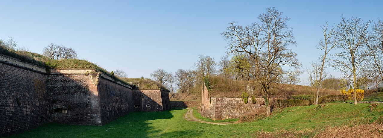
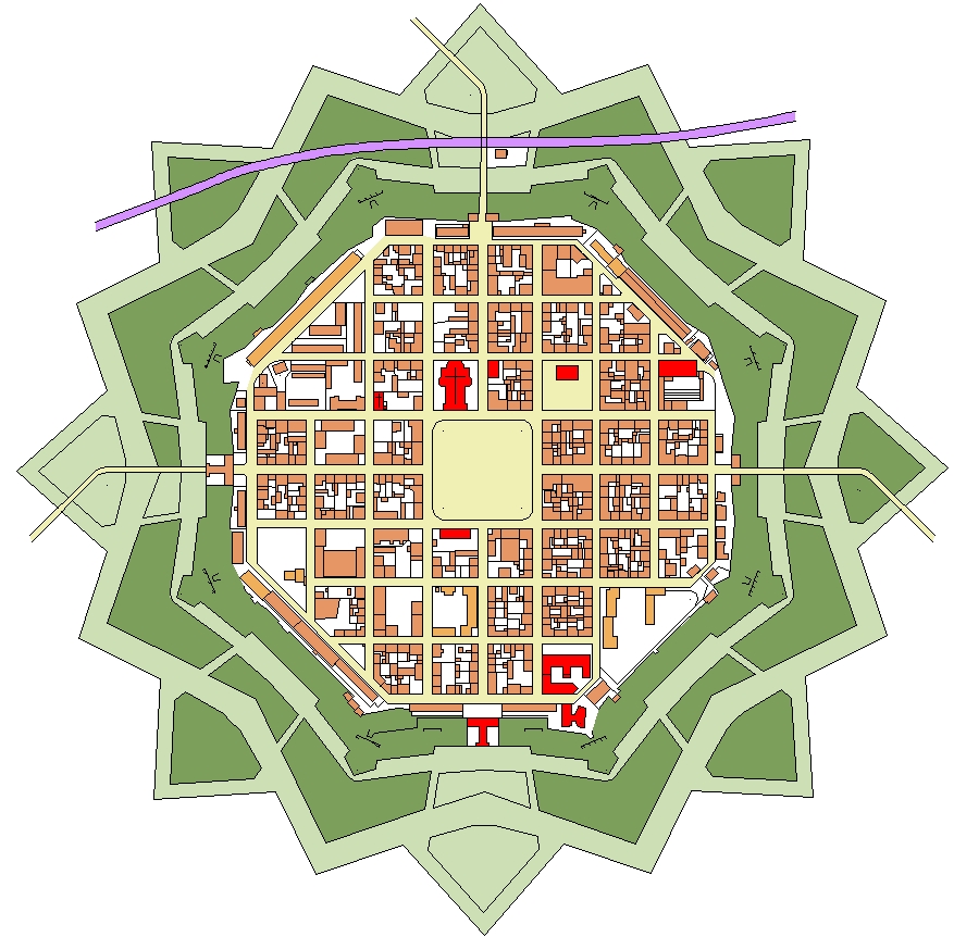
Neuf-Brisach is famed for its precise geometric fortifications. The town is built on a compact, largely regular plan centered on an internal grid and a market square. Surrounding this is a sequence of defensive works: bastions, ramparts, moats and glacis arranged in a radial/star pattern that creates a near-octagonal footprint.
- Characteristic star (bastioned) fort layout with projecting bastions
- Regular street grid and a central square inside the defenses
- Double lines of fortification elements designed to delay and channel attackers
History and development
The town was founded as a military and administrative response to frontier changes and was laid out by military engineers of the era. Its compact, purpose-built nature reflects late 17th–early 18th century advances in bastioned fortification. Over time it served defensive, logistical and civic functions and passed through periods of military and civilian use without losing its essential plan.
Significance and recognition
Neuf-Brisach is widely cited as an exceptionally intact example of bastioned town planning and military architecture. For this reason it was recognized by UNESCO and included on the list of World Heritage Site entries that highlight historic fortifications and their influence on European military engineering.
Visiting, preservation and notable facts
Today Neuf-Brisach functions as a living town and a heritage site. Conservation efforts focus on preserving the fabric of the ramparts, the pattern of streets, and the town’s public spaces while accommodating modern life. Visitors commonly explore the ramparts on foot, view the octagonal plan from nearby viewpoints, and learn about the military and urban history through local museums and guided walks.
Related articles
Author
AlegsaOnline.com Neuf-Brisach: Vauban’s Fortified Town in Alsace Leandro Alegsa
URL: https://en.alegsaonline.com/art/69311