
Nankaidō — ancient Japanese circuit and its coastal route
Nankaidō was one of the Gokishichidō circuits of classical Japan and the principal coastal and sea route linking the Kii Peninsula, Awaji and the island of Shikoku.
Overview
The term Nankaidō (南海道, literally "southern sea road") refers both to a historical regional circuit of classical Japan and to the principal route that ran through that region. It formed part of the Gokishichidō administrative and communication system put in place under ritsuryō law in the Asuka and Nara periods. As with other circuits, the name denotes a territorial division together with the main highway and maritime links connecting its parts.
Image gallery
2 Images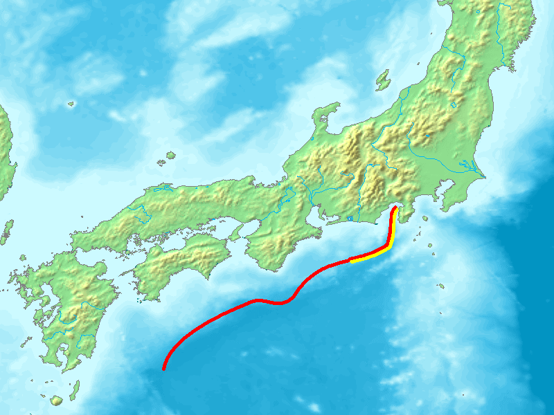

Geography and constituent provinces
Nankaidō encompassed the southern maritime corridor from the Kii Peninsula across to Awaji Island and the four provinces of Shikoku. In conventional lists it included Kii plus Awa, Sanuki, Tosa and Iyo. In modern terms this area corresponds roughly to parts of present-day Wakayama Prefecture, Awaji Island (administered with Hyōgo Prefecture) and the island prefectures of Tokushima, Kagawa, Kōchi and Ehime.
Route, function and characteristics
The Nankaidō route combined coastal roads with short sea crossings. It linked provincial capitals, coastal towns, ports and waystations used by official envoys, merchants, pilgrims and military units. Travel along the corridor required seamanship as well as overland movement, and seasonal winds, currents and storms influenced schedules and the choice of itinerary.
History and development
Under the Heian court and during later medieval periods the circuit remained important for administration, taxation and the movement of people. Over centuries improvements in coastal shipping and, in the early modern era, the development of post stations and ferry services altered patterns of travel, yet the historical identity of Nankaidō persisted in maps and place names.
Cultural and geological significance
Shikoku, within the Nankaidō area, is famed for the 88-temple pilgrimage associated with the Buddhist monk Kūkai (Kōbō Daishi), underlining the region's religious role. Geologically, the southern seaboard lies above the Nankai Trough, a major subduction zone that has produced large earthquakes and tsunamis repeatedly in Japanese history; awareness of these hazards shaped settlement, ports and coastal defenses.
Legacy
Although no longer an administrative unit, Nankaidō remains a useful term for historians and geographers studying premodern travel, trade and cultural exchange. Modern roads, ferries and railways follow parts of the ancient corridor, and the circuit's name survives in regional usage and historical literature as a way of describing the southern maritime connection of Honshū and Shikoku.
See also
- Gokishichidō — the system of provincial circuits
- Shikoku pilgrimage — cultural practice tied to the region
- Nankai Trough — major geological feature off the southern coast
Related articles
Author
AlegsaOnline.com Nankaidō — ancient Japanese circuit and its coastal route Leandro Alegsa
URL: https://en.alegsaonline.com/art/68258
Sources
- books.google.com : " Goki-shichidō"
- books.google.com : Annales des empereurs du japon, pp. 65-66 n3
- books.google.com : "Japan,"
- www-odp.tamu.edu : "Clay mineralogy of mudstone from the Nankai Trough reference sites 1173 and 1177 and frontal accretionary prism site 1174,"
- www-odp.tamu.edu : Figure F1. "Index map of the Nankai Trough study area"
- ngdc.noaa.gov : National Geophysical Data Center
- ngdc.noaa.gov : NOAA/Japan: Significant Earthquake Database
- bo-sai.co.jp : 安政南海地震 (in Japanese)
- books.google.com : books.google.com/books?id=p2QnPijAEmEC&pg=PA780