Mopti Region (Mali)
A central region of Mali centered on the confluence of the Niger and Bani rivers, noted for the Inner Niger Delta, diverse cultures (Dogon, Bozo, Fulani), historic towns like Djenné and the Bandiagara Escarpment.
The Mopti Region lies in central Mali and takes its name from its administrative capital, the city of Mopti. Located at the meeting of the Niger and Bani rivers, the region forms part of the Inner Niger Delta, a seasonally flooded expanse of wetlands that shapes local agriculture, fishing and transport. Mopti is an important commercial and river port for the country of Mali.
Image gallery
3 Images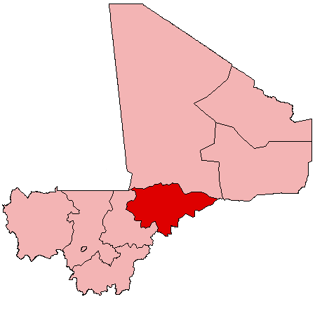

Geography and ecology
Topography ranges from floodplain and marsh in the delta to drier Sahelian plains and sandstone cliffs in the east. Seasonal flooding replenishes soils and supports extensive wetland habitats used by migratory and resident waterfowl. The climate is Sahelian: a distinct rainy season typically in mid-year followed by a long dry season.
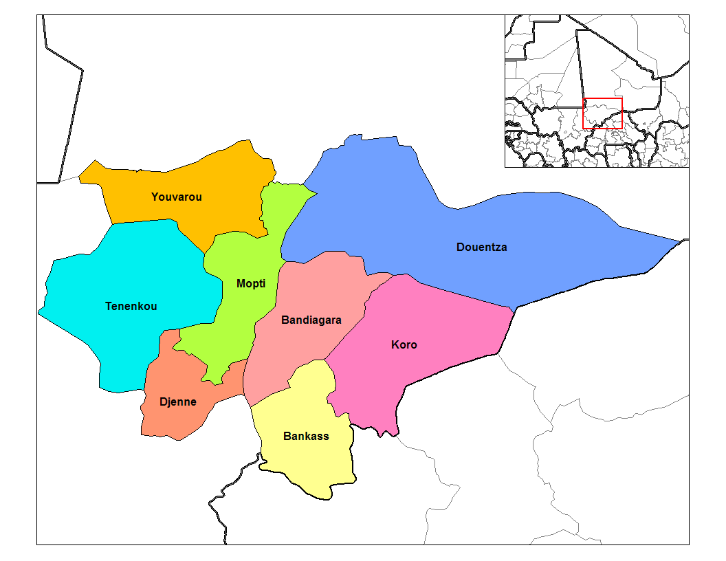
Administrative divisions
The region is divided into several cercles and communes, centered on towns such as Mopti, Djenné and Bandiagara. Local governance and customary authorities coexist with national administration; communities include riverine fishermen, herders and upland farming settlements.
History and culture
Mopti occupies a crossroads of Sahelian and West African cultures. It borders the Dogon country whose cliff villages and mask traditions are culturally prominent. Djenné and other historic towns are known for distinctive adobe architecture and long histories as market and learning centers dating back centuries.
Economy and importance
Economic life relies on fishing, flood-recession agriculture, livestock herding and river trade. Mopti city is a regional hub for markets, boat transport and artisanal activity. Wetlands of the Inner Niger Delta sustain seasonal livelihoods essential to food security across the region.
Notable sites and contemporary issues
Key sites include the Bandiagara Escarpment and the mosque at Djenné, both strong cultural draws. In recent years the region has faced challenges from instability, population pressures and environmental change that affect mobility, heritage protection and development efforts.
Related articles
Author
AlegsaOnline.com Mopti Region (Mali) Leandro Alegsa
URL: https://en.alegsaonline.com/art/66587