Karakoram Highway (China–Pakistan)
An international mountain highway linking Kashgar in China to Hasan Abdal in Pakistan; a high-altitude trade route, engineering landmark and popular tourist corridor through the Karakoram range.
Overview
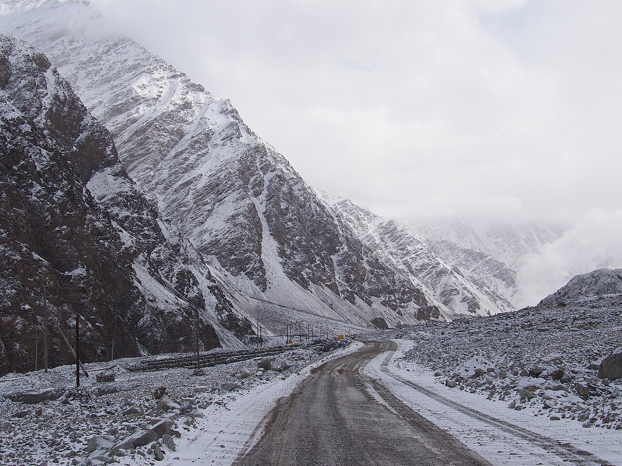
The Karakoram Highway is an international route that links northwest China with northern Pakistan across the Karakoram mountain range. Stretching roughly 1,300 kilometres, it connects the city of Kashgar in China to the town of Hasan Abdal in Pakistan. The road follows dramatic high-altitude terrain and provides a year-round land connection between the two countries, serving both commercial and tourism roles.
Image gallery
10 Images


Route and characteristics
The highway winds through steep valleys and mountain passes, including the high Khunjerab section near the China–Pakistan border. Much of the road is paved and varies from multi-lane sections near major towns to narrow, cliff-side stretches in remote areas. It provides access to the administrative regions of Xinjiang in China and Gilgit–Baltistan and Khyber Pakhtunkhwa in Pakistan. Travelers encounter glacier-fed rivers, alpine scenery and towns that depend on the road for supplies.
History and construction
Built with close cooperation between China and Pakistan, construction of the route was undertaken mainly during the mid-20th century. Work required extensive tunnelling, bridging and slope stabilization in rock and glacial terrain. The project is commonly regarded as an engineering achievement because it transformed previously difficult mountain tracks into a continuous motorable road. Upgrades and maintenance have continued since its opening to improve safety and capacity.
Uses and importance
The highway is important for several reasons:
- Trade: It functions as a land corridor for bilateral commerce and regional freight movements.
- Tourism: Its scenic vistas and proximity to peaks such as K2 attract domestic and international visitors.
- Connectivity: It links remote communities to markets, health care and services.
Sections have also been the focus of modernization efforts tied to broader regional infrastructure programs.
Challenges and maintenance
Operating a highway in such a geologically active and glaciated region poses persistent challenges: seasonal landslides, rockfalls, avalanches and flood damage require continuous repair and monitoring. High-altitude weather can limit travel during severe conditions, and engineering works such as retaining walls, tunnels and drainage systems are essential to keep the route open.
Notable facts and further information
The Karakoram Highway is often described as one of the highest paved international roads in the world. Visitors typically research conditions and border formalities before travel. For maps, travel guidance and historical background, see resources such as route maps, development summaries at regional infrastructure portals, tourism guides at local travel sites and archival accounts at historical references.
Related articles
Author
AlegsaOnline.com Karakoram Highway (China–Pakistan) Leandro Alegsa
URL: https://en.alegsaonline.com/art/52274