Hospental — mountain municipality in the canton of Uri, Switzerland
Hospental is a small alpine municipality in the Ursern valley of the canton of Uri, Switzerland, known for its historic village, proximity to the Gotthard pass, and alpine landscape (area 34.97 km²).
Hospental is a small mountain municipality in central Switzerland. The settlement sits in the Ursern valley and forms part of the canton of Uri. It is often mentioned in regional guides as a village with traditional alpine architecture and a strategic position on routes that climb toward the Gotthard pass. For official information see the municipality page: Hospental, the cantonal portal: Uri, and general Swiss resources: Switzerland.
Geography and landscape: Hospental occupies a high-valley setting surrounded by steep mountain slopes, alpine meadows and seasonal streams. Its territory includes steep ridges and pastureland used in summer grazing, offering clear views of nearby mountain passes and peaks. The municipality has an area of 34.97 square kilometres, much of which is undeveloped or reserved for nature and alpine farming.
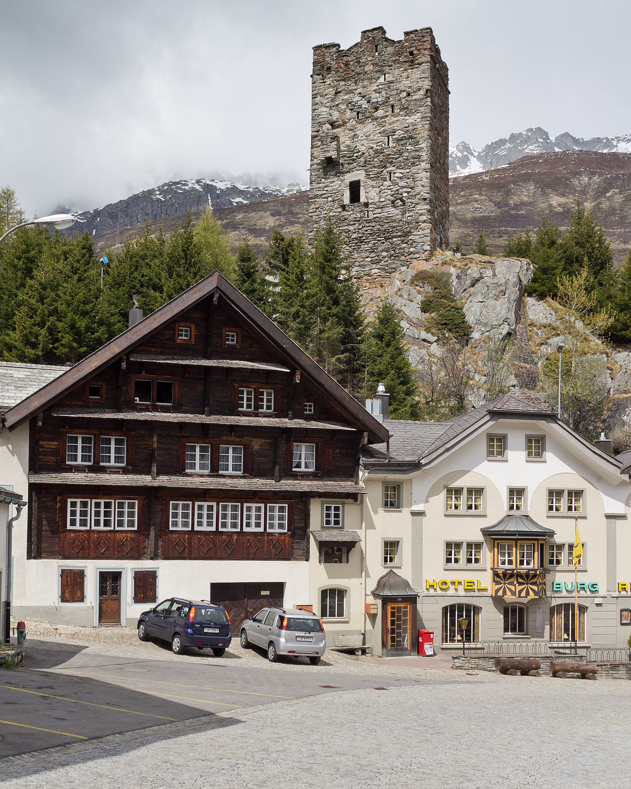
History and development: The village has medieval roots tied to the historic transit corridor through the Gotthard region. Over centuries the locality served travelers, mule-drivers and later tourists. Remnants of older stone houses, narrow lanes and defensive towers reflect this past; many buildings have been preserved or sensitively restored to retain the village character.
Economy and local life: Traditionally based on pastoral agriculture and local crafts, Hospental today combines small-scale farming with tourism and services. Visitors come for hiking, mountain scenery and quiet village stays; seasonal guest accommodation and guided outdoor activities support the local economy. Community life centers on village events and the maintenance of trails and alpine pastures.
Image gallery
7 Images


Transport and accessibility
Although near historic alpine routes, modern transport uses roads and tunnels that alter traffic patterns in the region. Hospental remains accessible by regional roads and public transport links that serve the Ursern valley, making it a convenient base for excursions into the surrounding mountains.
Notable facts
- Historic alpine village with well-preserved traditional buildings and a compact village core.
- Positioned close to the Gotthard transit area, which shaped its role in regional travel and trade.
- Area and municipal boundaries are documented in regional records: canton resources and the official area entry: 34.97 km².
- Popular for low-key mountain tourism, walking routes and as a starting point for higher alpine hikes.
For further reading and practical visitor details consult the links above or local tourist information offices for up-to-date seasonal offerings and trail conditions.
Related articles
Author
AlegsaOnline.com Hospental — mountain municipality in the canton of Uri, Switzerland Leandro Alegsa
URL: https://en.alegsaonline.com/art/45190
Sources
- bfs.admin.ch : "Arealstatistik Standard - Gemeinden nach 4 Hauptbereichen"
- bfs.admin.ch : "Ständige Wohnbevölkerung nach Staatsangehörigkeitskategorie Geschlecht und Gemeinde; Provisorische Jahresergebnisse; 2018"