Green belt (urban planning): purpose, types, history, and debates
Green belts are land-use policies that protect undeveloped land around cities to limit sprawl, conserve nature and provide recreation. This article explains forms, history, benefits, criticisms and governance.
A green belt (or greenbelt) is a planning tool that keeps a ring or band of predominantly open, natural, or agricultural land around or near an urban area. Its main purpose is to control urban growth, preserve landscapes and habitat, and provide public access to green space. Variants include greenways and green wedges: linear corridors or pie‑shaped reserves that may pass through towns rather than entirely encircle them.
Image gallery
9 Images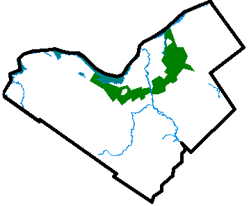


Key characteristics and types
Green belts typically rely on land‑use regulations, zoning limits or conservation easements to restrict built development. They differ in shape and management:
- Peripheral belts form rings around a city to contain outward expansion.
- Green wedges extend from the countryside into the urban area, allowing natural penetration of green space.
- Greenways and corridors are narrow strips along rivers, railways or trails that connect habitats and provide routes for recreation.
Origins and development
The idea of setting aside land near cities grew from 19th‑ and early 20th‑century movements that reacted to industrialisation and overcrowding. Planners and conservationists promoted belts of open land to improve public health, preserve food production close to towns, and keep landscapes intact as cities expanded. Numerous countries have adopted green belt policies at regional or municipal levels, adapting rules to local needs and legal systems.
Benefits and common uses
Advocates cite multiple public goods: protection of biodiversity and watercourses, buffers against flooding, urban cooling and better air quality, landscape preservation, and opportunities for recreation and agriculture close to cities. Green belts can also maintain cultural or scenic character by safeguarding historic views and rural practices.
Controversies and limitations
Critics argue that rigid belts can raise housing costs by limiting developable land, encourage 'leapfrogging' where development jumps beyond the belt, and put pressure on nearby towns. Effectiveness depends on governance: enforcement, size of the belt, permitted uses and whether complementary policies address housing supply and transport. Some regions allow carefully managed development or exchanges of land to balance protection with local needs.
Governance and examples
Implementation relies on planning law, zoning designations and, in some cases, incentives for landowners. Management practices include habitat restoration, recreational infrastructure and agricultural stewardship. For further overview and policy guidance see related planning resources.
Related articles
Author
AlegsaOnline.com Green belt (urban planning): purpose, types, history, and debates Leandro Alegsa
URL: https://en.alegsaonline.com/art/40661