Eagle Mountain (Minnesota)
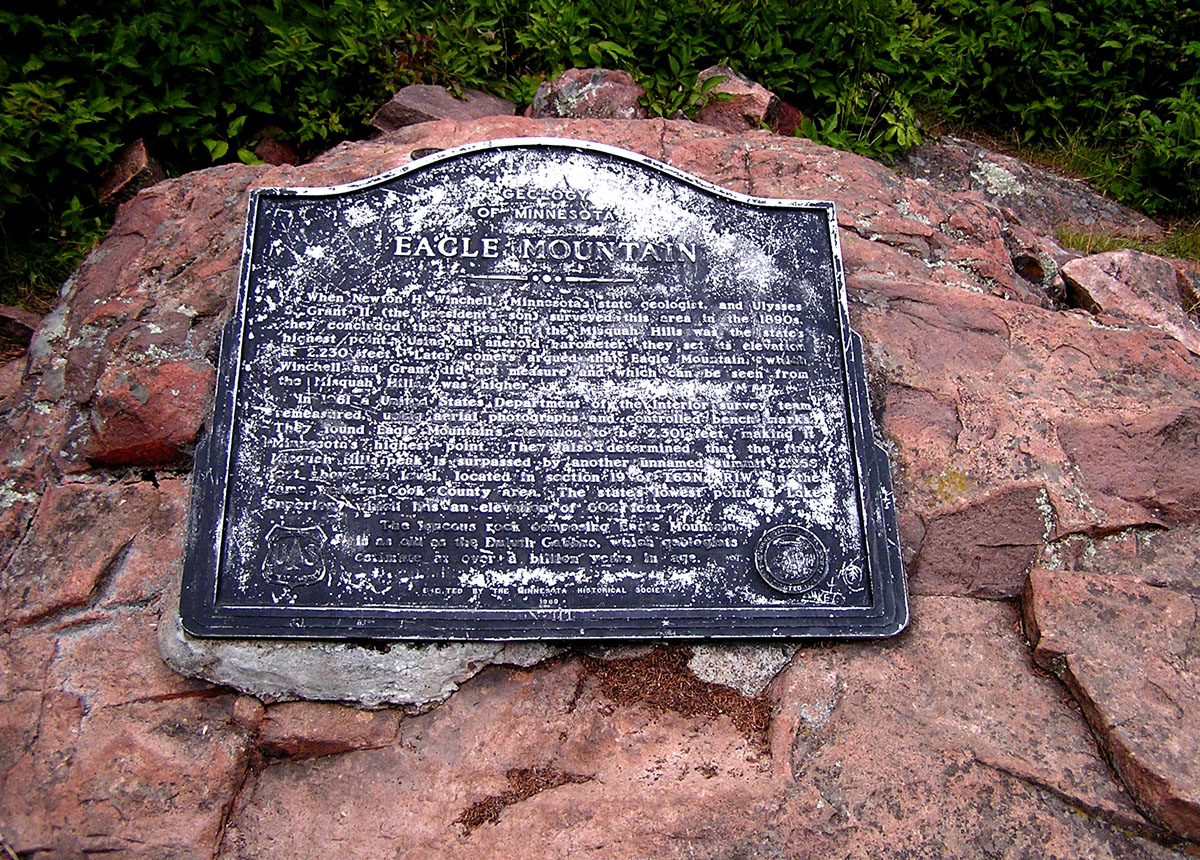
Eagle Mountain is the highest natural point in Minnesota at 2,301 ft (701 m), located in northern Cook County. It is a popular destination for hikers and a designated Minnesota State Historic Site.
Overview
Eagle Mountain is the highest natural point in the state of Minnesota at 2,301 feet (701 m). It lies in the far northeastern part of the state in northern Cook County and is recognized as a Minnesota State Historic Site. The summit is a celebrated destination for people who visit state high points and for local outdoor enthusiasts.
Image gallery
10 Images


Geography and physical characteristics
The summit rises above the surrounding boreal and mixed forest of the Arrowhead region. The landform is part of the ancient Precambrian bedrock that underlies much of northern Minnesota and bears evidence of glacial shaping from past ice ages. Unlike dramatic alpine peaks, Eagle Mountain is a rounded highland rather than a jagged summit, offering a modest prominence but clear status as the state's highest elevation.
Access and recreation
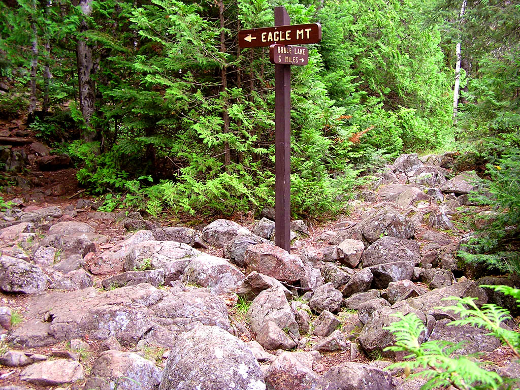
Reaching the top typically requires a hike on marked trails through forest and over exposed bedrock. Visitors come for day hikes, nature observation and to record a visit to Minnesota's state high point. Trails and conditions vary seasonally, so hikers are advised to prepare with proper clothing, navigation aids, and leave-no-trace practices. For official guidance and regulations consult regional land managers and recreation resources linked to the area.
Ecology and wildlife
The area around the summit supports plant and animal communities typical of northern Minnesota: conifers and mixed hardwoods, understory shrubs and mosses, and a range of wildlife from songbirds to larger mammals. Raptors, including bald eagles and other birds of prey, are found in the region, which likely contributed to the feature's name.
History and significance
Beyond its geographic distinction, Eagle Mountain holds cultural and recreational significance. It is a waypoint for highpointers—people who seek the highest points in each U.S. state—and is part of Minnesota's system of recognized historic and natural sites. Its name reflects the natural heritage of the region and the presence of birds of prey in local forests and waterways.
Practical notes
- Plan for variable weather and rugged footing.
- Respect trail signs and seasonal restrictions.
- Consult local resources before travel; further information about the site and region can be found through resources linked to the state's recreational and conservation offices such as the general page on the site's status as the state's high point (Eagle Mountain).
Related articles
Author
AlegsaOnline.com Eagle Mountain (Minnesota) Leandro Alegsa
URL: https://en.alegsaonline.com/art/29506
Sources
- terraserver.microsoft.com : "Topographical map, Eagle Mountain"
- ros.leg.mn : "Minnesota Statute § 138.57, subd. 3"