Bow echo (mesoscale convective system)
A bow echo is a radar-visible mesoscale convective storm with a bow-shaped reflectivity signature that commonly produces damaging straight-line winds and other severe weather.
Overview
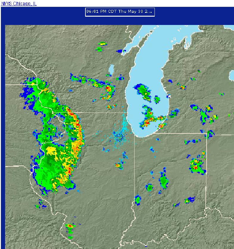
A bow echo is a mesoscale convective system that, on radar, shows a convex, archer's-bow shape in its line of thunderstorms. This radar signature reflects a concentrated zone of intense convection and strong forward winds. Bow echoes are notable for producing widespread, often severe straight-line wind damage and occasionally tornadoes or localized downbursts.
Image gallery
5 Images


Structure and formation
Bow echoes typically form within a larger squall line or convective line. A mid-level rear-inflow jet can accelerate air into the system from behind and force a bulging convective front forward, creating the bow shape. Endpoints of the bow often display rotating circulations known as "bookend vortices." These features can enhance wind production near the bow apex and contribute to system longevity.
Typical behavior and lifetime
Individual bow-echo events commonly last a few hours; their typical lifespan is often in the range of two to five hours, although some evolve into longer-lived wind storms. When a bow echo produces a long, continuous swath of damaging winds over hundreds of miles, it may be classified as a derecho.
Impacts and hazards
The primary hazard from bow echoes is strong straight-line wind, capable of toppling trees, downing power lines, and damaging structures. For further information about this hazard see straight-line winds. Secondary hazards include embedded microbursts, brief tornadoes, intense lightning, and heavy rain with localized flooding.
Detection and forecasting
Meteorologists identify bow echoes using radar reflectivity and velocity patterns: a pronounced convex reflectivity axis, enhanced core reflectivity, and mid-level inflow signatures. Timely warnings and mesoscale analyses aim to alert affected areas to the concentrated wind threat and possible rapid intensification.
Notable distinctions and climatology
Bow echoes differ from isolated supercells in that their principal threat is linear wind damage rather than a sustained mesocyclone; however, they can produce brief tornadoes at the bow ends. They occur most often in warm-season, unstable environments in mid-latitudes but are observed worldwide where organized convective lines develop.
- Key radar signs: convex reflectivity, high reflectivity core, bookend vortices.
- Primary hazards: widespread straight-line winds, sometimes derecho-scale impact.
- Duration: commonly 2–5 hours; can evolve into longer events.
Related articles
Author
AlegsaOnline.com Bow echo (mesoscale convective system) Leandro Alegsa
URL: https://en.alegsaonline.com/art/13443