Rivers of Hungary: major waterways and river systems
Overview and list of Hungary's principal rivers, their geography, historic role, uses and notable tributaries, including Danube, Tisza, Drava and other important streams.
Overview
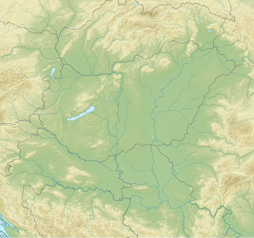
Hungary's river network shapes the country's landscape, economy and settlement pattern. Most Hungarian rivers belong to the Danube and Tisza drainage systems: the Danube cuts north–south through the west and central regions while the Tisza drains much of the Great Hungarian Plain. Many waterways cross international borders, making rivers important for transport, irrigation, flood control and cross-border cooperation.
Image gallery
3 Images

Major rivers and tributaries
The following are the principal rivers that flow wholly or partly through Hungary. Names given are commonly used in English and Hungarian; many rivers have different names in neighboring countries.
- Danube (Duna) — The largest river passing through Hungary, bisecting the country and flowing through Budapest. It collects numerous tributaries and serves as the main axis for navigation and urban development.
- Tisza — The second major river, draining the eastern plains and forming a key ecological corridor. It joins the Danube downstream of Hungary.
- Drava (Dráva) — Runs along or near the southern border with Croatia; important for regional biodiversity and local economies.
- Mura (Mur) — A tributary of the Drava, rising in the Alps and flowing along Hungary's southwestern boundary in places.
- Rába — A western river that flows toward the Danube basin and has historically supported industry and mills.
- Maros / Mureș — Originating in the Carpathians and joining the Tisza; notable for its international course through Romania before entering Hungary.
- Körös group (Criș) — A set of rivers in the southeast that form a linked system feeding into the Tisza.
- Ipoly / Ipeľ — Forms part of the northern border with Slovakia and is a smaller but regionally significant river.
- Sió — A man-made regulated channel that connects Lake Balaton to the Danube and plays a role in lake water management.
Characteristics and human influence
Hungarian rivers vary from fast mountain-fed streams to slow, meandering lowland channels. Over centuries, rivers have been regulated: meanders were cut, wetlands drained and floodplains reshaped to protect settlements and expand farmland. Water management infrastructure includes dams, locks, canals and levees that balance navigation, flood prevention and agriculture.
History, ecology and importance
Rivers have been central to Hungary's history—settlements, trade routes and cultural centers grew along them. Ecologically, floodplain rivers support diverse habitats, from marshes to riverine forests, hosting fish, birds and wetland plants. Conservation efforts now aim to restore natural river dynamics where possible while maintaining flood safety and economic uses.
Further reading and resources
For a more complete inventory and maps of Hungary's waterways, consult national hydrological surveys and regional river basin authorities. More rivers of Hungary provides lists and additional references for researchers and travelers.
Related articles
Author
AlegsaOnline.com Rivers of Hungary: major waterways and river systems Leandro Alegsa
URL: https://en.alegsaonline.com/art/125014