Pottawattamie County, Iowa
County in western Iowa along the Missouri River with county seat Council Bluffs; named for the Pottawattamie people and home to parts of the Loess Hills and the Omaha–Council Bluffs metro area.
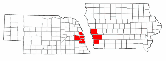
Pottawattamie County is a county located in western Iowa. It lies along the east bank of the Missouri River and forms part of the Omaha–Council Bluffs metropolitan area. According to the 2010 census, the county had 93,158 residents; the largest city and county seat is Council Bluffs.
Image gallery
3 Images

Geography and communities
The county’s landscape includes river lowlands and sections of the Loess Hills, a narrow band of wind-deposited silt notable for steep bluffs and prairie remnants. Settlement is concentrated near Council Bluffs, which serves as the economic and transportation hub. Other towns and villages range from small agricultural communities to suburban neighborhoods that house commuters to Omaha.
Major population centers and municipalities include:
- Council Bluffs (county seat and largest city)
- Smaller towns and unincorporated communities supporting farming, local business, and regional services
History and name
The county takes its name from the Pottawattamie people, a Native American group historically present in the region. Euro-American settlement and formal county organization occurred during the mid-19th century as the American frontier moved westward. River access and railroad connections shaped early growth, with Council Bluffs emerging as an important crossing and supply center.
Throughout the 20th and 21st centuries the county balanced agricultural activity with increasing industrial, retail, and service employment tied to the metropolitan area across the river. Transportation corridors, river commerce, and proximity to Omaha have supported regional integration.
Notable facts:
- Council Bluffs is the county seat and a regional transport hub.
- The county contains stretches of the Loess Hills and important Missouri River habitat.
- Economic activity includes agriculture, manufacturing, logistics, and services serving a bi-state metro region.
Related articles
Author
AlegsaOnline.com Pottawattamie County, Iowa Leandro Alegsa
URL: https://en.alegsaonline.com/art/78458