Mouscron — Belgian border city in Hainaut province
Mouscron is a French-speaking Belgian municipality in Hainaut near the French border. It has historic textile roots, several districts, cross-border ties and a population recorded at 53,174 in 2007.
Overview

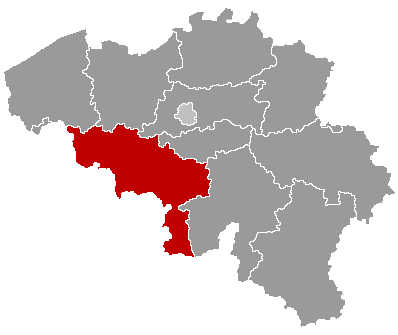
Mouscron is a municipality in the Walloon region of Belgium, located in the province of Hainaut. It lies at approximately 50°44′N, 3°12′E and sits immediately adjacent to the French border. The town functions as a regional centre for local commerce and services and is closely connected by road and rail to nearby Belgian and French urban areas.
Image gallery
5 Images


Geography and administration

Mouscron occupies a compact area in the Lys (Leie) valley and forms part of the cross-border urban zone that includes communities in northern France and neighbouring West Flanders. The municipality comprises several districts and former communes, notably:
- Mouscron (central core)
- Dottignies (Dottignies)
- Herseaux
- Luingne
Administratively it is a Belgian municipality; more information on its status appears in local government sources municipal details and provincial references Hainaut province.
History and development
The town grew substantially during the industrial era when textile manufacturing and related trades expanded across the Lys/Leie river basin. Like many towns in the area, Mouscron combined local commerce with manufacturing, and its fortunes have followed broader economic trends in Western Europe: industrial growth in the 19th and early 20th centuries followed by diversification toward services, small industry and cross-border employment.
Economy, culture and connections
Mouscron serves as a marketplace and transport node for surrounding rural and suburban areas. Its economy includes retail, light manufacturing and logistics, along with cultural institutions, local festivals and sports clubs that attract visitors from both Belgium and neighbouring France. The town's proximity to larger cities makes it part of a daily commuting network across the border.
Population and notable facts
Official population counts vary by year; one recorded figure for Mouscron was 53,174 inhabitants in 2007, cited in demographic reports population data. The municipality is predominantly French-speaking and is often cited as an example of Belgium's complex linguistic and geographic frontier between Wallonia, Flanders and northern France. Coordinates and basic civic information are commonly used by visitors and researchers planning travel or studies of cross-border regions.
Related articles
Author
AlegsaOnline.com Mouscron — Belgian border city in Hainaut province Leandro Alegsa
URL: https://en.alegsaonline.com/art/67164
Sources
- statbel.fgov.be : Werkelijke bevolking per gemeente op 1 januari 2007 / Population de droit par commune au 1 janvier 2007 (.xls)
- statbel.fgov.be : Geografische coördinaten van de gemeenten (.xls)
- commons.wikimedia.org : Mouscron