Freienbach — municipality in Höfe District, canton of Schwyz, Switzerland
Freienbach is a lakeside municipality in Höfe District, canton of Schwyz. It includes Pfäffikon and Hurden, combines residential areas, commerce and transport links near Lake Zurich and the Seedamm.
Overview
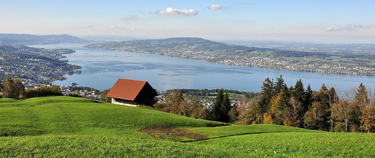
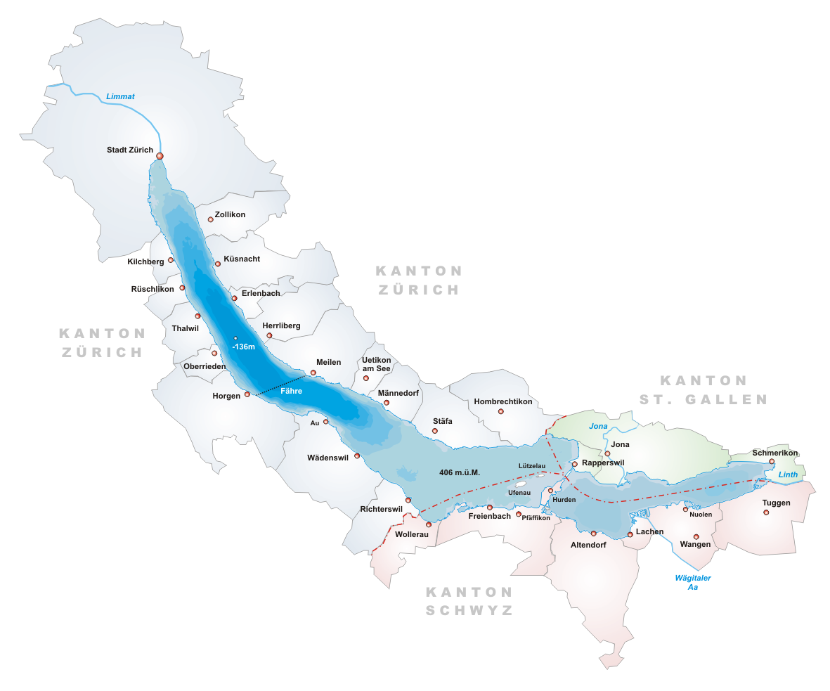
Freienbach is a municipality in the Höfe District of the canton of Schwyz, located on the eastern shore of Lake Zurich in Switzerland. The municipality combines several villages and settlements along the lakeshore and inland slopes, offering both residential neighbourhoods and commercial zones. Its position beside the Seedamm causeway gives it strategic transport links between the lake’s two shores.
Image gallery
6 Images


Constituent localities and character
Freienbach comprises several distinct localities, each with its own identity. Key parts include:
- Pfäffikon (often abbreviated Pfäffikon SZ) — the principal economic and service centre of the municipality;
- Bäch — a lakeside village with a quieter, residential character;
- Hurden — located on the narrow isthmus (Seedamm) connecting to Rapperswil, noted for its historic crossing;
- the central village of Freienbach and smaller hamlets and outlying settlements.
History and heritage
The area has a long human presence, with prehistoric and medieval remains recorded near the lakeshore. The neighbourhood of Hurden is associated with early lake crossings and pile-dwelling remains; these prehistoric stilt-house settlements in and around the Alps are widely studied for what they reveal about prehistoric lakeshore life. Over centuries the locality developed from rural villages into a more connected municipality as roads, railways and later motorways improved links to Zurich and neighbouring regions.
Economy, transport and daily life
Pfäffikon functions as the commercial hub, hosting shops, offices and financial services alongside local businesses. The municipality benefits from strong transport connections: regional and intercity rail services stop at the Pfäffikon SZ station, local bus routes link villages, and nearby motorways provide road access. The lakeside setting supports leisure activities such as boating, walking trails and seasonal tourism, while residential areas serve commuters working in Zurich and other cities.
Notable facts and distinctions
- Freienbach lies on the eastern shore of Lake Zurich and includes the Seedamm isthmus at Hurden, a historic crossing point.
- Pfäffikon SZ is a well-known local business and service centre; it is distinct from the town of Pfäffikon in the canton of Zurich.
- Archaeological sites near the shoreline form part of a broader group of Alpine pile-dwelling remains that attract research and interest.
For more detailed municipal information, administrative services and local events, consult local resources or the municipality’s pages linked above.
Geography
The municipality of Freienbach lies on the left bank of Lake Zurich and at the foot of the Etzel. The two islands, Ufnau and Lützelau, in Lake Zurich belong to the municipality. The Ufenau can be reached by scheduled boats.
- Total area: 20.31 km²
- Cultivated land: 35.9
- Forest: 13.7
- Of the total area, there are:
- Pfäffikon district: 11.5 km²
- Freienbach district: 3.0 km²
- Wilen district: 2.5 km²
- District Bäch: 2.0 km²
- Hurden district: 1.31 km²
- Highest point: Schönboden 1022 m above sea level.
- Lowest point: Lake Zurich 406 m above sea level.
Coat of arms
The current municipal coat of arms was adopted by the Hofleute-Korporation in 1948 after decades of disputes and shows three golden lions striding to the right in a red field. The symbolism is closely related to the historical connection to the Duchy of Swabia, which carried the three lions striding over each other on shields and flags since the 13th century. The reference to the duchy comes from the Ufnau island saint Adelrich, his mother Reginlinde and a later monastery abbot who is also said to have belonged to the ducal dynasty of Swabia.
Related articles
Author
AlegsaOnline.com Freienbach — municipality in Höfe District, canton of Schwyz, Switzerland Leandro Alegsa
URL: https://en.alegsaonline.com/art/36550
Sources
- bfs.admin.ch : "Arealstatistik Standard - Gemeinden nach 4 Hauptbereichen"
- bfs.admin.ch : "Ständige Wohnbevölkerung nach Staatsangehörigkeitskategorie Geschlecht und Gemeinde; Provisorische Jahresergebnisse; 2018"