Chakwal District (Punjab, Pakistan)
Chakwal District is an administrative district in Punjab, Pakistan, centered on the city of Chakwal. It combines Pothohar plateau landscapes, mineral resources, agriculture, and distinctive cultural and military traditions.
Overview
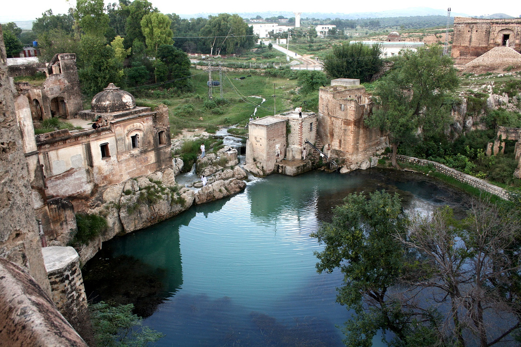
Chakwal District is an administrative district in the Punjab province of Pakistan. The city of Chakwal serves as the district headquarters. The district is located on the Pothohar plateau and lies close to the Salt Range, which shapes its terrain and contributes to local mineral resources. It is part of the wider administrative framework of Punjab and the national structure of Pakistan. For administrative classification the area is often referred to simply as a district.
Image gallery
4 Images


Landscape and characteristics
The district features rugged hills, undulating plains and patches of arable land rather than large river valleys. Soils and climate vary locally, supporting dryland farming, orchards and grazing. Vegetation includes scrub and cultivated crops adapted to the Pothohar environment. The proximity to the Salt Range means that mineral extraction and quarrying occur in the broader region.
Administration and settlements
Chakwal District is organized into several administrative subdivisions, including tehsils and numerous union councils, with the city of Chakwal as the primary urban center. Settlements range from small rural villages to market towns that serve surrounding agricultural areas. Local governance provides services, maintains infrastructure and oversees rural development projects.
Economy and uses
The local economy is mixed: agriculture, small-scale industry, commerce and mineral-related activities all play parts. Farmers grow cereals, oilseeds and fruit suited to semi-arid conditions; pastoralism remains important in marginal lands. Many residents also work in government service, trade, or serve in the armed forces, a longstanding regional pattern.
History, culture and notable facts
The area has a history of human settlement dating back to ancient times, with successive cultural influences from regional powers. Folk traditions, local crafts and religious sites contribute to a distinctive cultural identity. Chakwal has a notable reputation for military service and diaspora communities who maintain ties with their home district.
Significance and points of interest
- Strategic location on the Pothohar plateau and near the Salt Range.
- Agricultural and pastoral livelihoods adapted to semi-arid conditions.
- Cultural traditions, local festivals and historical sites that attract regional visitors.
- Administrative role as a district center providing services to surrounding rural areas.
For further institutional or geographic information, consult provincial maps and official administrative sources via the linked references above.
Related articles
Author
AlegsaOnline.com Chakwal District (Punjab, Pakistan) Leandro Alegsa
URL: https://en.alegsaonline.com/art/18364