
Reinickendorf: Borough of Berlin — geography, history, and features
Reinickendorf is a large borough in Berlin known for mixed urban and suburban areas, lakes and forests, and historic ties to the 1920 Greater Berlin Act. Overview of its geography, history, transport and governance.
Overview
Reinickendorf is one of Berlin's administrative boroughs and combines dense residential districts with substantial green spaces. The borough occupies an area of 89.50 km² (34.6 sq mi) and, according to an earlier official count, had about 246,577 inhabitants as of December 31, 2003. It forms part of the wider urban region of Berlin while retaining several suburban and village-like neighborhoods.
Image gallery
2 Images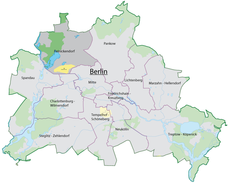

Geography and local character
The borough includes a varied landscape: built-up residential quarters, stretches of forest, and lakes. Notable natural features nearby include Tegeler See and the Tegeler Forst, which provide recreational space for residents. Districts range from more urbanized neighborhoods to those with a village atmosphere and garden-city planning; examples include Tegel, Frohnau, Wittenau, Hermsdorf and Heiligensee. The mixture of housing, parks and waterways gives Reinickendorf a distinctive transitionary character between central Berlin and the surrounding countryside.
Administrative history
Reinickendorf was established as a borough in 1920 by the Greater Berlin Act, a legal reform that incorporated many surrounding towns and villages into the city. Its borders were not altered in the administrative reforms of 2001, so the borough retained continuity of its territory and many local institutions through the late 20th and early 21st centuries.
Transport, landmarks and economy
Transport links in Reinickendorf include S‑ and U‑bahn services, regional rail connections and an extensive bus network, together with arterial roads that connect to other parts of Berlin. For decades the area was associated with Berlin–Tegel Airport, an important air hub that shaped local development (the airport ceased operations in recent years). Local commerce is a mix of small and medium enterprises, retail centers, and services supporting residential life and tourism to the lakes and forests.
Governance and demographics
The borough is governed by a local assembly and mayoral administration responsible for planning, schools, and social services. At the time of some earlier descriptions, the borough mayor was Marlies Wanjura (CDU); however, local leadership can change through municipal elections. The population profile is mixed in age and socio-economic background, reflecting both long-term residents and newcomers attracted by housing and green spaces.
Notable facts and distinctions
- Reinickendorf combines inner-city neighborhoods with suburban villages and significant parkland.
- Its parks and lakes make the borough a popular destination for outdoor recreation and day trips from other parts of Berlin.
- Historic administrative continuity: created in 1920 and largely unchanged by the 2001 borough reform.
- Readers seeking maps, demographic updates or civic services can consult local government and statistical sources for current figures and contacts.
For further reading about Berlin's boroughs, administrative history and local services, see official Berlin pages and municipal guides that cover Reinickendorf's neighborhoods and amenities in greater detail. A range of resources and historical notes are available through city archives and local information portals.
Conversion note • Population reference date • Statistical snapshot
Related articles
Author
AlegsaOnline.com Reinickendorf: Borough of Berlin — geography, history, and features Leandro Alegsa
URL: https://en.alegsaonline.com/art/81983