Chattahoochee River
Major river of the southeastern United States that rises in northeast Georgia, flows past Atlanta, forms part of the Georgia–Alabama border, and joins the Flint to form the Apalachicola River.
Overview
The Chattahoochee River is a principal waterway of the southeastern United States. It runs roughly 430 miles (about 690 km), rising in the Blue Ridge Mountains of northeastern Georgia and flowing generally southwest and south. Along its lower course it merges with the Flint River at the Florida line to form the Apalachicola River, which continues to the Gulf of Mexico. The Chattahoochee also helps define a long portion of the boundary between the states of Georgia and Alabama.
Image gallery
9 Images


Course and characteristics
The river descends from mountain streams into a mix of rapid and gentle reaches, passing through forested valleys, reservoirs and urban areas. In its upper reaches it supports trout and whitewater recreation; downstream it slows into broader channels and several impoundments used for water supply, flood control and hydropower. The Chattahoochee's watershed is closely tied to the Apalachicola–Chattahoochee–Flint (ACF) river basin, a major regional drainage system.
History and name
The name "Chattahoochee" comes from Muskogean languages and is commonly interpreted as meaning "painted rock" or "river of painted rocks," a reference to distinctive geology along some stretches. Indigenous peoples, including Muscogee (Creek) communities, long used the river for travel and sustenance. European-American settlement and later industrialization reshaped many reaches, particularly near growing population centers.
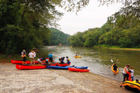
Uses, recreation and ecology
Today the Chattahoochee is vital for municipal water supplies, especially for the Atlanta metropolitan area, and supports recreation such as kayaking, fishing and riverside parks. It nourishes a range of fish, mussel and riparian plant communities, but faces pressures from urban runoff, altered flows behind dams and invasive species. Efforts to monitor and improve water quality and habitat have increased over recent decades.
Management and disputes
The river figures prominently in interstate water management. Competing demands for water, particularly during drought, have produced long-running negotiations and litigation among states that share the ACF basin. These disputes center on allocations for cities, irrigation, hydroelectric generation and ecosystem needs downstream.
Notable dams and reservoirs
- Buford Dam — creates Lake Lanier and is a major source of municipal water and recreation.
- Morgan Falls and other municipal impoundments near the Atlanta area.
- West Point Lake and the Walter F. George (Lake Eufaula) reservoir, which regulate flow and produce power downstream.
Because the Chattahoochee connects mountain headwaters, metropolitan use, agricultural demand and the biologically rich estuary formed with the Flint, it remains a river of considerable regional importance for ecology, economy and culture.
Author
AlegsaOnline.com Chattahoochee River Leandro Alegsa
URL: https://en.alegsaonline.com/art/136402