Tiber River (Tevere) — Italy’s historic river
The Tiber (Italian Tevere) is Italy’s third-longest river. Rising in the Apennines, it flows through Umbria and Lazio and shaped the development, commerce, and culture of Rome.
The Tiber, known in Italian as Tevere and in Latin as Tiberis, is the third-longest river in Italy. Often called simply the Tiber, it has been a prominent natural feature of central Italy since antiquity and remains a defining element of the landscape around Rome. Its status as the third-longest Italian river reflects a long course that links upland springs with the Tyrrhenian Sea.
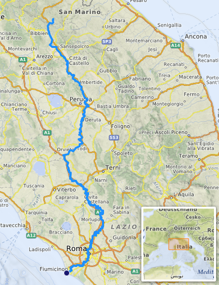
The river’s headwaters are in the Apennine Mountains, historically associated with the slopes of Mount Fumaiolo in the region of Emilia-Romagna. From there the Tiber runs southward, traversing the hills and valleys of Umbria and Lazio before reaching the coast. Its mouth opens into the Tyrrhenian Sea between the coastal localities of Ostia and Fiumicino, forming a natural outlet that has influenced settlement and maritime access for millennia.
Image gallery
10 Images


Geography and hydrology
The Tiber’s course crosses varied terrain, producing alluvial plains, meanders, and narrow gorges. Several smaller streams and rivers feed it; among the better known tributaries are those that drain the surrounding Apennine slopes and the lowland streams of Lazio. Historically the river’s regime was marked by seasonal high flows and floods that shaped settlement patterns and agricultural use of the floodplain. In modern times embankments and flood-control works have modified its natural behaviour to protect urban areas and infrastructure.
History and role in Rome
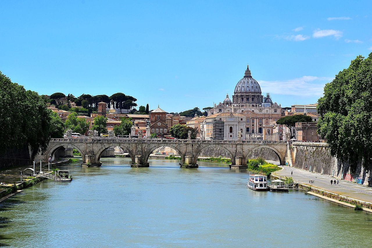
Human interaction with the Tiber goes back to prehistoric and ancient times. The river’s banks provided fresh water, fish, and a route for moving goods; Rome’s earliest neighbourhoods clustered on its slopes and along its eastern bank, an area often cited in foundation legends. The Tiber enabled riverine trade and linked inland producers to the ancient port at Ostia. Over centuries the riverfront acquired quays, bridges, and monuments that reflect Rome’s political, religious, and commercial life.
- Myth and foundation: Traditions about the city’s origins are tied to the river.
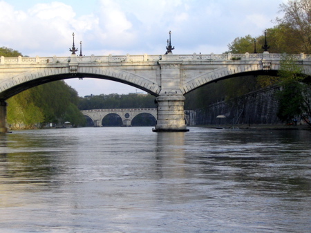
- Bridges and crossings: Successive bridges have been key urban connectors across the Tiber.
- Harbour links: The river’s access to the sea shaped Ostia and neighbouring ports.
- Flood management: 19th–20th century works greatly reduced historic flood damage.
Today the Tiber remains important for recreation, tourism, and urban character. Riverside promenades, historic bridges and riverside parks draw residents and visitors. Environmental initiatives have aimed to improve water quality and habitat while balancing flood safety and urban development. Navigation is limited compared with large navigable rivers, but the Tiber’s cultural and historical significance continues to be central to the identity of central Italy and the city of Rome, with many landmarks oriented toward its banks and quays.
For readers who wish to explore more detailed topics—such as the river’s source in the northern Apennines, the administrative regions it crosses, or its marine outlet—relevant regional and hydrological resources may be consulted: see materials on Apennine Mountains, Emilia-Romagna, Umbria, Lazio, and the Tyrrhenian Sea. Historical and archaeological studies about Rome and the development of its eastern banks likewise provide further context for the river’s long human story. Additional general references appear under Tevere and other regional entries on Italian rivers.
Questions and answers
Q: What is the Tiber river?
A: The Tiber river is the third-longest river in Italy.
Q: Where does the Tiber river originate from?
A: The Tiber river originates from the Apennine Mountains in Emilia-Romagna.
Q: What regions does the Tiber river flow through?
A: The Tiber river flows mainly through Umbria and Lazio.
Q: Where does the Tiber river ultimately empty into?
A: The Tiber river empties into the Tyrrhenian Sea, between Ostia and Fiumicino.
Q: Why is the Tiber river significant?
A: The Tiber river is significant because the city of Rome was founded on its eastern banks.
Q: What is the Latin name for the Tiber river?
A: The Latin name for the Tiber river is Tiberis.
Q: What is the Italian name for the Tiber river?
A: The Italian name for the Tiber river is Tevere.
Related articles
Author
AlegsaOnline.com Tiber River (Tevere) — Italy’s historic river Leandro Alegsa
URL: https://en.alegsaonline.com/art/99761
Sources
- abtevere.it : "Il Tevere"
- treccani.it : "Tevere"
- turismo.fc.it : "Tiber Springs - Monte Fumaiolo"