Teltow: town near Berlin in Brandenburg, Germany
Teltow is a town in Brandenburg, Germany, south of Berlin. Known for its historic core, proximity to the capital, the Teltow Canal and mixed residential and light‑industrial economy, it lies in Potsdam‑Mittelmark.
Teltow is a town in the federal state of Brandenburg, Germany, located immediately south of Berlin. It serves as a suburban and commuter community while retaining its own civic identity. The town belongs to the district of Potsdam‑Mittelmark and lies on the edge of the Teltow Plateau, a gently rolling landscape that has shaped local land use and settlement patterns.
Image gallery
3 Images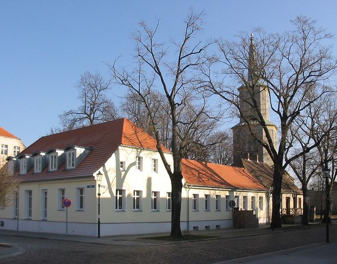

Geography and character
Teltow occupies a position close to Berlin’s southern suburbs and is linked to the capital by road and public transport. The nearby Teltow Canal, built in the early 20th century, is an important waterway that helped industrial development in the region. The town mixes older brick buildings and a small historic centre with post‑war and modern residential areas; green belts and small parks give it a suburban appearance.
History and development
The place developed from a medieval village on the Teltow Plateau and expanded with industrialisation and improved transport links. In the 19th and 20th centuries, proximity to Berlin encouraged manufacturing and trade. After World War II and German reunification, Teltow evolved further as part of the wider growth of the Berlin metropolitan area, attracting commuters and small enterprises.
Economy, transport and uses
Teltow’s economy combines local services, light industry and logistics, with many residents commuting into Berlin for work. Transport connections include regional roads and rail or S‑bahn links in nearby stations, while the canal supports freight movements. The town offers schools, municipal services and recreational facilities that serve both residents and neighbouring communities.
Points of interest and distinctions
- Historic town centre with municipal buildings and local shops.
- Teltow Canal and waterside paths popular for walking and cycling.
- Location on the Teltow Plateau, a notable landscape feature south of Berlin.
For administrative and civic information see the district page or the town’s information resources: Teltow municipal information and Potsdam‑Mittelmark district.
Geography
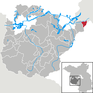
Teltow is bordered to the north by the Teltow Canal, only at the bridge to Kleinmachnow does the city area protrude a small piece beyond the Teltow Canal to the north. The Berlin district ofSteglitz-Zehlendorf lies to the north, Großbeeren to the east and south, Stahnsdorf to the west and Kleinmachnow to the northwest. The distance from Teltow to Potsdam city centre is about 17 kilometres, that to Berlin-Mitte about 20 kilometres.
The total area of the city is divided into the following types of use:
| Total land area | Agricultural area | Forest | Water | Settlement and transport area |
| 2154 ha | 1039 ha | 159 ha | 33 ha | 820 ha |
| 100 % | 48,2 % | 7,4 % | 1,5 % | 38,1 % |
Geology
Teltow is located on the Teltow ground moraine plateau, which occupies the southwestern part of Berlin and the adjacent part of Brandenburg. This ground moraine was formed during the last ice age, the Weichsel ice age, about 21,000 years ago. In the Bäke valley, the water currents formed a particularly turbulent relief with small-scale chains of hills made of boulder clay and meltwater channels, which today are interspersed with puddles and pools. This relatively loose deposit from a geological point of view and the stream channel preformed by the Bäke made the construction of the Teltow Canal considerably easier. The canal follows the original Bäke almost completely.
The Buschgraben is a narrow glacial meltwater channel on the southwestern edge of Berlin. The southern part runs in a north-south direction between Berlin-Zehlendorf and Kleinmachnow and flows northwest of Teltow into the Teltowkanal. In Teltow there are two small water bodies, the Röthepfuhl and the Grimmspfuhl, which were formed from dead ice holes.
Climate
Teltow has a temperate climate, influenced by the Atlanticclimate from the north and west and the continental climate from the east. Weather extremes such as storms, heavy hail or above-average snowfall are rare.
The average annual precipitation of 551.2 mm is lower than the national average of about 800 mm. Most precipitation falls in the summer months from June to August with a peak of 69 mm in June. The lowest precipitation falls in October with 33 mm. The sun shines for an average of 1618 hours per year. The average annual temperature is 9.0 °C.


City breakdown
The district of Ruhlsdorf and the residential areas of Birkengrund, Seehof, Sigridshorst and Städtlersiedlung belong to the town of Teltow.
Related articles
Author
AlegsaOnline.com Teltow: town near Berlin in Brandenburg, Germany Leandro Alegsa
URL: https://en.alegsaonline.com/art/96887
Sources
- statistik-berlin-brandenburg.de : "Bevölkerungsentwicklung und Flächen der kreisfreien Städte Landkreise und Gemeinden im Land Brandenburg - 2017" · web.archive.org
- destatis.de : destatis.de/DE/ZahlenFakten/LaenderRegionen/Regionales/Gemeindeverzeichnis/Administrativ/…
- statistik-berlin-brandenburg.de : "Bevölkerung im Land Brandenburg nach amtsfreien Gemeinden, Ämtern und Gemeinden 31. Dezember 2016 (Fortgeschriebene amtliche Einwohnerzahlen auf Grundlage des Zensus 2011)"
- commons.wikimedia.org : Teltow