Bay of Biscay: geography, climate, history and significance
The Bay of Biscay is a broad gulf of the northeast Atlantic along the western coast of France and northern Spain, noted for its depth, rough weather, marine life and historical importance to navigation and fisheries.
Overview
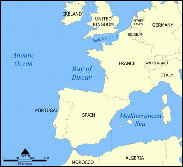
The Bay of Biscay is a large gulf on the northeastern edge of the Atlantic Ocean. It lies off the western shores of France and the northern coast of Spain, opening westwards into the Atlantic Ocean. Its name in English derives from the Spanish province of Biscay, part of the Basque Country. The bay forms a transition zone between the continental shelf to the north and the deeper abyssal plain to the west and south.
Image gallery
6 Images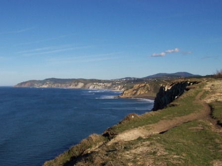


Geography and bathymetry
The bay stretches from the area around Brest on the French Atlantic coast southward to the Spanish border and westward toward Cape Ortegal. It borders the southern margin of the Celtic Sea to the north. Depths vary substantially: much of the inner shelf is relatively shallow, while the central and western parts reach great depths, with average figures often reported around 1,700–1,800 metres and local maximums approaching 2,700–2,800 metres.
Climate, currents and hazards
The Bay of Biscay is well known for energetic weather, particularly in autumn and winter when Atlantic depressions and strong westerly winds sweep across its waters. These systems produce high waves and frequent gales; historically many shipwrecks occurred during severe storms. Oceanographic currents and tidal flows interact with the continental shelf and underwater topography to create complex sea states that can be hazardous to navigation.
History, navigation and human use
For centuries the bay has been a major route for coastal and transatlantic shipping, fishing fleets and naval movements. Ports along its coasts served as departure points and safe harbours in different eras. The rich marine resources supported local economies through fisheries; today important activities include commercial fishing, shipping, offshore energy exploration and maritime research. Improvements in ship design, weather forecasting and rescue services have reduced, but not eliminated, maritime risks in the bay.
Ecology and conservation
The mixture of shallow continental shelf and deeper waters creates habitats for a wide range of species, from plankton and schooling fish to marine mammals and seabirds. Productive upwelling and nutrient exchange support valuable fisheries but also make the area sensitive to overfishing, pollution and the effects of changing ocean conditions. Conservation measures and international cooperation aim to balance economic use with protection of important habitats and migratory species.
Notable facts and distinctions
- The bay connects several regional seas and is a geographic transition between northern European coasts and the open Atlantic.
- Its name reflects a historical province rather than a single modern political boundary.
- Bathymetry and weather together have shaped a distinctive maritime culture along both French and Spanish shores, with local ports and communities adapted to variable conditions.
- Modern scientific programmes monitor the bay for ocean currents, climate signals and biodiversity, informing regional management.
For further regional context and maps see resources on the Atlantic Ocean, relations with the Celtic Sea, historical French and Spanish maritime links near Brest and the Spanish border, and cultural connections to Biscay and the Basque Country. Historical weather hazards remain a notable aspect of the bay's reputation for mariners (storms).
Designations
The southern Bay of Biscay, lying off the Spanish coast as far as the Adour River (France), is usually referred to in Spanish and Galician as the Mar Cantábrico (Cantabrian Sea, Latin Mare Cantabricum); the term Golfo de Vizcaya (or Golfo de Biscaia) is also used to refer to the whole of the Bay of Biscay. French also uses the term Cantabrian Sea (Mer Cantabrique) for the southern half of the Bay of Biscay, and in Basque Kantauri Itsasoa is common.
Part of Spain's Biscayan coast is known by the tourist name Costa Verde ('Green Coast'). The region has a temperate maritime climate with high rainfall, making the landscape greener than other parts of Spain.
On Mercator's 1589 map of Europe, the Bay of Biscay is designated Aquitanicus oceanus, while Cantabricus oceanus is marked west of the Spanish west coast at Cape Finisterre. The latter contradicts a synonymous use of both names.

Geography
f1![]() Map with all coordinates: OSM | WikiMap
Map with all coordinates: OSM | WikiMap
Sea
The waterside boundary between the Bay of Biscay and the rest of the Atlantic is considered to be as the crow flies (geodetic great circle) from Spain's Cabo Ortegal (44° N, 8° W43.77222222-7.86805555556) or from Estaca de Bares, a few kilometres to the east, (44° N, 8° W43.790277777778-7.68777777778), named as the western limit of the Cantabrian Sea, to the Breton Pointe Penmarc'h (48° N, 4° W47.7974444444-4.37486111111). The area enclosed by this line and the coast is about 223,000 km², and the greatest depth of water is 4735 m in Sables d'Olonne Canyon (46° N, 4° W45.9-4.05), north of the centre and 155 kilometres southwest of Île d'Yeu. With an average depth of 1774 metres, a water volume of 395,600 km³ is calculated. The main direction of wind and sea current is caused by the arrival of the Gulf Stream at the European mainland coast and leads from Pointe Penmarc'h at the southern coast of Brittany in a clockwise rotating current to Cabo Ortegal. The turbulences that occur between this current and the coast are considered quite dangerous in navigation, at least for small and medium-sized vessels.
Coast
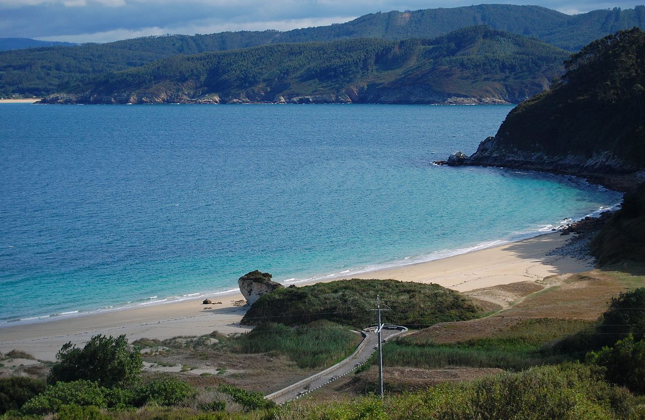
On the Spanish Biscayan coast, which is mostly rocky but - especially in Asturias - interspersed with charming sandy bays with offshore rocky islands, lie from west to east the four autonomous regions of Galicia, Asturias, Cantabria and the Autonomous Community of the Basque Country, the Spanish part of the Basque Country. The northern coast of Galicia has a fjord-like character due to the Rías Altas. The economic centre of Asturias is the port city of Gijón. The capital of Cantabria, Santander, is also located on the Bay of Biscay and is touristy. In the Basque Country lies the province of Bizkaia, after which the bay is named. The port of the coastal town of San Sebastian is one of the largest in the country.
The French part of the coast belongs to the three regions of Nouvelle-Aquitaine (with the coastal towns of Bayonne, Bordeaux, Rochefort and La Rochelle), Pays de la Loire (with the coastal towns of Nantes and Saint-Nazaire) and Brittany (with the town of Lorient).
On the coast of Brittany, the Bay of Biscay meets the Celtic Sea at the Pointe de Penmarch, which is also the southern limit of the Baie d'Audierne.
Questions and answers
Q: Where is the Bay of Biscay located?
A: The Bay of Biscay is a gulf of the northeast Atlantic Ocean south of the Celtic Sea. It is along the western coast of France from Brest south to the Spanish border, and the northern coast of Spain west to Cape Ortegal.
Q: What is the depth of the Bay of Biscay?
A: The average depth of the Bay of Biscay is 1,744 metres (5,722 ft), and the maximum depth is 2,789 metres (9,150 ft).
Q: Why is the Bay of Biscay named after the province of Biscay?
A: The Bay of Biscay is named after the province of Biscay, which is located in the Spanish Basque Country.
Q: What is the weather in the Bay of Biscay like?
A: The Bay of Biscay is home to some of the Atlantic Ocean's worst weather. Large storms occur in the bay, especially during the winter months.
Q: What is the history of ships in the Bay of Biscay?
A: Until recently, ships would be wrecked in Biscay storms, and many lives were lost.
Q: Have there been any improvements to prevent shipwrecks in the Bay of Biscay?
A: Improved ships and weather prediction have helped to reduce the problems of shipwrecks in the Bay of Biscay.
Q: What impact has improved shipping and weather prediction had on the Bay of Biscay?
A: Improved ships and weather prediction have helped to reduce the problems of shipwrecks in the Bay of Biscay.
Related articles
Author
AlegsaOnline.com Bay of Biscay: geography, climate, history and significance Leandro Alegsa
URL: https://en.alegsaonline.com/art/9667