
Battle of the Plains of Abraham (1759)
A decisive 1759 engagement near Quebec City in the Seven Years' War where British forces defeated French troops, leading to the fall of New France and a change in North American control.
Overview
The Battle of the Plains of Abraham was a short but pivotal engagement fought on September 13, 1759, between French and British forces during the North American phase of the Seven Years' War. It is usually considered part of the French and Indian War in colonial histories. The clash lasted less than an hour but helped determine the political future of large parts of continental North America.
Image gallery
10 Images


Location and name
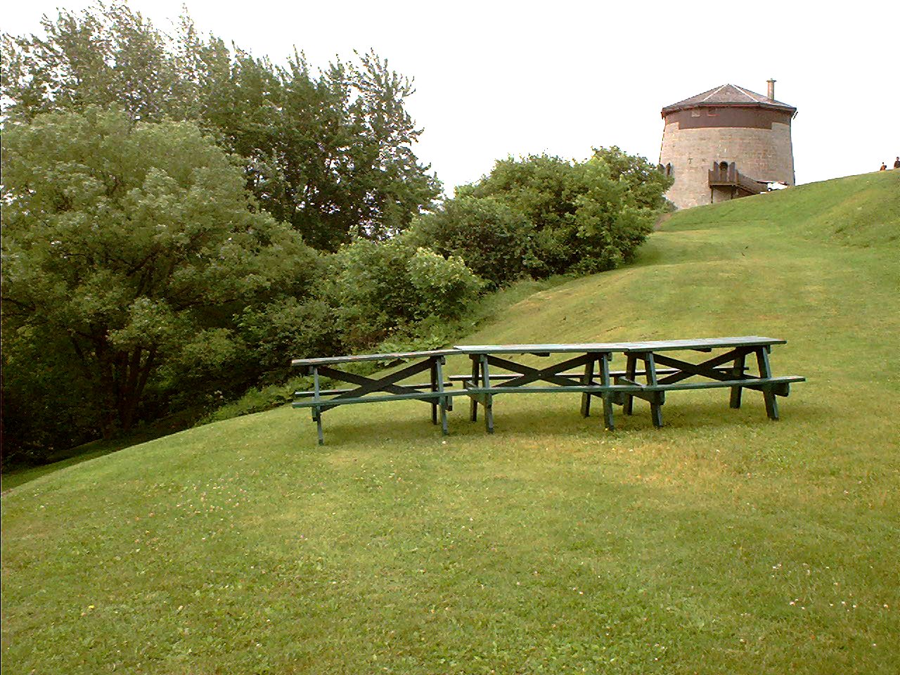
The battle took place on a gently rolling plateau just west of the walls of Quebec City, overlooking the Saint Lawrence River. That open area had been owned in earlier times by a local farmer named Abraham Martin, and the site became widely known as the Plains of Abraham. The ridge and its access routes strongly influenced the movements of troops and the tactical choices made that day; the plateau offered a clear field of fire but little shelter.
Forces and commanders
Each army numbered roughly a few thousand troops; contemporary accounts and later summaries typically report approximately 4,500 soldiers on each side, though units included regulars, colonial militia and supporting personnel. The French force was commanded by Major General Louis-Joseph de Montcalm and the British by Brigadier General James Wolfe. Both commanders were relatively young, and both were mortally wounded during the fighting. The opposing contingents were distinguished by uniforms (the British in red coats, the French in blue) and by differing levels of training, experience and logistical support.
Course of the battle
British ships had blockaded the river approaches and landed troops after a prolonged campaign of maneuver and siege. French defenders occupied works and a fortified position near the plateau; they had been warned of British intentions by scouts and informants but were not fully concentrated or reinforced when the decisive action began. The British established siege lines and prepared for a bold daylight landing and ascent onto the plains. On September 13 the two armies formed and engaged in disciplined volleys and short advances. Casual fighting soon turned into a rout for the French as British formations held steady and delivered effective musketry. The French withdrew and surrendered control of the heights to British forces within days; formal capitulation of the city followed after a short period of operations.
Aftermath and consequences
The fall of Quebec was followed by the British campaign to secure the remainder of French possessions in Canada, culminating in the capture of Montreal in 1760. The defeat effectively ended major French military authority in New France and led, through later treaties, to the transfer of much of continental Canada to the British Empire. The struggle was one theater of the wider conflict known in Europe as the Seven Years' War and in North America as the French and Indian War. Some French influence and territories persisted elsewhere in North America, but control of the St. Lawrence valley had decisively shifted.
Significance and notable facts
- The battlefield lies on a plateau that played a tactical role in the fighting and is now a major historic site.
- The encounter was brief but strategically decisive: a single engagement changed the balance of power in eastern North America.
- Both armies included colonial and regular elements; leadership, training and logistics were critical factors in the outcome.
- Intelligence and early warning—through scouts, rumors and spies—affected decisions on both sides, as did the presence of defensive works and a nearby fort.
- The British approach combined naval blockade and a prolonged siege with a well-timed assault; this integrated use of sea and land forces was a hallmark of the campaign.
- The battle and its aftermath are central episodes in the history of colonial competition in North American colonies and the eventual reshaping of imperial possessions across the continent.
For readers seeking more on troop types and battlefield dispositions, scholarly and museum resources provide detailed orders of battle, maps and contemporary accounts; general introductions and site guides also explain why the plateau that once belonged to Abraham Martin remains closely associated with this turning point in North American history. Primary-source accounts and later analyses discuss command decisions, the brief but intense nature of the fighting, and the broader diplomatic settlements that followed.
Additional contextual sources and collections of documents can be found through research libraries and dedicated historical institutions that focus on colonial warfare, the soldiers who served, and the communities affected by the campaign in North America.
Further reading and references: see specialized works on the French and Indian War and the Seven Years' War, battlefield studies of the Plains of Abraham, and collections of correspondence by Wolfe, Montcalm and other contemporaries for detailed primary evidence and interpretation (battle accounts, city records, colonial administration documents).
Siege
→ Main article: Siege of Québec
By 1758, the British had captured Fort Louisbourg on Cape Breton Island, Fort Duquesne in the Ohio Valley, and Fort Niagara on Lake Ontario. The French were encircled, but were initially able to halt the outright conquest of New France with victory at the Battle of Fort Carillon. The British blockade of the St. Lawrence River during the winter proved a failure, as numerous French ships managed to deliver supplies to Quebec. In May 1759, the French began to evacuate and entrench the population. On June 26, the British fleet landed in the vicinity of Québec, whereupon the soldiers occupied Île d'Orléans and established the main camp there. A French attack on the fleet with fires failed. The following day, the British also occupied the south bank of the St. Lawrence River and began building artillery batteries.
British artillery fire from the opposite bank began on July 12 and continued unabated for the next two months. The heavy bombardment, which the French had little to counter, took place mainly during the night hours and caused extensive damage to the city. Numerous buildings, including Notre-Dame de Québec Cathedral and Notre-Dame-des-Victoires Church, fell victim to the flames. On July 31, General James Wolfe attempted the first serious attack on the north shore. The British landed at Beauport but were repulsed by the French. In all, this Battle of Beauport claimed 443 casualties on the British side and 60 casualties on the French side. In retaliation, Wolfe ordered the destruction of all houses in a section several dozen miles long along the south bank of the St. Lawrence River, also northeast of Beauport. While this action was in progress, he drafted and discarded new plans of attack. He had to interrupt his work due to a prolonged period of illness in August.

Preparations and landing
In late August, Wolfe and his brigadiers agreed to cross the St. Lawrence River west of the city. Numerous soldiers had already boarded the ships and drifted up and down the river for several days when Wolfe made the final decision on September 12 and his choice of landing site was Anse au Foulon. This small cove is located southwest of town at Sillery, about three kilometers from Cap Diamant. It is located at the foot of a 53-meter-high cliff that merges into the plateau above; it was protected at the time by a battery of cannons. It is not known why Wolfe chose this site, as the landing was originally planned further upstream. There the British could have set up a beachhead and moved against Louis Antoine de Bougainville's troops encamped farther west, thereby luring Louis-Joseph de Montcalm out of the city and onto the high plateau. According to Brigadier George Townshend, the general had changed his mind based on scouting reports. In his last letter, dated September 12 at 8:30 p.m. on HMS Sutherland, Wolfe wrote:
"I had the honor to inform you today that it is my duty to attack the French army. To the best of my knowledge and ability, I have fixed upon that spot where we can act with most force and are most likely to succeed. If I am mistaken I am sorry for it and must be answerable to His Majesty and the public for the consequences."
"I had the honor to inform you today that it is my duty to attack the French army. To the best of my knowledge and belief, I have chosen that place where we can act with the greatest strength and are most likely to succeed. If I am wrong, I am sorry and will have to answer to His Majesty and the public for the consequences."
Wolfe's plan of attack depended on secrecy and surprise. A small group was to go ashore at night on the north shore, climb the steep slope, occupy a small road and overwhelm the garrison standing guard there. The bulk of the army (5000 men) was to climb the slope via the small road and then form up on the high plateau. Even if the first group succeeded and the army managed to follow it, his troops would be placed inside the French defensive line - with the river as the only means of retreat. It is possible that Wolfe's decision to change the landing site had less to do with a desire for secrecy than with his general disdain for his brigadiers (a feeling that was mutual). He may also still have been suffering from the effects of his illness in the second half of August and the opiates he took as painkillers. Historian Fred Anderson believes Wolfe ordered the attack in the belief that the advance guard would be repulsed and that he expected to die chivalrously with his men rather than return home in disgrace.
Bougainville, charged with defending the extensive plateau, was with his troops farther upriver at Cap Rouge on the evening of September 12 and did not notice the numerous British ships drifting downriver. A group of 100 militiamen under the command of Captain Louis Du Pont Duchambon de Vergor had been ordered to patrol the narrow road at Anse au Foulon, which followed the bank of the Saint-Denis creek. On the night of September 13, there were probably just 40 men at their post, as the others were busy bringing in the harvest. Vaudreuil and others had expressed concern about the possible weak point at Anse au Foulon, but Montcalm dismissed them, saying 100 men were enough to hold off an army until sunrise. He commented, "The enemy cannot be expected to possess wings, so that in the same night he would cross the river, disembark, climb the obstacle-strewn slope, and scale the walls, carrying ladders for the latter."
Guards actually spotted boats on the river, but they were expecting a French supply convoy - a plan that had been cancelled without Vergor being informed. When the first boats landed, the crew was asked to identify themselves. To this, an excellent French-speaking officer of the 78th Fraser Highlanders responded and allayed suspicion. The boats had gone a little off course. Instead of landing at the end of the road, numerous soldiers found themselves at the bottom of a slope. A group of 24 volunteers led by William Howe was sent out to clear the fence along the road and climb the slope. This allowed them to emerge behind Vergor's camp and quickly capture it. Wolfe followed an hour later when he was able to use a convenient access road to get to the plateau. By the time the sun rose over the Abraham Plateau, Wolfe's army had a solid base above the slope.


Related articles
Author
AlegsaOnline.com Battle of the Plains of Abraham (1759) Leandro Alegsa
URL: https://en.alegsaonline.com/art/9571