Syria
Template:Infobox State/Maintenance/TRANSCRIPTION
Template:Infobox State/Maintenance/NAME-German
Syria (officially Syrian Arab Republic, Arabic الجمهورية العربية السورية al-Jumhūriyya al-ʿarabiyya as-sūriyya) is a state in the Near East and part of the Mashreq. Syria is bordered by Israel and Jordan to the south, Lebanon and the Mediterranean Sea to the west, Turkey to the north, and Iraq to the east. The island of Cyprus is located about 125 km as the crow flies from the Syrian coast. With about 185,000 km² Syria is about half the size of Germany. In 2010, almost 21 million people lived in the country, most of them in Aleppo, the capital region of Damascus, in Homs, Hama and Latakia.
The Roman province of Syria, founded in 63 BC, was rich and important; after Islamization in 634, the territory alternated between claims to power. The Syrian Republic was first established in 1930 and became independent in 1946. Since a coup d'état in 1963, the Arab Socialist Baath Party has ruled the country dictatorially.
Since spring 2011, demonstrations against the Syrian government have turned into a civil war in Syria, which has claimed more than 465,000 lives so far (as of 3/2017), according to estimates by the Syrian Observatory for Human Rights. More than 5 million Syrians have fled the country (as of 3/2017), mostly to neighboring countries or Europe. 6.3 million more are fleeing within Syria. The civil war led to a de facto division of the country. As of May 2015, the Islamic State terrorist organization controlled more than half of Syria's territory, though barely 15% of the population lives there, while the capital Damascus, 10 of the 13 provincial capitals, and densely populated areas in the west of the country, where the majority of the population lives, remain under the control of Syrian government forces. The remaining areas are controlled by rebel groups such as the Free Syrian Army, Kurdish militias and the al-Qaeda offshoot al-Nusra Front.
Besides Sunni Muslims, there are about 12% Alawites in Syria. Christians already lived in Syria in pre-Islamic times; today they still make up about 10% of the population. There are eight public and several private universities in the country, including the German-Syrian Wadi International University. Syria's economy is based on agriculture, the production and export of oil, and the production of textiles and foodstuffs. Due to the civil war, however, economic performance plummeted and the Syrian lira was subject to strong inflation at times.
Etymology
The name Syria is attested in the bilingual Çineköy inscription from the 8th century BC, where it occurs in Phoenician as ʾšr, "Assur" and ʾšrym, "Assyrian", and in Luwish as Sura/i. Some scholars believe that it is a derivative of Greek Σύριοι (Sýrioi) or Σύροι (Sýroi), which may be derived from Akkadian Aššur as Ἀσσυρία (Assyria).
In the Behistun inscription Syria is enumerated under the term Syria (Suriah) as the 16th satrap of the ancient Persian empire, comprising Cyprus, Syria, Jordan, Lebanon, Israel, Phoenicia, Palestine, i.e. the whole of Canaan up to the border of Egypt and Arabia. The seat of the satrap was Damascus. According to some researchers, therefore, the name is not derived from Assyria. A derivation from Tyros (Ṣūr) is assumed by them. In Kurdish, "Soryan" is a possible derivative and is translated as "white spring", which may lead to the origin.
There is also an Akkadian name Šubartum/Subartum (Sumerian KUR SU.BIR4KI; Assyrian mât Šubarri and mâtsu-bar-te), which, however, can only be located imprecisely north of Babylon and, according to Naram-Sin, probably describes the entire region northwest of Mesopotamia up to the Amanus Mountains. It is found, among other places, in Ugarit as Šbr and in the Armana letters of the new empire of Egypt. The language of the Subartu is Akkadianized as SuKI/SU.BIR4AKI and may mean a North Semitic language. From the end of the Neo-Assyrian period, and especially in Neo-Babylonian times, Šubartu is also used to refer to Assyria, when Assyria gained control over large areas of Asia Minor. Aššur-uballit is said to have subjugated the Šubaraeans (Subaeans). Accordingly, the name would have survived for at least 5500 years, during which time it evolved both regionally and linguistically to its present form. The Arabic short form occurs in two forms: Sūriyā (سوريا) and Sūriya (سورية, when pronounced with the suffix Sūriyatun), both without articles.
From the Greek antiquity the name Koilesyria ("Hollow or High Syria") is known, which was localized south of the Eleutheris river (Greek name, today Nahr al-Kabir al-Janoubi) a border river between Jordan and Syria and was also called beside the provinces Syria and Syria Palaestina by Pliny. The Syriac language das (Eastern Aramaic) had risen in the 1st millennium BC to the language of trade and was therefore much more widespread.
Apparently, with the rule of the Assyrians (New Assyrian Empire 911-605 BC), an equation of Assyria and Syria had taken place, but it was redefined under the New Babylonian Empire (612-539 BC) as New Babylonian Ebir-nāri (Aramaic Abar-Nahara, Syriac 'Ābēr Nahrā) and taken over by the Old Persian Empire (539-332 BC). Now Syria encompassed the entire Canaanite coast, was adopted in ancient Greece from Alexander's victory over the Persians in 325 BC, and endured through the spread of Christianity and eventually Islam into the Middle Ages. This Syria thus describes a considerably larger area than the present state, bounded by the Mediterranean and Taurus to the north and the Arabian Peninsula and Mesopotamia to the south. The present localization is thus essentially based on Islam and its administrative units.
Geography
Syria received its present borders after World War I through the partition of the Arab East, until then dominated by the Ottoman Empire, among the victorious powers, Britain and France, by the secretly negotiated Sykes-Picot Agreement of 1916. Originally, Syria was understood to include the entire western branch of the Fertile Crescent, as Arthur Ruppin wrote in 1916:
"Syria in the wider sense of the word, in which it includes Palestine, extends from the Egyptian frontier and the Arabian Desert on the south (31st and 30th parallels of latitude) northward to the Amanus (37th parallel), which separates it from Asia Minor. The Mediterranean Sea is the boundary on the west, and the Syrian Desert and the Euphrates River on the east. The north-south extent of this area is 700 to 800 km, the west-east 100 to 300 km, the total area about 200,000 km²."
Landscapes
Syria reaches the east coast of the Mediterranean Sea for about 193 km, just north of the state of Lebanon. Along this coast stretches a narrow plain. Parallel to it - at a distance of about 20 km from the coast - runs the Alawite Mountains, whose eastern slope drops steeply to the fertile Orontes plain. On its eastern side rises the North Syrian limestone massif, which geologically represents the upturned western edge of the central Syrian plain and slopes gently in an easterly direction. This plain is shielded further south by the Antilibanon Mountains with the 2814 m snow-capped peak of Mount Hermon (ArabicError on submission * Mandatory parameter missing (Template:arS): 1 جبل الشيخ Jabal ash-Shaykh) to the west. Smaller rivers rise here, which carry water all year round and allow oasis formation; among them are the two rivers Barada and Aaouaj, which irrigate the Ghuta oasis surrounding Damascus.
On the plateau in the east and southeast of Syria stretches the Syrian Desert, which is interrupted in its centre by smaller chains of hills and gradually slopes down towards the Euphrates depression. In northeastern Syria the Euphrates cuts through the foothills of the desert. It is joined to the north by a fertile plain, the Jazirah. In the southwest lies the Hauran region with the volcanic massif of the Jebel ad-Duruz as the eastern border to the desert steppe. The most important rivers of Syria are the Euphrates (676 km) and the Orontes (325 km).
Syria has only one island in the Mediterranean, Aruad.
Climate
Along the coast there is a winter humid Mediterranean climate with precipitation up to over 1000 mm in the heights of the Jebel Ansariye. The winters are mild and the summers dry-hot. Inland the precipitation decreases rapidly. In the valley of the Orontes to the east, annual precipitation is less than 500 mm. This semi-arid steppe zone continues in the north in a strip along the Turkish border to the east, where rain-fed agriculture is possible in Qamishli with similar rainfall. In the largest part of the country east of Damascus and south of the Euphrates arid climate prevails. In the Syrian Desert precipitation falls below 250 mm and in the southeast of the country below 100 mm.
In Latakia on the Mediterranean coast, the maximum temperature in the summer months is 29 °C and the minimum in January/February is 9 °C. In the interior, there are greater differences in temperature between summer and winter, with Palmyra recording 38 °C in July and 3 °C in December/January. In the mountainous regions, temperatures drop below freezing in winter.
In Syria, climate change with rising temperatures and decreasing precipitation is having a particular impact on agriculture in areas that rely on rain-fed agriculture. During an extreme drought from 2006 to 2011, only one third of the usual rainfall fell. Because the grain harvest shrank by half, some 800,000 people lost their livelihoods between 2006 and 2009. The persistent water shortage is exacerbated by lower groundwater levels and fewer water-bearing rivers.
wildlife
Syria's flora and fauna has been severely impoverished by thousands of years of settlement. Apart from farm animals, there are no larger mammals left. Even dromedaries can hardly be found today. Only the bird world is still diverse. 354 bird species have been documented in Syria. Syria is an important transit country for migratory birds. Remarkable are the forest bustards, which were rediscovered in Syria only in 2002 and which belong to the most endangered bird species at all. The natural flora has been severely degraded by deforestation and overgrazing since ancient times. Forests can hardly be found in the country anymore. The Aleppo pine and the Lebanon cedar are still found in remnants. In contrast, olive and fig trees are frequently planted. The Aleppo plateau is also the natural habitat of the golden hamster.
There are 23 species of bats in Syria.

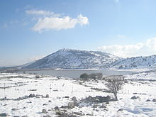
Winter in the Golan Heights

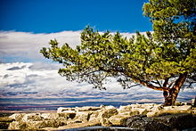
Landscape near Aleppo
Questions and Answers
Q: What is the location of Syria?
A: Syria is located in the Middle East, in the western part of Asia.
Q: Which countries does Syria share borders with?
A: Syria shares its borders with Lebanon, Israel, Jordan, Iraq, and Turkey.
Q: What is the geographical landscape of Syria?
A: The eastern and northern parts of Syria are mountainous, while the western part faces the Mediterranean Sea.
Q: Who is the current president of Syria?
A: The current president and head of state of Syria is Bashar al-Assad.
Q: What is the national capital of Syria?
A: The national capital of Syria is Damascus.
Q: Which is the largest city in Syria?
A: The largest city in Syria is Aleppo.
Q: When did the Syrian civil war begin?
A: The Syrian civil war began in 2011.
Search within the encyclopedia