
Sutlej River (Satluj)
Major Himalayan river rising near Mount Kailash in Tibet, flowing west through northern India and Pakistan as the easternmost branch of the Indus basin with key cultural, agricultural and hydrological roles.
Overview
The Sutlej (also spelled Satluj or historically Shatadru) is a principal river of South Asia. It originates on the Tibetan Plateau near Mount Kailash and Lake Rakshastal and flows generally west and southwest into the plains. The Sutlej is regarded as the easternmost of the five rivers of Punjab and is one of the major branches of the Indus River system. As a highland-to-plain river, it links glacial and monsoon-fed highlands with extensive irrigation and agricultural zones downstream.
Image gallery
10 Images


Source, course and basin
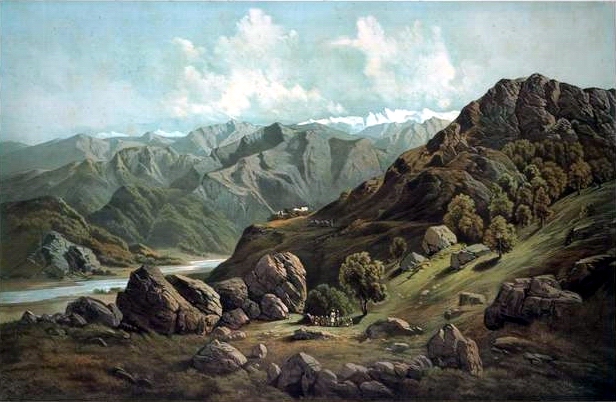
The river rises on the Tibetan Plateau and descends through mountain valleys into northern India, traversing the states of Himachal Pradesh and Punjab before crossing into Pakistan. In its upper reaches the Sutlej is fed by snow and glacial melt; farther downstream it receives contributions from tributaries and engineered diversions. It runs to the south of the Hindu Kush axis in the broader regional map and forms a natural divide between more humid highlands and drier lands, including areas approaching the Thar Desert. Hydrologically the Sutlej functions as a major tributary within the Indus basin and ultimately joins other rivers to form the Panjnad before reaching the Indus proper.
Tributaries and confluences
In the plains the Sutlej receives flows from smaller streams and is connected by canal works to adjacent rivers such as the Beas; their junctions create wetlands and headworks that are important for irrigation and biodiversity. Downstream, the Sutlej combines with other major rivers of the region to contribute to the Panjnad, which then feeds into the Indus. These confluences historically shaped settlement and agriculture across the Punjab plain.
Infrastructure, uses and management
- Irrigation: Extensive canal networks draw from the Sutlej to support cereal and cash-crop agriculture across both Indian and Pakistani plains.
- Hydropower and reservoirs: Large projects in the upper basin, including well-known dams and barrages, provide flood control, seasonal storage and electricity while regulating downstream flows.
- Water governance: The river is subject to interstate and international agreements that govern allocation and use; cooperative management has been central to maintaining supplies for agriculture and communities.
Environment and challenges
The Sutlej basin supports wetlands, riparian forests and important bird habitats; areas such as the confluence wetlands serve as refuges for migratory species. Contemporary challenges include changes in glacial melt patterns at source elevations, sedimentation and erosion, water-quality issues from agricultural runoff and salinity in lower reaches, and the environmental impacts of dams and canalization. Climate variability and competing demands for irrigation, hydropower and urban supply make adaptive basin management a priority.
History and cultural significance
The river appears in ancient South Asian texts and has long been central to local histories, settlement patterns and economies. Over centuries the Sutlej and the other rivers of Punjab shaped linguistic, agricultural and cultural regions; in modern times large-scale engineering projects have further altered the basin while supporting millions of livelihoods. For general regional context see resources on Punjab, and on the national settings of India and Pakistan, as well as wider geographic discussions that include links to the Hindu Kush and the Thar Desert.
Researchers and managers continue to monitor the Sutlej's flow regime and ecosystem as part of efforts to balance development, transboundary cooperation and environmental conservation within the broader Indus basin context.
History
The river rises in Tibet near Mount Kailash. From here it flows through the Indian states of Himachal Pradesh and Punjab, where it receives the waters of the Beas. For a good 100 km it forms the border between India and Pakistan. In Pakistan, it joins the Chanab; together with the latter, it forms the Panjnad, which eventually flows into the Indus.
Myth and history
The Satluj originally drained into the mythical Sarasvati, which cannot be located with certainty, until tectonic activity reversed the direction of the river around 1700 BC, making it a tributary of the Indus. As a result, the Sarasvati dried up, leading to the desertification of Cholistan.
Along the largely gorge-like upper reaches of the river, the Shang Shung culture existed more than two thousand years ago. The ruins of their capital Khyunglung Ngülkhar, the "Silver Palace in the Garuda Valley", are located above a valley basin of the Satluj in western Tibet. The Austrian Bruno Baumann searched for the Buddhist Shangri-La there and came across the cradle of this Tibetan culture, ruins left behind by the empire of the Shang Shung kings.
To the west, the Sutlej breaks through the main Himalayan ridge near Shipki Pass to flow down through deep gorges in India's Kinnaur district. This is the region of the old Hindustan Tibet Road, a caravan route from India to Tibet built high above the river, now replaced by National Highway 22 built since 1961 rather close to the river.
Related articles
Author
AlegsaOnline.com Sutlej River (Satluj) Leandro Alegsa
URL: https://en.alegsaonline.com/art/95314
Sources
- commons.wikimedia.org : Sutlej River
- britannica.com : "Sutlej River"
- books.google.com : "Journal of a trip through Kulu and Lahul"