Surses
![]()
The title of this article is ambiguous. For other meanings, see Surses (disambiguation).
Surses (![]() zʊɾˈses) is a political municipality in the Albula region of the canton of Graubünden in Switzerland. It was created on 1 January 2016 by the merger of the political municipalities of Salouf, Riom-Parsonz, Cunter, Savognin, Tinizong-Rona, Mulegns, Sur, Marmorera and Bivio. In terms of area, it is the second-largest municipality in Canton Graubünden after Scuol and the third-largest in Switzerland behind Glarus Süd.
zʊɾˈses) is a political municipality in the Albula region of the canton of Graubünden in Switzerland. It was created on 1 January 2016 by the merger of the political municipalities of Salouf, Riom-Parsonz, Cunter, Savognin, Tinizong-Rona, Mulegns, Sur, Marmorera and Bivio. In terms of area, it is the second-largest municipality in Canton Graubünden after Scuol and the third-largest in Switzerland behind Glarus Süd.
The municipality covers the whole valley of Oberhalbstein (Rhaeto-Romanic Surses).
Name
The name is composed of the two Romance words sur for "over" and Ses from the Latin saxum for "stone", "rock". Ses refers to the Crap Ses (764310 / 16721446.6359489.584709) between Tiefencastel and Cunter.
Geography
The lower valley level up to Tinizong is called Sotgôt (in the Rhaeto-Romanic idiom Surmiran sot for "below" and gôt for "forest"), the one above Surgôt (sur for "above").
The lowest point is at Tgant Ladrung between Cunter and Tiefencastel and is 995 m high. The highest point is Piz Calderas (3397 m).
The Julia flows through the municipality. Looking out of the valley, the Albula Alps lie to the right and the Oberhalbsteiner Alps to the left.
The municipal boundary is as follows:
- To the municipality of Albula/Alvra from Curvér Pintg da Taspegn via Del, Tgant Ladrung, Motta Palousa to Piz Mitgel
- To the municipality of Filisur from Piz Mitgel via Tinzenhorn, Pass digls Orgels, Pass d'Ela almost to Piz Ela
- To the municipality of Bergün/Bravuogn from Piz Ela via Piz Val Lunga, Piz Salteras, Piz da l'Antgierna da Salteras, Piz da Peder Bucs, Piz Bleis Marscha to Piz Laviner
- To the municipality of Bever from Piz Laviner via Piz Jenatsch, Corn Jenatsch, Piz Calderas, Tschima da Flix, Piz d'Agnel to Piz Surgonda
- To the municipality of Silvaplana from southeast of Piz Surgonda via Piz Valetta, Julierpass, Piz da las Coluonnas almost to Piz Lagrev
- To the municipality of Sils in the Engadine/Segl from Piz Lagrev via Piz d'Emmat Dadaint, Piz Materdell, Motta Radonda to Piz Grevasalvas
- To the municipality of Bregaglia from Piz Grevasalvas via Pass Lunghin, Motta da Sett to Piz Turba
- To the municipality of Avers from Piz Turba via Piz Forcellina, Fuorcla da la Valletta, Stallerberg to almost Piz Surparé, then Fallerfurgga, Mazzaspitz, Jupperhorn, Tälihorn, Tälifurgga to Usser Wissberg
- To the municipality of Ferrera from Usser Wissberg via Fuorcla Starlera, Fuorcla da Saletscha, Piz Alv, Piz Settember, Pass da Schmorras, Sur Carungas, Pass da Surcarungas
- To the municipality of Andeer from the Colmet pass to Piz Curvér
- To the municipality of Zillis-Reischen from Piz Curvér to Curvér Pintg da Taspegn

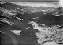
Aerial photograph by Walter Mittelholzer (1928)
Search within the encyclopedia