Sunninghill Park
Sunninghill Park was a country estate in Berkshire, England, notable for an early 19th‑century house, a late 20th‑century replacement that served as a royal residence, and its demolition in 2016.
Overview
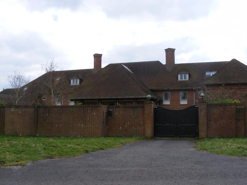
Sunninghill Park was an historic country estate in the civil parish of Sunninghill and Ascot in Berkshire, England. The holding comprised parkland, woodland and farmland of roughly 665 acres and included a principal house set within extensive grounds near the town of Ascot and close to Windsor. General location information and formal references to the estate are available from mapping and local history sources, see location details.
Image gallery
2 Images
Site and features
The estate combined landscaped drives, specimen trees, meadows and ancillary service buildings typical of large English country properties. Historically it was described as a country house within an associated estate of grazing land and managed parkland. Surviving boundary lines, access roads and planting patterns reflected successive phases of landscaping and agricultural use.
Architecture and earlier house
An early 19th‑century mansion stood on the site and represented the period of estate growth common after the Napoleonic wars. That house was substantially damaged by fire in 1947 and did not survive intact into the later 20th century. Period descriptions note formal rooms and service wings typical of a country‑house plan, though detailed architectural records are limited in published sources.
Rebuilding and royal association
In the late 1980s a new principal house was erected within the surviving parkland. From 1990 the newer dwelling served as the principal residence of a senior member of the British royal family and is frequently cited as an official residence associated with the office of the Duke of York. During that period the estate functioned as a private family home rather than a public site, though its occupation attracted media and local attention.
Sale, decline and demolition
The property was sold to private owners in 2007. Over the following decade the late 20th‑century house deteriorated amid changing ownership, planning discussions and security concerns. After prolonged decline the building was demolished in 2016, bringing to an end the estate’s most recent architectural phase.
Legacy and present day
Sunninghill Park is often cited as an example of the challenges faced by large country estates close to urban centres: conservation costs, changing patterns of ownership and competing development pressures. Current and future uses of the cleared site have been the subject of local planning records and community interest, and the location continues to be monitored in regional heritage and land‑use discussions.
Questions and answers
Q: What are the geographical coordinates of Sunninghill Park?
A: The geographical coordinates of Sunninghill Park are 51°25′34″N 0°39′00″W.
Q: What was Sunninghill Park before it was burned down?
A: Sunninghill Park was a country house and estate of about 665 acres directly north of Cheapside.
Q: When did the early 19th century house at Sunninghill Park burn down?
A: The early 19th century house at Sunninghill Park burned down in 1947.
Q: When was a replacement house built at Sunninghill Park?
A: A replacement house was built at Sunninghill Park during the final years of the 1980s.
Q: Who was the official resident of Sunninghill Park from 1990 until 2004?
A: The official resident of Sunninghill Park from 1990 until 2004 was the Duke of York.
Q: When was Sunninghill Park sold?
A: Sunninghill Park was sold in 2007.
Q: What happened to the replacement house at Sunninghill Park?
A: The replacement house at Sunninghill Park fell into disrepair and was demolished in 2016.
Related articles
Author
AlegsaOnline.com Sunninghill Park Leandro Alegsa
URL: https://en.alegsaonline.com/art/94912
Sources
- money.aol.co.uk : "Queen's wedding present to Prince Andrew is flattened"
- berkshirehistory.com : "RBH: History of Sunninghill, Berkshire"
- british-history.ac.uk : A History of the County of Berkshire: Volume 3
- trove.nla.gov.au : "Surrey home for princess"
- mirror.co.uk : Prince Andrew's £15million former royal residence could be seized and used for the homeless
- royal.gov.uk : "Will of Queen Elizabeth The Queen Mother"
- theguardian.com : From royal fairytale to crumbling eyesore: the mystery of Prince Andrew's old home
- mirror.co.uk : "Exclusive: Prince Andrew's £15 million former royal residence could be seized and used for the homeless"
- thedailybeast.com : "Prince Andrew's House—and Old Royal Life—Lies in Ruins"