Sturt National Park: arid landscapes, history and visitor guide
Large protected area in north‑west New South Wales named for explorer Charles Sturt. Contains mesas, gibber plains, dunes and a Ramsar wetland; formed from former pastoral stations in the 1970s.
Overview
Sturt National Park is a vast protected area in north‑west New South Wales in eastern Australia. It is located many hundreds of kilometres from the state capital and preserves a large swath of arid and semi‑arid country. The park is named for the 19th‑century explorer Charles Sturt who travelled through parts of inland Australia in the 1840s. For administrative and visitor information see the official park page. The park lies within New South Wales and within the national context of Australia.
Image gallery
9 Images
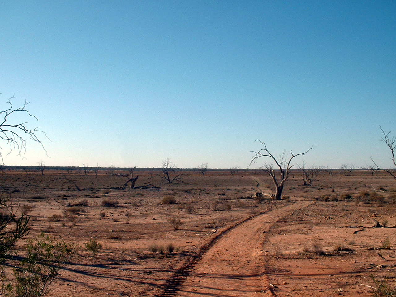


Landscape and natural features
Sturt National Park covers an area of roughly 340,000 hectares (about 840,000 acres). Its environments range from ephemeral floodplains and tree‑lined creek beds to stony gibber plains and red sand dune fields at the park's western edge, where the country merges with the Strezlecki Desert systems. In the central part of the reserve are distinctive flat‑topped mesas or "jump‑ups" that rise as much as 150 metres (approximately 492 feet) above the surrounding plains. Lake Pinaroo, near Fort Grey, is one of the park's important wetland features and is listed under the Ramsar Convention when it supports significant waterbird populations after flood events.
History and formation
The modern protected area was created in the 1970s by combining several large pastoral leases. The park incorporates land that was formerly part of multiple sheep and cattle stations; these former holdings are often still referred to by their historic names. Notable properties from which the park was formed include Mount Wood, Olive Downs, Whitta Brinna, Mount King, Binerah Downs and Fort Grey. For background on the pastoral era and station histories consult the material linked on the park and heritage pages (pastoral station history).
Heritage buildings and pastoral remains
Remains of the pastoral era are visible around homestead sites such as Mount Wood Station. The Mount Wood homestead complex, originally built in the late 19th century, has been stabilised and interpreted for visitors; part of the site offers basic visitor accommodation and a small museum display describing station life. Shearing sheds, yards and other rustic structures can still be found and are referenced in local heritage summaries (area information).
Visitors, access and activities
Sturt National Park is remote and conditions vary seasonally. Access is often by long unsealed roads that may require a high‑clearance four‑wheel drive; some camping areas and day‑use spots are found near Fort Grey, Olive Downs and Mount Wood. The small settlement of Tibooburra lies near park access routes and acts as a base for many visitors (Tibooburra). One well‑known roadside landmark is Cameron's Corner, where the borders of New South Wales, South Australia and Queensland meet — a popular photo stop for travellers in remote Australia. Activities in the park include self‑guided drives, birdwatching after rains, walking among jump‑ups and learning about Aboriginal and pastoral histories. Visitors should prepare for isolation, carry adequate water and check seasonal access advisories.
Conservation, wildlife and cultural value
Although much of the park is arid, it supports a range of adapted animals and plants: red kangaroos, emus and a variety of reptiles are typical, while episodic floods bring an influx of waterbirds to ephemeral lakes and channels. The reserve protects important examples of inland habitats and cultural heritage places associated with both Aboriginal peoples and the pastoral era. Sturt National Park has also reached wider audiences through natural‑history media and has been featured in documentary programmes (international broadcast) that canvass Australia's outback environments.
- Practical links: park information, heritage and stations, area details.
- Nearby towns and services: Tibooburra, remote roadhouses and station facilities.
- Border landmark: South Australia / Queensland / New South Wales meeting point at Cameron's Corner.
For current conditions, visitor safety advice and booking of limited on‑site accommodation check the park's management and visitor pages prior to travel (official park page).
Questions and answers
Q: What is Sturt National Park?
A: Sturt National Park is a national park in north west New South Wales, Australia. It was created in the 1970's from six large sheep and cattle stations (farms). The park covers more than 340,000 ha (840,158 acres) of arid area.
Q: Who named the park?
A: The park was named after explorer Charles Sturt who travelled through the area in 1845.
Q: What features can be found within the park?
A: The east of the Sturt National Park has flood plains, some trees and small rocky gorges and creek beds. Lake Pinnaroo near Fort Grey is a Ramsar listed wetland. The central area of the park has "jump-ups", flat topped mesas rising up to 150 metres (492 ft) above the plains. In the far west of the National Park are red sand dunes of the Strezlecki Desert.
Q: How big was Mount Wood Station?
A: Mount Wood Station used to cover 500,000 acres (202,343 ha) and had 86,000 sheep. It employed 100 people.
Q: What kind of accommodation can be found at Mount Wood Station?
A: The historic homestead built in 1884 has been turned into a place for up to 15 tourists to stay and there is also an old shearer's house which can hold 38 people. There are camping areas at Dead Horse Gully at Tibooburra, Olive Downs, Fort Grey and Mount Wood as well as an outdoor farm museum that has been started at Mount Wood Station.
Q: Where is Cameron's Corner located?
A: Cameron's Corner is a very remote but popular place for tourists to visit located where the borders of New South Wales, South Australia and Queensland meet.
Related articles
Author
AlegsaOnline.com Sturt National Park: arid landscapes, history and visitor guide Leandro Alegsa
URL: https://en.alegsaonline.com/art/94413
Sources
- environment.nsw.gov.au : "DECC | Ramsar sites in New South Wales"
- environment.nsw.gov.au : "DECC | Sturt National Park"
- smh.com.au : "Tibooburra - New South Wales - Australia - Travel - smh.com.au"
- environment.nsw.gov.au : "DECC | Sturt National Park - Accommodation"
- environment.nsw.gov.au : "DECC | Sturt National Park - Camping"
- commons.wikimedia.org : Sturt National Park