
Storegga Slide: prehistoric submarine landslides and the resulting North Atlantic tsunami
The Storegga Slide refers to massive submarine landslides off Norway's continental shelf that generated a North Atlantic tsunami around 6100 BC, leaving sedimentary evidence across Scotland and studied for causes and coastal risk.
Overview
The Storegga Slide is the name given to a series of very large submarine landslides off the coast of Norway that generated a major tsunami in the North Atlantic during the early Holocene. The events occurred on the Norwegian continental margin, roughly centered near coordinates 64.867°N, 1.300°E. The most widely studied and most recent of the slides is dated to about 6100 BC by radiocarbon analysis of washed-up plant material and other deposits (studies).
Image gallery
3 Images

Physical characteristics
These slides involved the catastrophic failure of sediment accumulated on the edge of the continental shelf. Estimates summarize the displacement as on the order of thousands of cubic kilometers of debris: an area hundreds of kilometres long and many tens of kilometres wide collapsed and flowed downslope, leaving a hummocky deposit on the seabed. The collapse occurred beneath the Norwegian Sea (Norwegian Sea), on the margin between Norway and the Greenland region (Greenland), just north of the British Isles (Great Britain).
Geological context and timing
The slides took place along the continental shelf near Norway (Norwegian continental shelf) in an area shaped by glacial processes during the Last Glacial Maximum. Sediment supplied by glacial meltwater, iceberg rafting and turbidity currents built thick unstable drift deposits during and after the ice age (ice age influences). Radiocarbon dating and stratigraphic correlation provide the principal chronology; the most prominent event is commonly placed around 6100 BC based on organic fragments and other markers (stratigraphic studies).
Impact and sedimentary evidence
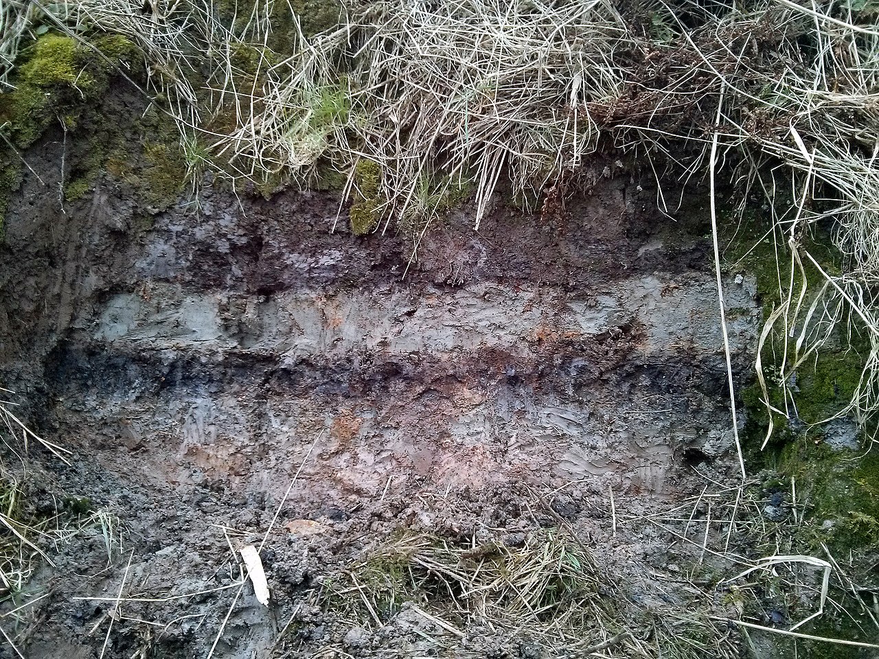
The collapse generated a trans-oceanic tsunami that left measurable traces on nearby coasts. In eastern Scotland, for example, tsunami deposits and disturbed peat layers have been found in locations such as the Montrose Basin (Montrose Basin) and the Firth of Forth (Firth of Forth), with sedimentary layers traced up to tens of kilometres inland and several metres above present mean sea level. River estuaries, including the South Esk (South Esk estuary), preserved shelly sand sheets and rip-up clasts interpreted as tsunami deposits. The scale of seafloor disruption has been compared to covering an island the size of Iceland with metres of debris.
Causes, mechanisms and scientific study
Researchers attribute the slides to rapid buildup of glacially derived sediments and changes in seabed strength after deglaciation. Possible contributing mechanisms that have been discussed include oversteepening of slopes, pore pressure increase within fine-grained deposits, and—less conclusively—the destabilization of gas hydrates. The Storegga events have been the subject of focussed investigation because of their relevance to offshore development, notably the Ormen Lange gas field (Ormen Lange), where detailed hazard assessments concluded that a similar event is unlikely except under comparable post-glacial circumstances (shelf investigations).
Modern relevance and distinctions
Although the last major Storegga Slide took place many millennia ago, it remains an important case study for submarine mass-wasting, tsunami generation and coastal hazard assessment. Distinctive aspects include the submarine setting, enormous volume of displaced material, and the far-field tsunami effects recorded across the North Atlantic. Contemporary offshore projects and hazard planners refer to Storegga both for lessons on sediment instability and for the need to distinguish natural long-term risk from human-triggered events. For maps and summaries see tsunami reconstructions, comparative area, and general regional syntheses.
Further reading and resources
- Glacial and post-glacial sedimentation context
- Primary geological papers on the slides
- Palaeogeographic summaries
- Tsunami evidence in the British Isles
- Coordinate and location reference
Other useful entries and datasets are available through regional geological surveys and tsunami research centers (Norway margin data, continental shelf studies, estuarine records, Firth records, offshore field assessments, and ice-age context).
Questions and answers
Q: What are the coordinates of the Storegga Slides?
A: The coordinates of the Storegga Slides are 64°52′N 1°18′E / 64.867°N 1.300°E / 64.867; 1.300.
Q: How much debris was caused by the slides?
A: Approximately 3,500 km3 of debris fell due to the Storegga Slides.
Q: When did the latest incident occur?
A: The latest incident occurred around 6100 BC according to carbon dating of plant material.
Q: Where have traces of this tsunami been found in Scotland?
A: Traces of this tsunami have been found in the Montrose Basin (estuary of the South Esk river) and Firth of Forth, up to 80 km inland and 4 metres above today's normal tide levels in Scotland.
Q: What conclusion has been made about Ormen Lange natural gas field regarding triggering a new slide?
A: It has been concluded that development of Ormen Lange gas field would not significantly increase risk of triggering a new slide, and that it would only happen again after a new ice age, which is supported by scientific studies.
Q: What evidence supports this conclusion?
A: Facts and arguments supporting this conclusion were made public in 2004, such as scientific studies on Ormen Lange natural gas field which indicate that a new slide would trigger a very large tsunami which would be devastating for coast areas around North Sea and Norwegian Sea.
Related articles
Author
AlegsaOnline.com Storegga Slide: prehistoric submarine landslides and the resulting North Atlantic tsunami Leandro Alegsa
URL: https://en.alegsaonline.com/art/94092