Steyr-Land District: geography, administration and regional role
Steyr-Land is a rural district in Upper Austria surrounding the city of Steyr. It covers about 972 km², is home to roughly 60,000 people (2019), and combines river valleys, industrial heritage and agricultural countryside.
The Steyr-Land District (German: Bezirk Steyr-Land) is a territorial district and administrative unit in Austria. It is officially a district located in the state of Upper Austria and forms part of the country of Austria. The district covers roughly 971.7 km² and had a population of about 60,427 on 1 January 2019. The administrative seat is the city of Steyr, which serves as the district’s centre for public services.
Image gallery
1 Image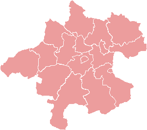
Geography and landscape
Steyr-Land occupies a transitional zone of river valleys and low foothills in central Upper Austria. The district includes portions of the valleys formed by the Enns and Steyr rivers and reaches into forested uplands and agricultural plains. Its terrain supports mixed farming, woodland and small industrial sites; scenic riverbanks and hiking areas attract local recreation visitors. The region’s character is shaped by the mix of rural communities and the influence of nearby urban centres.
Administration and municipalities
The district is organised into 21 municipalities ranging from small villages to larger market towns. Although the city of Steyr functions as the administrative centre, it is administratively separate from the surrounding rural district: a common arrangement in Austria where a statutory city provides services for a neighbouring district. Local government in Steyr-Land deals with regional planning, social services, building permits and coordination among municipalities.
History and development
Historically the area developed within the Habsburg lands of Upper Austria and combined agriculture with early industrial activity along the rivers. The Steyr area became known for metalworking and manufacturing; those historic industries influenced settlement patterns and transport links. Over the 19th and 20th centuries the district’s villages evolved as suppliers, residential communities and small-scale industrial sites connected to the larger town of Steyr.
Economy, transport and local life
Economic activity in Steyr-Land includes agriculture, forestry, small and medium-sized enterprises, and service-sector jobs. Many residents commute to Steyr or to larger cities in Upper Austria for work. The district is served by regional roads and rail links that connect valleys and towns, facilitating commuting, freight and tourism. Cultural life reflects central Upper Austrian traditions: parish festivals, markets and outdoor recreational activities along river corridors and in woodland areas.
Notable facts and distinctions
- Area: approximately 971.7 km²; population (2019): ~60,427, giving a modest population density typical of mixed rural districts.
- The district surrounds but does not include the statutory city of Steyr, which acts as its administrative hub.
- Landscape combines river valleys, agricultural land and forested uplands, supporting recreation and tourism opportunities.
For administrative details, municipal lists and current statistics consult the relevant Upper Austrian authorities and regional publications. The Steyr-Land District remains an example of a predominantly rural Austrian district with close ties to a historic industrial town and to the broader economy of Upper Austria. Further regional information is maintained by state and municipal sources.
Questions and answers
Q: What is the Steyr-Land District?
A: The Steyr-Land District is a district in the state of Upper Austria in Austria.
Q: What is the area of the Steyr-Land District?
A: The Steyr-Land District has an area of 971.7 km².
Q: How many people live in the Steyr-Land District as of 1 January 2019?
A: As of 1 January 2019, 60,427 people lived in the Steyr-Land District.
Q: What is the administrative center of the Steyr-Land District?
A: The administrative center of the Steyr-Land District is Steyr.
Q: How many municipalities are in the Steyr-Land District?
A: The Steyr-Land District has 21 municipalities.
Q: What is the official language of the Steyr-Land District?
A: The official language of the Steyr-Land District is German.
Q: What is the Steyr-Land District known for?
A: There is no specific information provided in the text about what the Steyr-Land District is known for.
Related articles
Author
AlegsaOnline.com Steyr-Land District: geography, administration and regional role Leandro Alegsa
URL: https://en.alegsaonline.com/art/93902